
|
|
Mountain/Rock |
|---|---|
|
|
38.93522°N / 107.11679°W |
|
|
Download GPX » View Route on Map |
|
|
Gunnison |
|
|
Mountaineering |
|
|
Summer |
|
|
12410 ft / 3783 m |
|
|
Overview
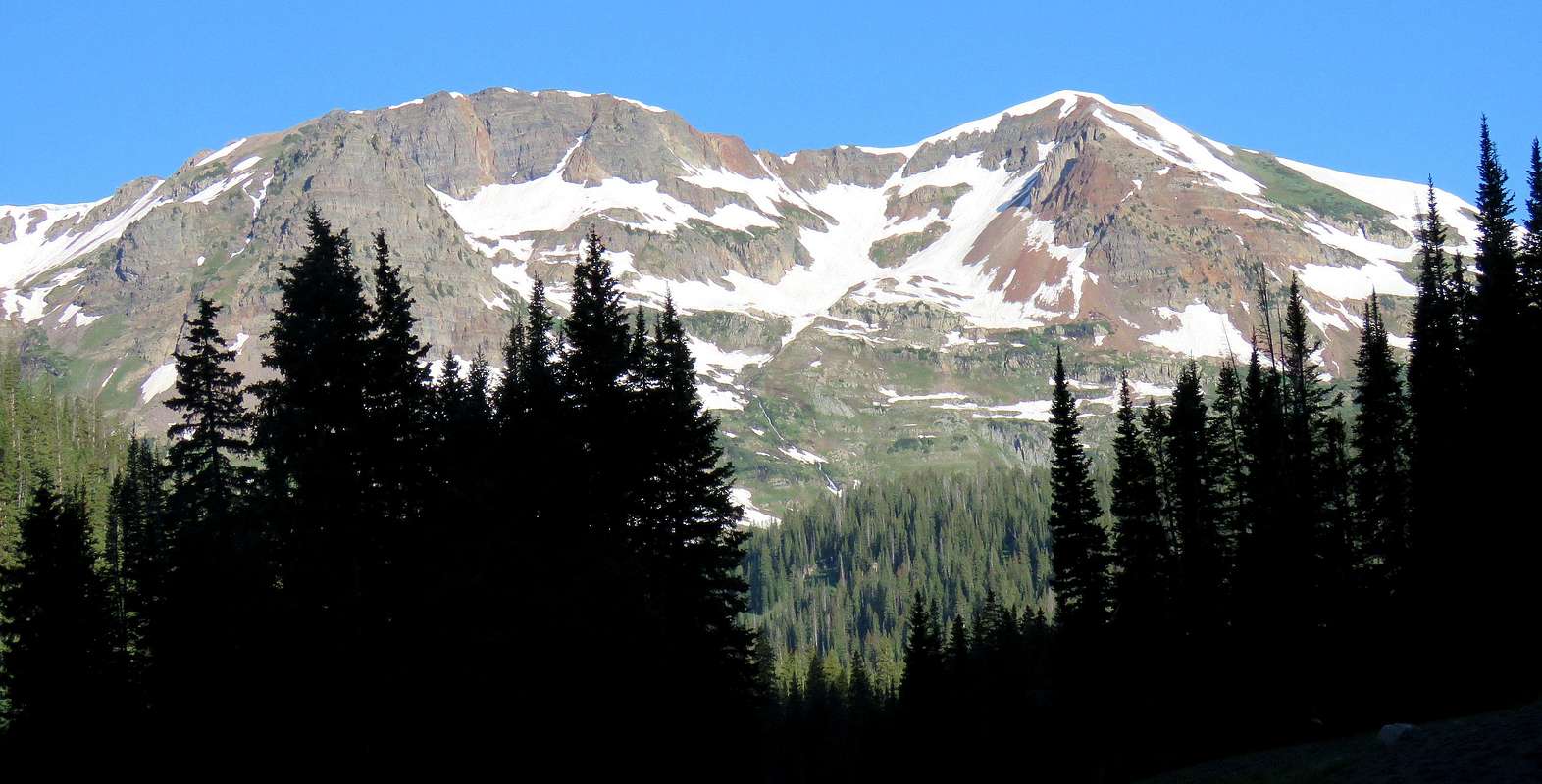
Hancock Peak on the right and Oh-Be-Joyful Peak on the left, east face
Hancock Peak along with its twin summit Oh-Be-Joyful Peak are two mid 12ers that rise to the west of Oh-Be-Joyful Basin to the northwest of the town of Crested Butte in the Elk Mountains of central Colorado. USGS Map gives Hancock Peak an exact elevation of 12410 ft and only contour lines above 12400 but below 12440 ft for Oh-Be-Joyful Peak. For this reason, the elevation of Oh-Be-Joyful Peak is often quoted as 12420 ft. Both of these peaks have less than 300 ft of prominence and are therefore not ranked peaks.
A trail starts off of Slate River Road and goes into Oh-Be-Joyful drainage. Reaching the trailhead requires that you cross Slate River. This is often done in a pickup truck or SUV. At the upper end of Oh-Be-Joyful Drainage, the trail splits. One branch heads south to reach Blue Lake while the other goes north into the beautiful Democrat Basin and ultimately the 11740 ft Oh-Be-Joyful Saddle. From the saddle, Hancock Peak is a walkup.
Hancock Peak on the right and Oh-Be-Joyful Peak on the left
Getting There
Directions to Oh-Be-Joyful Trailhead,requires stream crossing:From the town of Crested Butte in central Colorado drive a short distance north on Gothic Road. Before reaching the ski area, turn left onto Slate River Road (Road 734). Drive this well graded dirt road less than 3 mile north until you see a dirt road on the left side going down to reach the river. Make a U-turn and get on this rougher dirt road and go a short distance to reach Slate River. You can park on the east side of the river but the trailhead is on the west. Most people cross the river in a pickup truck or SUV. When I was in the area, the river was knee deep. A sign said: Do not attempt to cross at times of high water.
Route
All distances are per my GPS.At the trailhead, head south and go on a gated four wheel drive road that is closed to motor vehicles. The trail goes up in elevation and soon turns west going into the Oh-Be-Joyful drainage. The cascading stream can be seen below.
 Stream
Good view of Mt. Crested Butte behind to the southeast.
 Mt. Crested Butte
After about a mile the road turns into a trail that continues up the drainage in a beautiful meadow with patches of trees around. Peeler Peak to the left.
 Peeler Peak
Richmond Mountain will appear to the distant northwest.
 Richmond Mountain
Water pouring down.

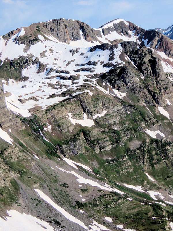
As the valley turns, Hancock and Oh-Be-Joyful Peaks finally come to view.
 (R) Hancock, (L) Oh-Be-Joyful
Mount Emmons behind.
 Mt. Emmons
Afley Peak plus Hancock and Oh-Be-Joyful.
 R to L: Hancock, Oh-Be-joyful, Afley Peaks
Afley and Purple Peaks.
 (R) Afley, (L) Purple Peaks
Garfield Peak.
 Garfield Peak
The trail crosses to the south side of the stream, enters a pine forest and goes up steeply to reach a split in the trail. Left goes to Blue Lake and right to Oh-Be-Joyful Pass. Turn right and follow the trail north in a meadow at the base of a 12060 rocky protrusion.
 Point 12060 ft Point 12060 ft |
 Hancock Peak & Point 12060 ft Hancock Peak & Point 12060 ft |
The trail then enters the beautiful Democrat Basin.
 Hancock Peak & Richmond Mountain
Good views of Hancock Peak.
 Hancock Peak
Scarp Ridge.
 Scarp Ridge
Richmond Mountain.
 Richmond Mountain
Scarp Ridge, Garfield and Peeler Peaks.
 R to L: Scarp Ridge, Garfield & Peeler Peaks
Point 12060 ft.
 Point 12060 ft
Streams, waterfalls everywhere.
 |
 |
Peeler and Garfield Peaks.
 Peeler & Garfield Peaks
As I went higher the trail got lost under patches of snow. The path to Oh-Be-Joyful Pass was obvious.
Lake forming in the snowfields.
 Lake Lake |
 Lake Lake |
The uneven egg-carton-like surface of the snowfield with depressions thigh deep, made my progress slow and energy consuming.
 "Egg Carton" Snowfield
Crossing a stream in the snowfields.
 Stream
Snowfields.
 |
 |

Oh-Be-Joyful Pass and the summit of Hancock Peak.
 Summit of Hancock & Oh-Be-Joyful Pass
Snow cornices blocking access to the ridgetop. Fortunately a snow-free rocky area provided access.
 Snow Cornices
Above Oh-Be-Joyful Pass, you can leave the trail and hike up grassy slopes toward the summit of Hancock Peak.
Marcellina Mountain to the west.
 Marcellina Mountain
Talus field below the summit.
 On the way to the Summit On the way to the Summit |
 Summit Summit |
Views from the summit.
 The Raggeds The Raggeds |
 Richmond Mountain Richmond Mountain |
 Maroon Bells Maroon Bells |
 Mt. Crested Butte Mt. Crested Butte |