-
 12456 Hits
-
 76.66% Score
-
 7 Votes
|
|
Mountain/Rock |
|---|---|
|
|
39.19111°N / 105.39472°W |
|
|
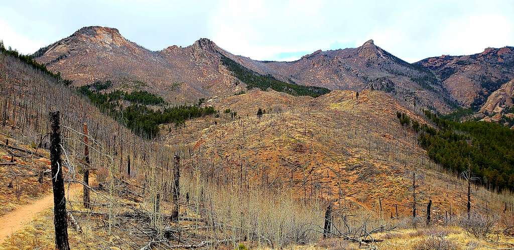
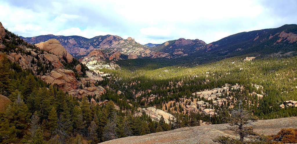
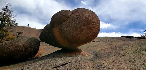
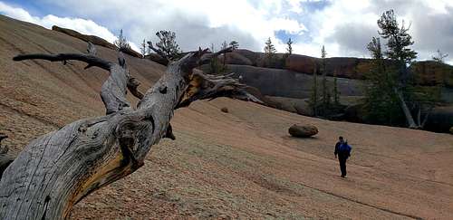
The hike starts at the Goose Creek trailhead. The trailhead is in the Hayman Fire burn area. The Hayman Fire in 2002 burned 138,000 acres. While the drive to the trailhead passes miles and miles of burned forest, the trail only winds through about 0.4 of a mile of burned forest. At 0.2 mile hikers cross a bridge and come to a trail split. Turn right and stay on the Goose Creek trail for about 0.75 of a mile when the trail comes to another bridge. The Goose Creek trail crosses the bridge, hikers heading for Harmonica Arch do not. There is a lot of debate about whether to cross the bridge and how to find the Harmonica Arch trail. In June 2009, our group easily found a trail splitting off to the left just before the bridge. While this is considered "off-trail," we found the trail to be easy to find and well worn. There is no sign here saying Harmonica Arch or trail or anything. But I'm going to call it the Harmonica Arch trail since it is. The trail follows the gushing creek here. There are short ups and downs and occasional muddy spots. Why is the creek called Goose Creek, but the area is the Lost Creek Wilderness? The Forest Service Web site says, "Lost Creek ducks in and out of granite slides 22 times. When the stream finally burst into the open it is called Goose Creek." I don't think that's really an answer, but there is it. Harmonica Arch in the distance As you hike along, look straight ahead and up occasionally, we easily spotted the arch on a granite dome in the distance. Look closely to the left of the arch and you'll see the challenge ahead. A very steep, drop off. You will have to negotiate that area to see the arch. It is not a spot for anyone afraid of heights or steep drops. Also as you maneuver the "Harmonica Arch trail" expect at least one creek crossing. Not back to the Goose Creek trail side, but just across the creek itself. We found a crossing with several thick branches to step on. About 1 mile from the turn-off at the bridge, the trail begins to climb higher, then splits. There is a very pronounced turn left into a semi-narrow canyon. The right turn heads down towards the river and onward. We saw campers set up down there. Since we were looking for a left turn, we turned here. DON'T DO IT. While this looks like a real trail, if you find yourself in a narrow canyon with lots of big lichen covered rocks, turn around. We lost the trail a couple times in this area, but easily found another. There are several social trails here where other people made the wrong turn. The best advice I can give is when you've hiked about 1 mile from the bridge turn-off, don't take the first left, take the second left. If you are hiking up a semi-narrow canyon and suddenly find a drop of 20 feet or so into a meadow-like area, you've gone the wrong way. The trails disappear at the meadow, that may also tell you that you've gone the wrong way. The wrong canyon Take the right split, drop down to the river and a camping spot. Go about another 0.1 of a mile until you get to the next left turn. Turn here up into the canyon. As we hiked along we found several sets of cairns. That should tell you that you're in the right place. The trail is tough to follow at times, but often there's a cairn nearby to help. On the hike up, you're actually on the south side of the canyon while the arch is on the north side of the canyon, that's because of the large boulders on the north side. So at some point, there's a big right turn on the trail over to the arch side of the canyon. The trail up the canyon climbs from 8,235 feet elevation to 9,059 feet in about 1 mile. You'll know you're near the top when you leave the trees and enter a smooth rock basin. Stop for a moment at one of the so-called "balanced notes" for a photo. One of the many funky rocks near Harmonica Arch. Some call them "balanced notes." At the basin, there is some debate about which way to go. Some directions say walk south, some say east. I think south worked best. Another way to describe it, is think about the direction you were heading when you left the trees. Keep going that direction. You may need to change direction and maneuver around the rocks in the area, but the arch is directly ahead of you when you exit the trees. Expect some class 2 gaps to maneuver across. Because the high point of the hike is 9,059 feet and the arch is at 8,960 feet, you are actually above the arch and will have to climb down a bit to actually get to the arch. For those afraid or concerned about heights, it might be best to head for the left side of the granite formation and try to come from the backside of the arch. Organ pipe formation and valley below When you see the organ pipe formation directly in front of you, the arch is below you and to your left. The arch sits at 39 degrees 11.46 N and 105 degrees 23.69 W. Take pictures of the arch, the organ pipe formation, the Goose Creek valley and Pikes Peak in the distance. Some say you can climb on top of the arch, but the wind was blowing so hard when we were there that we decided that was a bad idea. To Harmonica Arch and back, the right way, is about 6 miles round trip and about 1,600 feet of elevation gain.
links
Getting There
Drive west on Highway 285 to Pine Junction. Turn south (left) at Pine Junction on to Jefferson County Road 126 toward Pine and Buffalo Creek. Drive 21.8 miles on County Road 126. Turn south (right) on to Forest Service Road 211 that leads to Cheesman Reservoir. Travel 2 miles and turn west (right) at the sign pointing to Goose Creek. Drive 1.1 miles in a westerly direction until you reach a fork in the road. Bear left at the fork and stay on 211. From this fork drive 5.2 miles to a road intersection south of Molly Gulch Campground. Turn right and drive 4.7 miles to the Goose Creek Trailhead access road. Half way along this road you'll pass Goose Creek Campground. At the trailhead access sign turn north (right) and drive 1.3 miles to the trailhead parking.
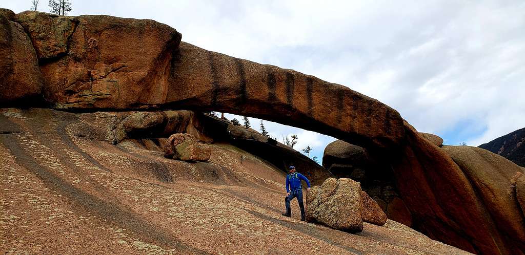
Distance: 6 miles roundtrip Elevation: Trailhead: 8,220 Feet, Arch: 8,960 feet Arch location:39*11.46 N, 105* 23.69 W Location: Lost Creek Wilderness, Pike National Forest, near Deckers Dogs: allowed on leash Trailhead: signs only, no bathrooms Entrance fee: none Hiking partners: Members of the Denver Trail Heads & Second Wind meetups While Utah is famous for having arches, even a National Park dedicated to arches, Colorado has several. Maybe the best know is Royal Arch in the Boulder Flatirons. Maybe the longest arch in Colorado is Harmonica Arch near Deckers. Harmonica Arch is in the Lost Creek Wilderness. The Forest Service Web site says the Lost Creek Wilderness was established in 1980 and is 120,151 acres. The Web site says, "some of the most spectacular granite formations in the Rockies are found in Lost Creek Wilderness. Domes, half-domes, sheer walls, pinnacles, spires, minarets, and a natural arch dominate the skyline.
 Harmonica Arch Harmonica Arch |
 Harmonica Arch Harmonica Arch |
 Harmonica Arch Harmonica Arch |
Red Tape
General Notes:
Trails
Please stay on trails. Cutting switchbacks and avoiding wet and muddy sections can cause severe erosion and multiple trail systems. For individuals travelling cross country, remember that alpine tundra is very susceptible to damage. Walk on durable routes of rock or talus when possible. In areas where this is not possible, disperse your use so no two footsteps land on the same spot. In keeping with the character of wilderness, where risk and self-reliance are part of the experience, map and route finding skills are essential.
Camping & Campfires
Take some time when you reach your destination to find the most appropriate site for you and your group. Try not to pick the first site you see, even if you're tired. Look around, choose a site that is protected, not visible from the trail, and is at least 100 feet from any water source. To minimize impacts, please use an existing site. If you choose to have a campfire, consider the following:
- Large hot fires or concentrations of charcoal and ash can sterilize soils, leaving them unable to sustain plant life
- Many visitors consider fire-rings an eyesore
- Keep fires small and limit them to evenings or early mornings
- Avoid having fires above treeline. Dead wood removed from Krummholz (dwarf trees near timberline) affects their survival.
Animals
Secure packstock 100 to 200 feet away from lakes, streams, or trails. Use a picket line and move stock often to prevent resource damage. Please remember, dogs must be on a leash at all times.
Water & Waste
All water can carry giardia (a protozoa that affects human intestinal systems and can cause serious illness). Boiling water for at least 5 minutes, using iodine tablets, or filtering can treat water.
Soap, even biodegradable, pollutes the water. Dispose of wash water at least 100 feet away from any water source. Bury human waste in a hole 6" deep and 200 feet away from any water source, trail, or campsite. Pack out toilet paper, feminine products, and left over food. Please Practice Leave No Trace Principles.
When to Climb
summer, fall, spring, winter.

