
|
|
Mountain/Rock |
|---|---|
|
|
39.23370°N / 105.4546°W |
|
|
11108 ft / 3386 m |
|
|
UN 11,180 Overview
Click left side or right side to enlarge for better, more crisp detail.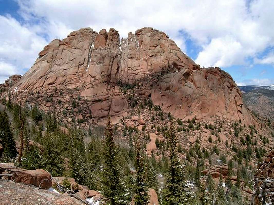
Located deep in the heart of the Tarryall Range and anchoring the very north end of McCurdy Park, UN11,180 resides a long way away from anything, including people. If you climb UN11,180 and run into another party, consider it a sign from the climbing Gods, and go buy a lottery ticket. Most people have trouble just getting to McCurdy Park via a 5 mile and 2,500-ft approach. However, less than ten people (2004) have ever continued the additional 3 miles and 1000-ft to the private and secluded summit of UN11,180. For those of us that have, I'm sure we will always remember this one as an exercise in mental and physical toughness that was well worth the effort.
Two-thirds of UN11,180 is surrounded by 2,100-ft of vertical relief in less than one mile; it is a prominent crag that is easily recognized from other area summits. The obvious 450-ft vertical southeast face harbors many unclimbed routes. The summit views are intense as well, offering a very unique vantage of the rugged Refrigerator Gulch.
This is an extremely complex crag, looking completely different from different perspectives. One could spend an entire day exploring this sucker! The summit is a very strange place as well. Ribbed with deep inset cracks and riddled with with deep inset notches, the summit will excite your exploring mind.
You may be wondering why I submitted a hidden gem that ranks #1 on my LCW list. It's because UN11,180 is not for everybody; along with the long approach, expect tough route-finding, intense bushwhacking and a few tough class 5 moves to attain the summit. However, for those that plan and execute a day trip of this magnitude, deserve a sublime experience, and a pristine place to visit as well. The summit feels so away and remote, it's downright spooky. An accident out there would be bad experience for even the most experienced, so leave a detailed note as to your exact whereabouts, especially if you solo the route.
Lost Creek Wilderness Overview
First, the mountains of the Lost Creek Wilderness submitted here on Summitpost are exclusive to this site. Locating information or any route beta for this area is almost nonexistant. I am honored to shed some light on this area and hopefully some of you will visit these far and away summits. Thanks to Jennifer and Gerry Roach's LCW book all of us can view photos and visit these remote summits here on SP.
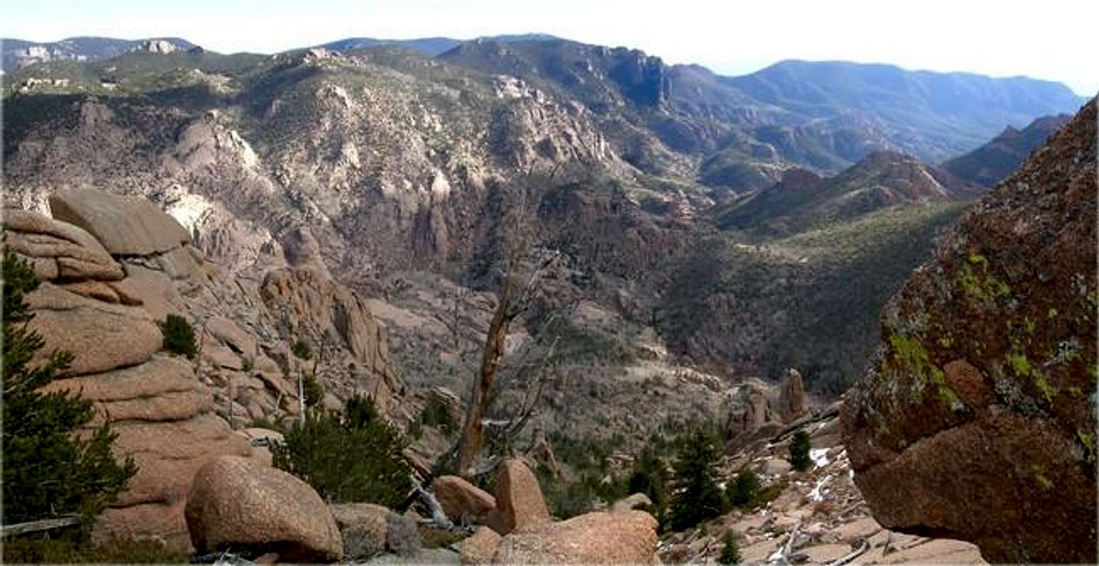
In 1980, Congress established the Colorado Lost Creek Wilderness area at the request of more comments of Wilderness designation than any other Colorado area. This 120,151-acre wilderness is as diverse as it is spectacular plus, its proximity from Denver Colorado is only two hours.
The Lost Creek Wilderness encompasses three small mountain ranges; the Platte River Mountains, the Kenosha Mountains and the Tarryall Mountains.
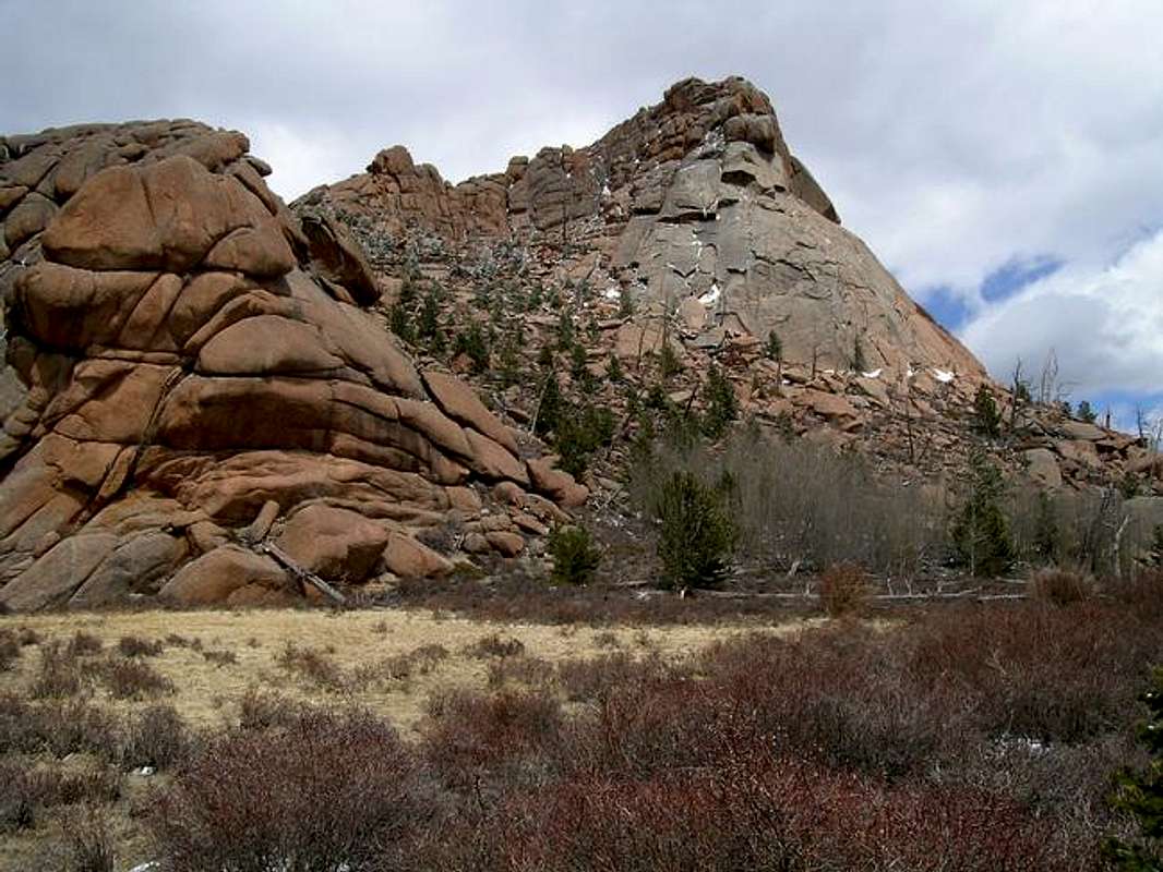
Unlike most of Colorado's alpine mountain Wilderness, Lost Creek Wilderness provides rare Pikes Peak granite in a myriad of formation and configuration. This strange but beautiful landscape is a world of fascinating domes, spires, rock towers, and rounded knobs.
The scenic "Lost Creek" area gets its name from the elusive Lost Creek, disappearing and reappearing as it weaves in and out of granite talus slides.
McCurdy Park
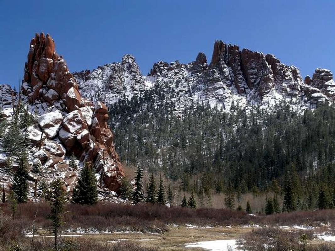
Nestled in between the McCurdy Mountain Massif and the Tarryall Massif resides McCurdy Park. This park or area is not a popular place, so labeling it a "secret hideaway" is not too far off base. But it is a place where those who know of it, keep going back. I have endured the 5-mile and 2,500-ft approach on seven different occasions. There seems to be a sense of exploration for me every time I go back, which is very appealing to my primitive ego. For those of you that endure the worthwhile but long approach, be prepared for a truly spectacular place. A place where gnarled pinnacles of pink granite reach for the sky! This craggy wonderland is hands down, the best place to experience the true beauty of the Lost Creek Wilderness.
Twin Eagles TH
You will need $3.00 to park in the Twin Eagles parking area.From Denver Colorado, travel Hwy 285 past Aspen Park, Conifer, Pine Junction and Bailey. Continue to Kenosha Pass where you will find the Kenosha Pass Campground. It is only one hour from Denver to Kenosha Pass. Continue to the tiny town of Jefferson and turn left on Park County 77 (Tarryall Road). This road is located directly before Jefferson's only convenient store. Continue 16.9 miles on the convenient paved road to Tarryall Reservoir. Continue passed the Ute Creek Trailhead at 3.3 miles beyond Tarryall Reservoir. Continue another 3 mile to the signed "Twin Eagles TH" turnoff. There is plenty of parking. It shouldn't take more than two hours to get to this TH.
Point Forecast-McCurdy Park
Click here for current weather conditions for McCurdy Park at 10,860-ftClick image to enlarge

