
-
 10646 Hits
-
 84.79% Score
-
 22 Votes
|
|
Mountain/Rock |
|---|---|
|
|
46.87709°N / 13.71128°E |
|
|
Hiking, Skiing |
|
|
Spring, Summer, Fall, Winter |
|
|
8005 ft / 2440 m |
|
|
Overview
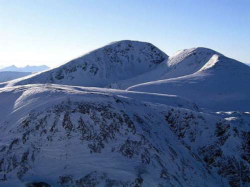
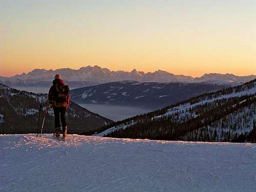
Rosennock from the NE
Rosennock is the highest mountain in Nockberge, but also a typical representative of this region - broad, rounded, in summer easy to ascend from many sides, in winter offering nice and easy ski tours. NE of the main summit there stands Kleiner Rosennock, 2361 m, a rocky smaller brother of Rosennock. In rounded ridges, descending from the summit towards the South there are some more elevations, but their importance is low. We can traverse them, choosing hiking routes over these ridges. Also the broader ring of mountains on the north can not be sonsidered to belong to Rosennock any more. There are some summits, which can be goals of a hike themselves.
The majority of visitors, be it in summer or in winter, ascend Rosennock from the southern side, which is touristically most developed. Through the Langalmtal in summer goes a forest road, by which many private huts are supplied. From there also all marked paths go. The other option is longer. Starting from the south around the western side the valley of Koflachbach encircles the summit. There starts the western summer approach. The northern side of Rosennock is much less touristically developed, even if also from that side approaches are possible, the most obvious one is from the Nockalmstrasse (panoramic road) through the valley of Hofalmbach.
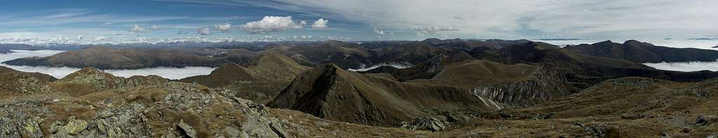
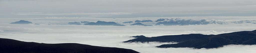
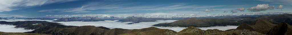
Rosennock is a mountain with a broad and nice panorama. All around us we see the hilly landscape of Nockberge. No sharp contours can be seen on near mountains, all attractive sharp peaks are quite distant - in Schladminger Tauern on the North, Hohe Tauern on the West and Julian Alps on the South.
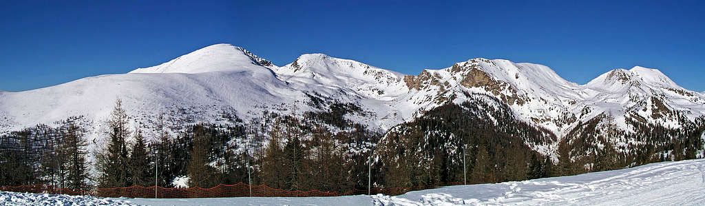
Various Summit Panoramas
All these panoramas were posted by Gangolf Haub.


Getting There
For the broader overview see the Gurktal Alps / Nockberge page!
1. From the south you best reach the well known tourist resort Bad Kleinkirchheim either from Klagenfurt via Feldkirchen or from Villach or Spittal via Radenthein. In Bad Kleinkirchheim you turn north into the valley of St. Oswald (8 km). On the upper part of the village you can in winter use the cable-car on Brunnachhoehe. For 550 m of altitude a one-way ticket is EUR 7.90 (in winter 2006).
2. The other, more obvious option is through Langalmtal. We enter this valley above Radenthein, the town lying west of Bad Kleinkirchheim. In Radentheim we drive northwards to Kaning, 1023 m, and, if the road is passable, from there into the valley - toll road. In summer you can drive to Erlacher Haus, 1636 m, or even higher.
3. There's also a forest road through the valley of Koflachbach, but I don't know if it's allowed for public traffic.
4. The fourth option is the Nockalmstrasse. There you pay EUR 13 toll for a car or EUR 7 toll for a motor bike. It is opened from begin of May till end of October. The suitable trail heads are Sacklhütte and Grundalm.
On the web, you can see a detailed map on: http://www.austrianmap.at/ The map below is even more clear, because only the most important features are shown.
Routes Overview
| See full screen |
 Rosennock from below Brunnachhoehe Summer marked paths1. From the south. In Kaning, 1023 m, two long routes begin, one going over the shoulder of Gridleck, 1887 m, the other one over the Neuwirthuette, 1568 m. They both join on the ridge of Feldhoehe.
|


3. We go from Kaning by the valley of Koflachbach or above it, till we reach the western slopes of Rosennock. There the marked path deters right (towards the E), first ascending steeply by a cart-road (till Thomelahütte), then using the SW ridge of the main summit.
4. From the northeast we start on Nockalmstrasse by Sackl Huette, 1519 m, and go into the valley of Hofalmbach. On Hofalm we turn westwards and by the creek continue to Kaninger Wolitzen Huette, 2070 m. From there we continue to Nassbodensee and towards the West to the highest point. The first part of this route is not marked.
5. The second possible starting point on the northeast is Grundalm, 1688 m. From there we first gain Oswalder Bocksattel (saddle), where we have many options how to contin ue towards the west.
6. From the East good marked paths are traversing this part of Nockberge. They offer approaches to the summit, which can be done in more than one day.
Ski tour from the south-east
1. You start either on the ridge of Brunnachhoehe, 1902 m, (or in St. Oswald, 1356 m), by the upper station of the cable-car, or in Langalmtal. First you must reach Erlacher Haus, 1636 m. From there you continue by a cart-road below Zunderwand towards the West and reach Feldhuette, 1758 m. From there directly towards the West and North-west to the summit. You'll need from the cable-car station some 3 h.
2. From Langalmtal directly. You go by the valley till Veidlhuette, 1425 m (just before Langalm, 1458 m). There the marked path (and often a ski trail) turns left and ascends in the northern direction directly to Feldhuette, 1758 m. From there directly towards the West and North-west to the summit. 3 h.
Red Tape
No limitations, but a great portion of Nockberge is a natural parc. For more details, see the official web site of Nationalpark Nockberge.
The Nockalmstrasse is opened from May to October (toll!).
When To Climb?

On the ridge
You can climb Rosennock in any season.
For weather conditions for Austria see here (then choose regions: Steiermark and Kaernten).
Avalanche info page is the following: Kaernten.
Camping
To ascend Rosennock you don't need to sleep on the mountain. Otherwise east of it, at the end of Langalmtal, there's the Erlacher Haus, 1636 m. It is private, opened from May till October, has 54 beds. Tel. 0043/ (0)4246/4460 or 0043/(0)676/4210545. Can be reached from the parking place above Radenthein in 1 h 15 min.