
-
 20150 Hits
-
 81.92% Score
-
 15 Votes
|
|
Mountain/Rock |
|---|---|
|
|
39.91750°N / 105.6823°W |
|
|
12072 ft / 3680 m |
|
|
Overview
"Radiobeacon Mountain" also referred to as "Beacon Peak" is located on the Continental Divide in the James Peak Wilderness. Radiobeacon's northeast face is a very popular spring ski descent. It's not named on the USGS map, but it does indicate a radiobeacon on the summit. The radiobeacon no longer exists, but a 10' by 10' concrete slab near the summit is evident. Ron Haddad and Eileen Faughey are responsible for naming the mountain "Radiobeacon Mountain". More information is available in their book, "Front Range Descents."
From the summit you can see James Peak to the south and the Arapaho Peaks to the north. You can also see the Winter Park Ski Resort to the west.
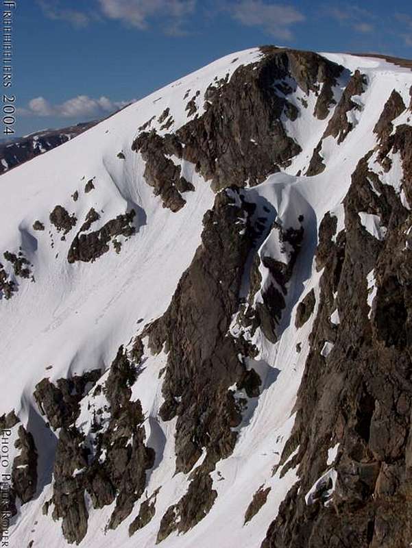
Radiobeacon's Northeast Face.
Getting There
Forest Lakes Trailhead:
Park at Forest Lakes Trailhead (10990') on Rollins Pass Road. The road usually opens sometime in May. Depending on snow closures, you may not be able to make it to Forest Lakes Trailhead. If this is the case park at 10457' where the road crosses right over a creek.
To get to Rollins Pass Road, take 119 south out of Nederland 5 miles from the traffic circle. Take a right onto a dirt road. Take a right onto Rollins Pass Road 7.6 miles from the start of the road.
North Ridge: From the Forest Lakes Trailhead, gain the Continental Divide by hiking an east-facing ridge southwest of Jenny Lake. Hike south on the Continental Divide to Radiobeacon's summit.
East Face: Hike downhill to upper Forest Lake and hike around the north and west sides of it eventually hiking south until the Radiobeacon is due west. Climb the East Face of Radiobeacon (35 degrees max).
Northeast Face: Hike downhill to upper Forest Lake and hike around the north and west sides of it eventually hiking south until Radiobeacon is southwest. Climb either the North Couloir (45 degrees max) or the Northeast Couloir (50+ degrees max).
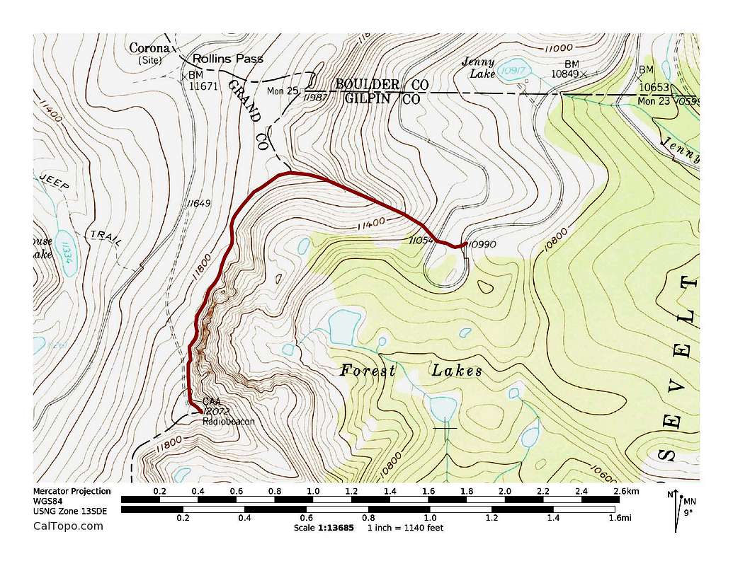
Radiobeacon's North Ridge Route. 1.2 miles with 1,240 feet of elevation gain. Click to enlarge.
East Portal Trailhead:
"For those who don't wish to brave the long, bumpy drive up the Rollins Pass Road from the east (or when the road is closed by snow), it's easy enough to approach Forest Lakes from the East Portal TH (five miles?). From the large East Portal TH near the train tunnel, hike up the popular South Boulder Creek trail for about a mile to a large clearing. Take a hard right at a signed intersection up a hill and follow the trail keeping right at the intersection with the Arapaho Lakes spur. This will bring you to lower and then upper Forest Lakes. Shorter and much more interesting than hiking the Rollins Pass road, and pretty easy in terms of elevation gain as well." Submitted by CharlesD on October 31, 2005 1:23 PM.
Rollins Pass Trailhead:
Drive Forest Road 149 from Winter Park to Rollins Pass.
Ski Runs
East Face: II D5 R1
North Couloir: II D10 R3
Northeast Couloir: II D15 R3
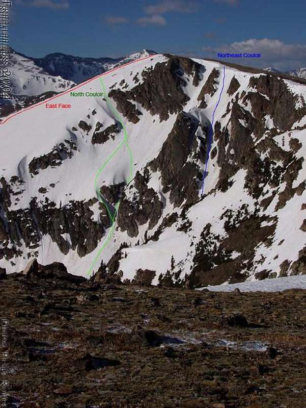
Radiobeacon's Ski Runs.
When To Climb
It's best to climb Radiobeacon in the spring, summer or fall when Rollins Pass Road is open. When the road is closed, a 10 mile snowshoe or ski is required or you can approach from the East Portal TH.
Mountain Conditions
7 Day Forecast for Rollinsville, CO
External Links
Lists of John