
|
|
Mountain/Rock |
|---|---|
|
|
35.37590°N / 111.75519°W |
|
|
coconino |
|
|
Spring, Summer, Fall |
|
|
9170 ft / 2795 m |
|
|
Overview
The Hochderffer Hills are made up of a 2-mile+ wide ridge topping out less than 5 miles west of Humphreys Peak. The area is named after an honored 19th and early 20th Century Flagstaff resident, George Hochderffer.
Topping out at 9,170’, the summit is actually the tenth highest summit in the Flagstaff area (the fifth highest outside of the San Francisco Peaks).
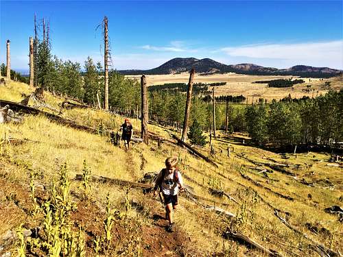
There is no marked trail to the summit; although a faint use trail does lead up towards the summit via the primary route; making it rather simple to get up the mountain. The primary challenge is finding the summit itself, which is marked by a pile of rocks on a fallen tree. Rest assured, if you are persistent enough, you can find the summit by walking around the open forest until you find the rocks on the fallen tree.
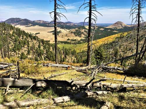
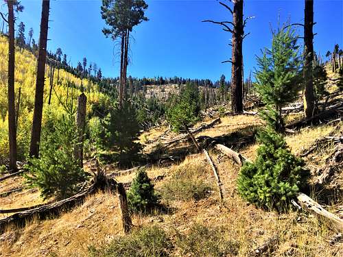
There are no actual views from the summit itself; but there are plenty of nice views on the hike up to it; particularly in fall.
The Hochderffer Hills are best hiked between April and mid-June and early September to early November. If hiking in the heart of summer, it is best to hike in the early morning to avoid the heat and the afternoon rains and thunderstorms.
Getting There
From Flagstaff take Highway 180 and drive approximately 12 miles north of the turn off to the Arizona Snow Bowl. Take a right on FR 151E. Drive about 0.4 miles and look for a road on the right. This is the road that goes south towards the hills.
You can park on the side of the 151 road near the dirt road heading south.
Route
There are two primary routes to the summit. The first is the gully route. The second is the west side route.
For the gully route, hike 0.2 miles south on the road, and turn left before a gate. Continue for about half a mile towards the gully. The gully runs between the trees. However, you don’t take the actual gully. On the right side of the gully there is an overgrown, but generally visible, game trail. While the trail isn’t clear all the time, it generally follows a straight path and is easy to find again if you lose track of it. The trail heads up almost 500’ and then you need to turn right and head up to a saddle about 150’ above. Continue to the top of the ridge which is about a quarter mile and almost 250’ above the saddle. Then take a left and head into the forest. The summit is less than a quarter mile away. The summit is not far from a more open spot in the woods. Just look around for the highest spot and look for a pile of rocks on a large fallen tree stump. The rocks are still up there on the fallen tree as of 9/26/2020.
The one-way distance to the summit is about 1.8 miles, gaining about 1,220’. However, be prepared for a little extra distance if you need to search for the summit. Creating a GPS waypoint is recommended. The topographic coordinates mentioned on this site will lead you directly to the summit.
For the west side route, continue past the gate on the road for another ¾ of a mile; about a mile from the 151 road. Once you get out of the heavier forest, start hiking off-trail up the west slope of the mountain. Generally head to the left up the slope until you reach a trail. Take the trail until it tops out at over 8,400’. At this point, head off-trail, generally to the left towards the saddle. The saddle is about 0.4 miles and 480’ above. From here, follow the directions mentioned above for the gully route.
The one-way distance to the summit is about 2.4 miles, also gaining about 1,220’.
This can easily be done as a loop hike going up one way and down the other.
Red Tape
There is some private land in the vicinity of the start of the trail. Be mindful of signs, and park where appropriate. Be mindful of Forest Road closures which are reported here: https://www.fs.usda.gov/detail/coconino/alerts-notices/?cid=stelprdb5339811
External Links
Details on George Hochderffer: https://snaccooperative.org/ark:/99166/w6185h1f