

|
|
Mountain/Rock |
|---|---|
|
|
35.33886°N / 111.2867°W |
|
|
Coconino |
|
|
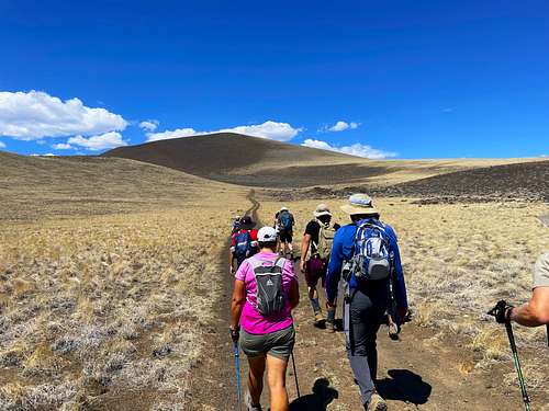
Hiking |
|
|
Spring, Summer, Fall |
|
|
6813 ft / 2077 m |
|
|
Overview
Merriam Mountain or Merriam Crater is a prominent summit in the eastern San Francisco Volcanic Field. There are numerous peaks in the area, but they have a smaller prominence. Merriam is much more pronounced and steep than neighboring cinder cones, and it shows. It is also the youngest cinder cone in the San Francisco Volcanic Field. The nearest mountain with a higher prominence is O'Leary Peak 8,938' which is 14 miles to the west.
Merriam Mountain is best hiked between March-May, September-November. It gets cold with snow in winter, and very hot and exposed in the summer. There are also rattlesnakes in the area.
There are numerous other peaks one can hike if visiting Merriam Mountain that are located along Leupp Road, including Cochrane Hill, Junction Crater, and North and South Sheba craters, to name a few.
Thank you to Scott Surgent for creating this page. I used some of his information to create the description. For more information, visit his trip report page.
Getting There
Merriam Mountain is about 23 miles east/northeast of Flagstaff. It is reached off the Winona exit off of I-40. Once off the exit, take a left and drive for 2.3 miles to Leupp Road, and then 13 miles to a small turn off southeast of the mountain. This is Grandfalls Road. Take Grandfalls Road for about 3/4 miles and take a left. Drive up another 250 yards and there is good parking. Any 2WD vehicle can make it up here. There is a rough hill at this point, which is pretty smooth afterwards. However, at this parking area, the summit is just over 2 1/2 miles to the summit, with about 1,400' of gain. About 3/4 miles from the turn off from Grandfalls Road is a smaller road on the left. This road is straight and flat, but then turns north towards the summit ridge. Once on the summit ridge, it connects with a main road leading to the summit. The last mile to the summit gains 1,000'.
Red Tape
There is no red tape of note. Merriam Mountain itself lies within one square mile section of BLM land. The surrounding lands are State Trust and some private sections. Access does not appear to be restricted and this is a popular destination without any signs indicating any issues or rules or regulations.