
-
 30022 Hits
-
 90.73% Score
-
 33 Votes
|
|
Area/Range |
|---|---|
|
|
35.34426°N / 111.99463°W |
|
|
Hiking |
|
|
Overview
If you have any photos of any volcano's in this area please submit them. Some pics I am looking for are SP Crater, Merriam Crater, strawberry crater, Red Mountain, Sunset Crater, or any other crater you have, named or unnamed.
 |  |
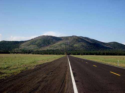
The San Francisco Volcanic Field, a geologic term used to describe the mountains and hills of Northern Arizona.
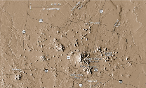
The San Francisco Volcanic Field covers a large area of Northern Arizona. It starts just west of Williams and extends to Grand Falls on the Navajo Reservation near the town Leupp, covering 1,800 square miles. This area is comprised of mainly cinder cones that rise about 300-600 feet high with other scattered lava domes and has only one strato-volcano. This area is more of a hill range with scattered mountains. Much of this area resides in the Kaibab and Coconino national forests, which are the world’s largest ponderosa pine forest. Just outside of the ponderosa pine forest, this area also resides in the pinion and juniper forests of Northern Arizona. The elevation of this area is between 4,500 feet and 12,633 feet. The lowest point of this area is by Grand falls, along the Little Colorado River.
There are 600+ volcanoes in this area, which makes it an interesting place to live and visit. This region would be flat and uninteresting if it was not for the volcanic nature of this area. Most of the residents in Flagstaff have moved there simply because it is a pretty place to live with nice summer whether. Without the volcano’s Flagstaff would either be a small tiny town or nonexistent.
Hiking is plentiful in this area, but by no means is it a mountaineer’s paradise. All of the peaks are class one and two hiking to the top. The only mountain that has anything more difficult is Mount Elden. It has a few class 3 routes and in the Dry Lake Hills there are quite a few rock-climbing areas.
There are only 2 mountains in this area that sees a lot of foot traffic, Humphreys Peak and Mount Elden. Humphreys, being the only alpine summit in Arizona and a state high point has made it increasingly popular on weekends. It is also the easiest of the western state high points and easy to access. If there was a higher summit in Arizona, Humphrey's Peak might be overlooked.
Mount Elden is popular because the trail head is right in the city limits of Flagstaff, right across from the Flagstaff mall. This mountain probably sees more weekday hikers then Humphreys Peak. While on weekends both mountains are very busy.
Kendrick Peak also is frequently hiked, but is never crowded. It's the second highest in this area and the only other peak with a trail on it that exceeds 10,000 feet.
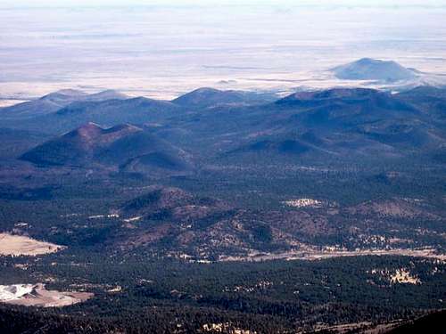
Cinder Cones
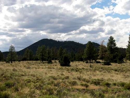
The San Francisco Volcanic Area contains over 600 cinder cones, which makes up most of this region. Most of the cones are between 300-600 feet tall. There are some larger cones that exceed 1,000 feet.Here is a description of some of the more interesting and popular cones:
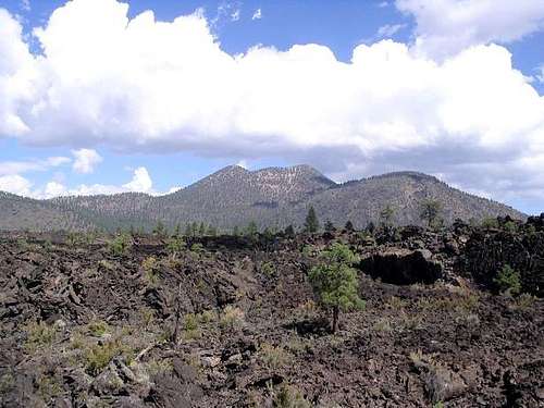
Sunset Crater 8,039'
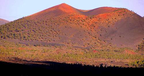 |  |
Sunset Crater is one of the most beautiful, the most popular and the most interesting of all cones in this region. It is the newest addition to this region, forming about 1,000 years ago. At an elevation of 8,039', it rises over 1,000 feet from its surrounding area. It's best view from O'Leary Peak, as you can veer down into its black and red crater. Sunset Crater is the northern most crater along a small range of black craters running southeast from Sunset Crater. There are about 3 craters rising more than 1,000 feet in this area, the highest being Double Crater at 8,004'. The locals call these hills as the "Cinder Hills" or the "Cinder Pits". These craters did not erupt one at a time, but rather, all at once forming a wall of fire, covering the area for miles in its black cinders. O'Leary Peak was once the same color as Mount Elden, but is now covered with Sunset Craters cinders and now is a blackened mountain.
Hiking up Sunset Crated was once allowed but is now prohibited.
Any recreation is allowed on the rest of the Cinder Hills. I've hiked to the top of point 7,804, which took about 1.5 hours on accent and about 20 minutes on decent. These summits are like hiking sand dunes, and the cinders give way as your walking on them.
Hiking is not the main recreation in this area. Most people go to Cinder Lake (a lake of Cinders not water) and ride their motorbikes around the lake or up the craters.
These craters form the boundary line for the Ponderosa pine forest. The Volcanic Field continues into the desert from this area.
Merriam Crater , Roden Crater and Grand Falls
 |  |
Merriam Crater is one of the largest craters in the San Francisco Volcanic Field. At an elevation of 6813' it rises 1,200-1,500'. It sits next to the Navajo Indian Reservation boundary along the road that goes from the Townsend-Winona Rd to the little town, Leupp. Merriam Crater and Roden Crater lay along the edge of the San Francisco Volcanic Field.
About 10 Miles from Merriam Crater is a large waterfall called Grand Falls. This waterfall sits along the Little Colorado River and only runs part of the year. A lava flow had filled the canyon and run over to the other side of it blocking the flow of the river. Throughout time the other side of the canyon had filled up with sediment and the river had flowed around the lava flow and back into the canyon. The Little Colorado River now flows down the side of the canyon creating the beautiful, muddy Grand Falls. Which crater that blocked the canyon is unknown. It's undecided whether Merriam Crater or Roden Crater's lava spilled into the canyon. Roden Crater's elevation is 5,440' and rises about 600 feet. It sits about 5 miles from Grand Falls. The more popular speculation is that Merriam Crater is the Crater that formed Grand Falls even though it is twice as far from the river.
SP Crater 7,021'
 | SP Crater is on of the most perfectly cylindrically shaped craters in this area and rises about 800 feet. It is a nearly perfect example of a cinder cone and its associated lava flow. Its lava flow flows north for about 4 miles and is about 100 feet thick. It is located about 24 miles north of Flagstaff and is on the Babbitt ranch |
Sheep Hill
 | Sheep Hill rises about 400 feet from the northeastern end of Flagstaff near Mount Elden and is recognized by its massive scar from extensive mining. The top of this hill also has been mined away. This hill has been heavily mined for its cinders. It contains both black and red cinders which has many different uses, such as landscaping, rocking the roads after snowstorms, and many other uses. This hill is off limits for hiking. |
Red Mountain

Red Mountain is visible from Hwy 180 driving to the Grand Canyon from Flagstaff. It rises over 1000 feet from its surrounding area. It was formed on a windy day giving it an oblong shape. It's definitely not a perfect looking cone. The east side of it has eroded away exposing the inner layers if this cone. There's a trail leading to the top where you can peer down into the eroded side of the crater.
This is one of the more interesting craters in the area. If anybody has done it and could make a worth while page, please add it to SP.
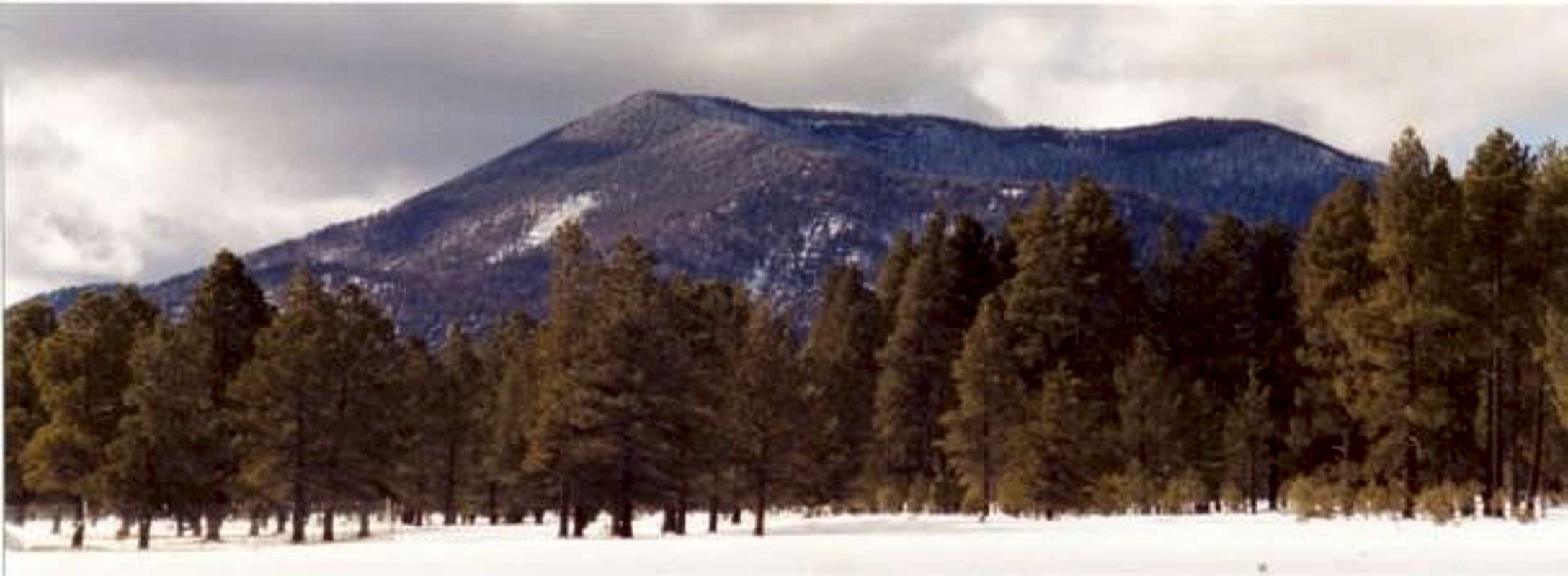
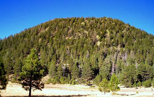
Harts Prairie Shield
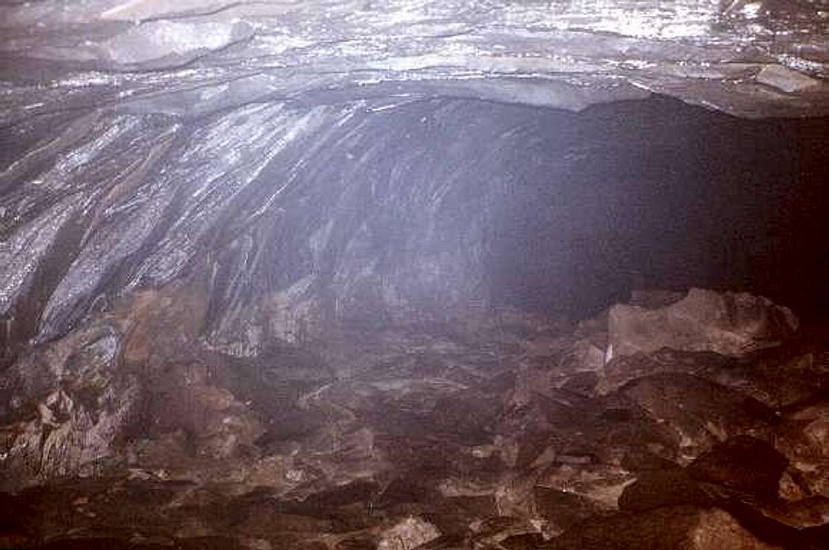
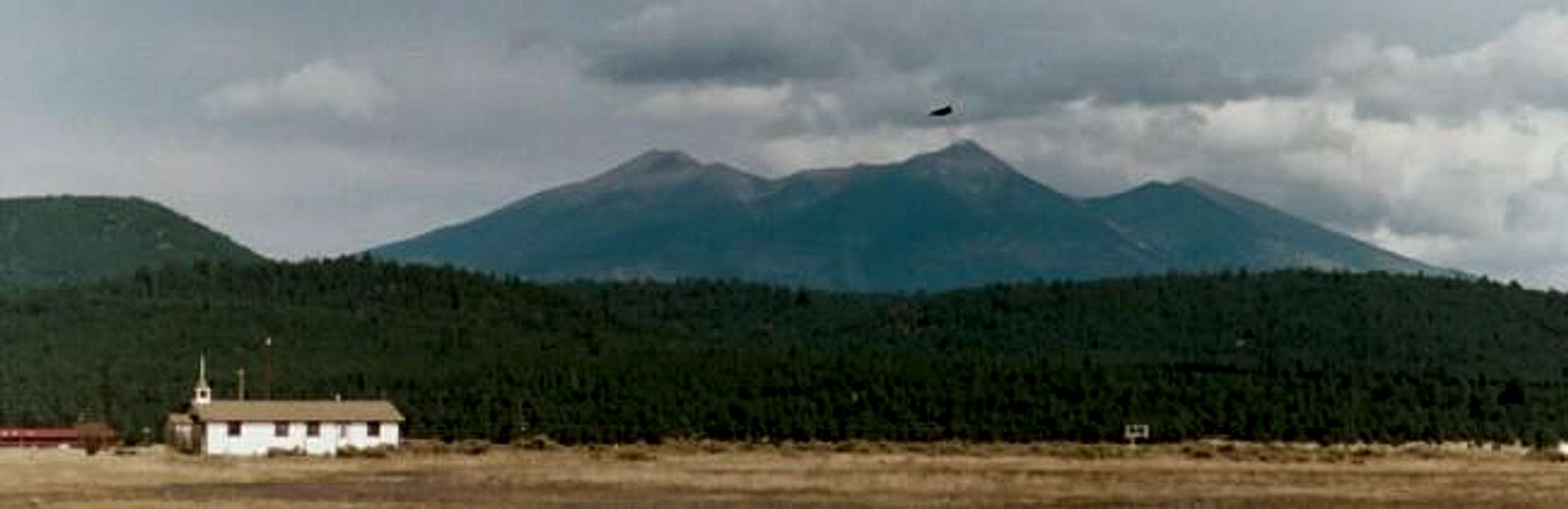
 This shot shows Harts Prairie Shield with Kendrick Peak behind it. You can see other craters have formed on top of it and appears to be nonexistent. This shot shows Harts Prairie Shield with Kendrick Peak behind it. You can see other craters have formed on top of it and appears to be nonexistent. | The Harts Prairie Shield is the only Shield Volcano in the San Francisco Volcanic field. This volcano officially has no name, but unofficially carries this title since it sits under Harts Prairie. Other Cinder cones and lava flows have completely covered this volcano making it unattainable. The Harts Prairie Shield is responsible for making Lava River Cave, near Kendrick Peak. This cave is about 3/4 mile long. |
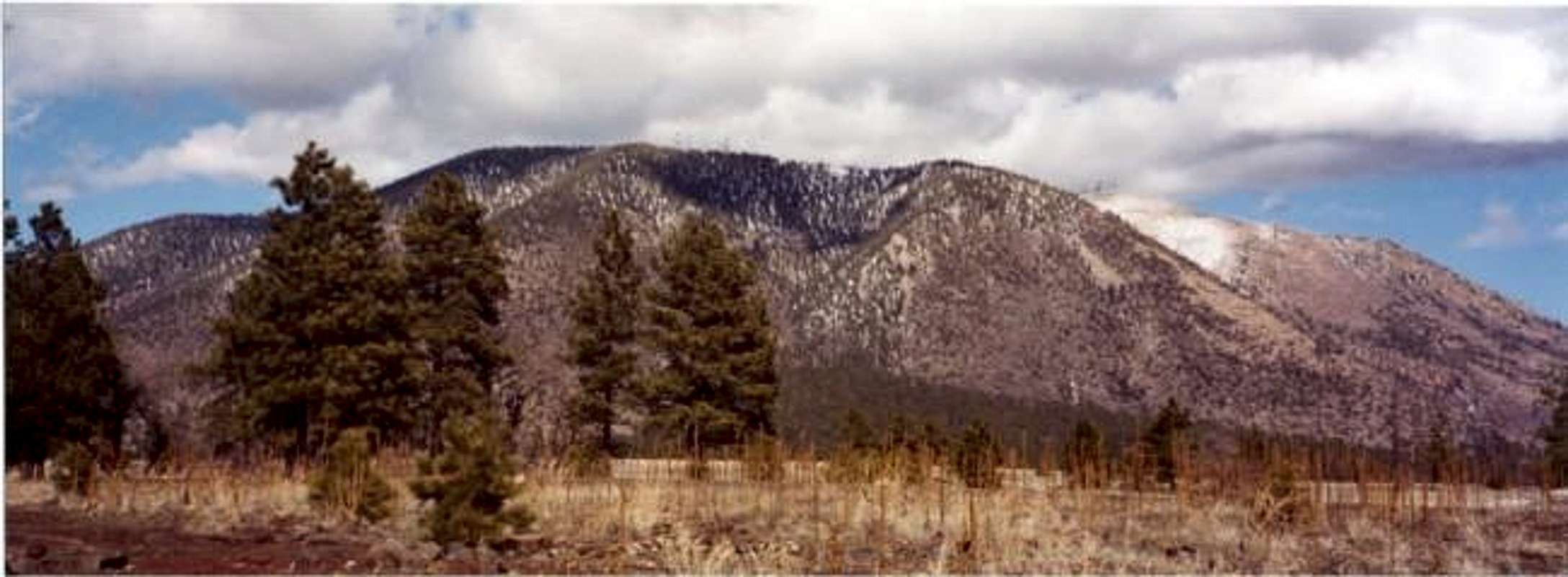
San Francisco Mountain
The Mountains that make up San Francisco Mountain are the states highest summits.
In order of elevation these are the summits that make up this great volcano:
| Humphreys Peak | 12,633' |
| Agassiz Peak | 12,356' |
| Fremont Peak | 11,969' |
| Aubineau Peak | 11,838’ (unranked) |
| Rees Peak | 11,474' (unranked) |
| Doyle Peak | 11,460' |
| Shultz Peak | 10,058'(unranked) |
| Sugarloaf | 9,283'(lava dome) |
Shultz Peak is a mountain on the exterior part of the crater making up part of the ridgeline that starts behind Mount Elden near Shultz Pass and works it way up to Doyle peak.
Sugarloaf seams to form the eastern boundary along the crater, but is a lava dome that was formed after the massive explosion.
San Francisco Mountain is the only strato-volcano in the San Francisco Volcanic Field. It is a fragment of what was a much larger mountain, which is estimated to be about 16,000-20,000 feet.
San Francisco Mountain is considered Mt. Saint Helens twin. Before the eruption of Mt. Saint Helens there was many questions about San Francisco Mtn. Scientist did not know why it had its bowl shape. Volcanos usually blow up and not to the side. And if it did erupt, what happened to all the matter that was blown away. It was once assumed that maybe the mountain caved in and created its bowl appearance. That theory was never fully accepted. After Mount Saint Helens erupted a lot of questions were answered. Mount Saint Helens did not blow up, it blew out; and then a lava dome stared to grow inside of it. San Francisco Mtn. has a lava dome just on the outside of it, named Sugarloaf, which formed after it blew. The appearance of both San Francisco Mtn. and Mount Saint Helens is remarkably similar when viewed from looking into both of their bowls.
The Kachina Peaks wilderness provides a very large hiking area, from easy to difficult hikes. There are 3 trail heads that lead to the Humphreys Peak Summit. There are many other trails that lead to different parts of this giant mountain. Unfortunately Agassiz Peak and Fremont Peak are off limits. Only winter access is permitted.
Lava Domes
The lava Domes make up most of the largest and highest mountains in the S.F.V.F. Most of them rise over 2,000 feet above the surrounding area.Bill Williams Mtn.
The San Francisco Volcanic Field started its procession of Volcano's around the area that the town of Williams. The small town of Williams sits at the base of Bill Williams Mountain. This mountain was the first major lava dome to form and was possibly the highest point in Northern Arizona until other volcanoes started to form. This is presuming it predates San Francisco Mtn. Bill Williams sits along a fault that two other of the major Lava domes sits on, Sitgreaves Mtn, and Kendrick Peak.
Both a road and a trail access the Peak of Bill Williams. The Peak has is a radio Tower and a lookout tower on top.
Sitgreaves Mtn
Sitgreaves Mtn is a very large lava dome north east of Bill Williams. It is best viewed along I-40 between Parks and Belmont. This lumpy twin peaked mountain is almost a range of its own. It contains 2 peaks and many false peaks. It has a sub summit at 9,290' and an eastern summit at 9,004 feet. Peak 9,0004 rises nearly 400' from the saddle. Sitgreaves Mtn. is the only major mountain in the San Francisco Volcanic Field that has no trail to summit. The hike to the summit is steep and takes a bit of route finding, navigating through the forest and having no views of the summit or where it is. The best route is up Peak 9,004 then across the ridgeline up and down a few minor ridge points then up to the summit. Sitgreaves is the most strenuous summit to do in this range.
Kendrick Peak
Kendrick Peak is the highest lava dome in the San Francisco Lava Field reaching an elevation of 10,418 feet. This Peak can be accessed by both I-40 and US 180. It has a lookout tower on top, yet no road up to it. It is only accessible by trail. The 2 trails that lead to the summit are the Pumpkin Trail and the Kendrick Trail. This Mountain has great views of San Francisco Mountain and the Grand Canyon.
Mount Elden
Mount Elden is a very large lave dome north of Flagstaff. It extends over 2 miles to the sub north summit, Little Elden. This is the only mountain that has any sort of technical challenge on it. The Dry Lake Hills along the Mt. Elden Road has a fairly popular area for technical climbing and repelling. Mount Elden is surrounded by a large trail Mecca. This Mountain has more trails than any of the other lava domes.
O'Leary Peak
O'Leary Peak is a double peaked mountain just north west of Sunset Crater. This lava dome is interesting since it is covered in cinders. Sunset Crater covered a vast area in cinders including O'leary Peak.
It does not have any trails leading to the top, but does have a closed off road leading to the summit tower. The peak without the tower is the actual peak. The tower sits at 8,916 feet, while the true summit is 8,938 feet. There is no trail leading up to the true summit. The views are probably better than any other lava dome. It sits near the high deserts of Northern Arizona. The north has a view of the Painted Desert. To the west, an amazing view into the interior of San Francisco Mountain. And just below, a view right into Sunset Crater.
Slate Mountain
Slate mountain is one of the smaller lava domes in this area, and is located north of Kendrick Peak. Slate mountain has not slate on this mountain, but is named after the slate like rock metamorphic rock that breaks into large thin sheets. This small summit can be reached by the Slate Mountain Trail #128, which is 2.2 miles to the summit.
Sugarloaf Mtn
This lava dome occurred after San Francisco Mountain blew itself apart, similarly the same as Mount St. Helens.
There is no trail to the top, but from the Inner Basin it is a very steep climb to the top with only about 800 feet elevation gain.
Hockderffer Hills
Hockderffer Hills are a cluster of both lava domes and cinder cones That reach an elevation of 9,152 feet. These hill are on the east side of US 180 north of Flagstaff and can be accessed from FR 151. There is no trail leading to the top.
Mormon Mountian Volcanic Field
Mormon Mountain Volcanic Field is a southern extension of the SFVF and covers about 1,000 square miles. I'm not sure what geological formation Mormon Mountain is but from what I have read, it is not a lava dome. I don't know much about this area, but I am trying to find information on it. I will be adding to it as I find out more. The 2 summits on Summitpost.com in ht MMVF are Mormon Mountain and Hutch Mountain. Hutch mountain is the high point of the MMVF. This area also contains Arizona's only two natural lakes, Stoneman Lake and Mormon Lake.
Mountains with 1,000 feet of Prominence
This is a list of all the mountains in this area that are over 1,000 feet of prominence. There is a topozone.com link to every mountain that is not currently on summitpost.| Name | Prominence | Elevation |
| Humphreys Peak | 6039 | 12633 |
| Kendrick Peak | 2488 | 10418 |
| Bill Williams Mountain | 2306 | 9256 |
| Sitgreaves Mountain | 1949 | 9389 |
| O’Leary Peak | 1778 | 8938 |
| Hutch Mountain | 1542 | 8532 |
| Mormon Mountain | 1310 | 8500 |
| Merriam Crater | 1273 | 6813 |
| Mount Elden | 1259 | 9299 |
| Red Mountain | 1015 | 7965 |
| Saddle Mountain | 1008 | 8880 |