|
|
Mountain/Rock |
|---|---|
|
|
31.06587°N / 7.91318°W |
|
|
Central High Atlas |
|
|
Hiking, Mountaineering, Scrambling |
|
|
Spring, Summer, Fall |
|
|
13156 ft / 4010 m |
|
|
Overview
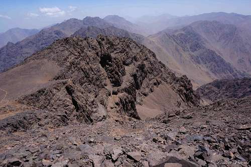
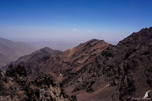
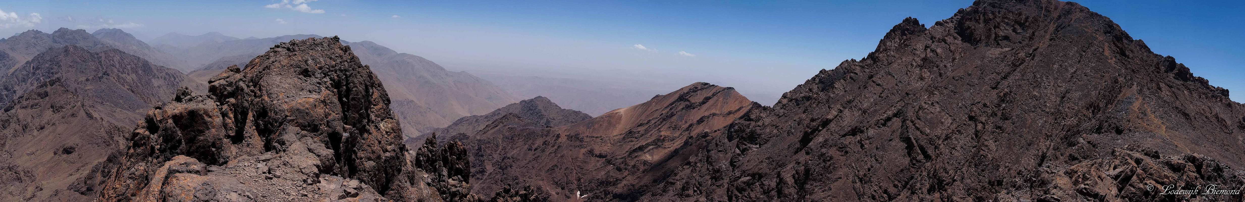  Imouzzer summit Panorama from North to South; with Imouzzer (4010m, left) and Jbel Toubkal (4167m, right) |
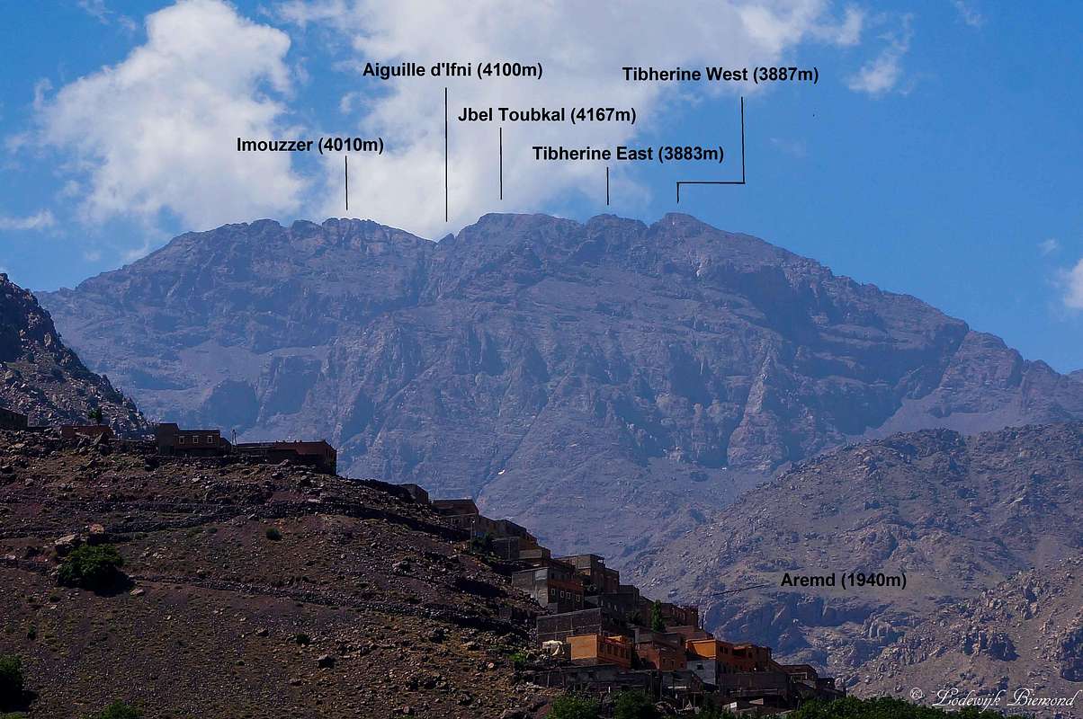
Imouzzer is a 4000-meter peak in the Moroccan Central High Atlas. It is among the highest peaks in Morocco and Northern Africa. Imouzzer is part of the Toubkal Massif and is close to the highest mountain in Northern Africa: Jbel Toubkal with an altitude of 4167 meters (13671ft). Imouzzer is located to the north-northeast of Jbel Toubkal and offers great views especially towards the north. The villages Aroumd (1945m) and Imlil (1740m), starting point for most ascents of Toubkal, Imouzzer and other surrounding peaks, can be clearly seen. Towards the south Jbel Toubkal rises over 150 meters higher. Towards the west some of the other major 4000 meter peaks like Afella (4043m) and Biguinnoussene (4002m) can be seen.
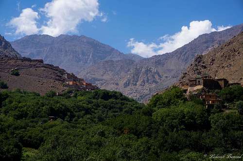
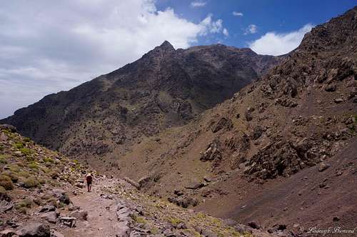 Climbing Imouzzer; The trail with Agouti (3673m) behind | 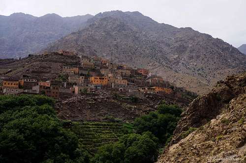 The beautiful village Aremd (1940m) |
Imouzzer is occasionally climbed together with its higher neighbor Jbel Toubkal. Although most people in the region just climb Toubkal and use the easiest South Cwm route up and down, it is more rewarding to use the North Cwm route up and the South Cwm route down (or the other way around). Imouzzer is located along the North Cwm route to Toubkal and can be ascended together with Toubkal this way. The difficulty of the route is graded T4, although the most part of the route is graded T3 in my opinion. The very last part of the route is the most difficult and involves some scrambling. The summit is built up of large blocks which have to be climbed to reach the actual summit of Imouzzer. The climbing is rather easy (UIAA grade I, T4) and short.
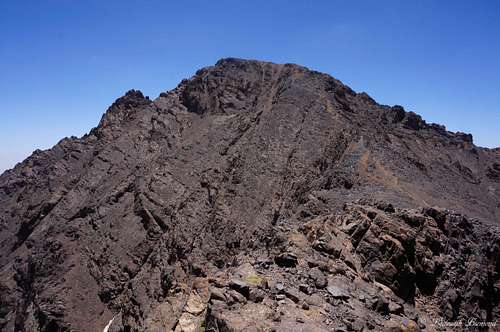
 South Face | 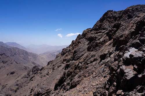 North Face | 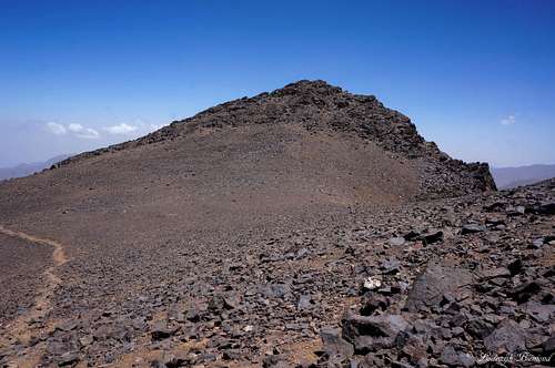 West Face |
Climbing Imouzzer (and Toubkal) requires at least two days. The first day starts in Imlil (1740m) and ends at the Toubkal Refuge (3207m). After spending the night in the Refuge use the North Cwm up and climb Imouzzer (and optional Jbel Toubkal as well). Descent back to the Toubkal Refuges and stay another night here or descent back to Imlil the same day. If you choose for the last option; prepare for a long day with a vertical drop of 2500 meters in a single day.
In my opinion Imouzzer is a great peak to climb along with its higher neighbor Jbel Toubkal. The traverse route (South Cwm – Toubkal –North Cwm with Imouzzer) is highly recommended. The views towards the north are better from Imouzzer compared to Toubkal. Also the north Cwm route is more quiet and last but not least: The remains of an old aircraft are scattered along this route.
 North Cwm Route: July | 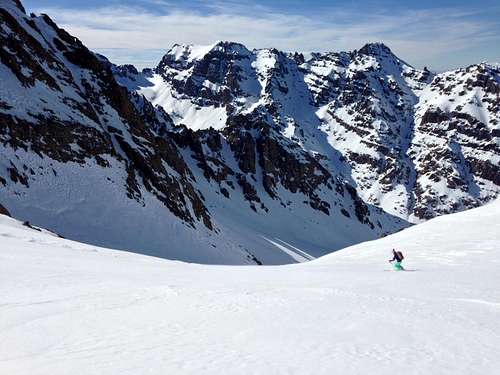 North Cwm Route: January by Jurgen |
Route Description
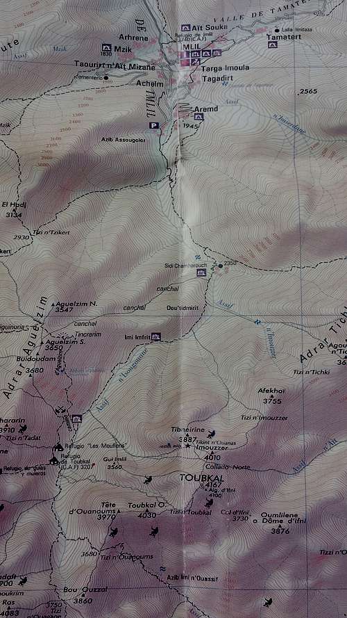
ROUTE MAP
The route starts at the village of Imlil (1740m). From here it is 6-8 hours walking to the two Toubkal Refuges at an altitude of 3207 meters. The route is described on the Ikhibi Sud / Normal Route page here on SP. After spending the night in one of the Refuges there are two options for climbing Imouzzer.
1) If you are planning on only climbing Imouzzer take the North Cwm route up the mountain (also named Ikhibi Nord). This route is described on SP as well. Following the North Cwm route up (T3+) the mountain you will eventually reach the saddle that connects Imouzzer with Toubkal. From this point head up the South face of Imouzzer. The first part is easy and there are multiple trails to be recognized. Eventually you will arrive at the shoulder of the mountain. From here a rocky ridge starts with large ‘rock blocks’. Obviously, the highest block is the one to go to. It is reached by some easy climbing (UIAA I, T4)
2) Take the South Cwm route up to the summit of Toubkal (T3). Descent from the summit along the North Cwm Route (T3+). See the individual Route pages (North and South Cwm) for more detailed information. After descending the north face of Toubkal the saddle that connects Toubkal with Imouzzer is reached. Climb to the summit of Imouzzer as stated at 1). After summiting descent the same way back to the saddle and follow the North Cwm route down to the Toubkal Refuges or all the way back down to Imlil.
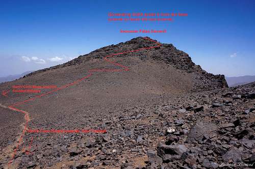 Imouzzer Route Beta (1) | 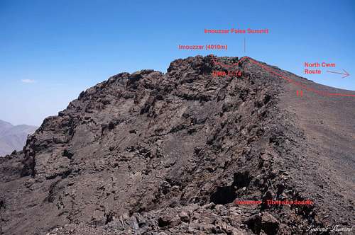 Imouzzer Route Beta (2) |
How to get There
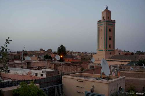
Marrakech
Roof Terrace @ Riad in Imlil
The starting point for the ascent of Imouzzer, Toubkal and the other surrounding mountains is the village of Imlil (1740m). In past days it was hard to get there, but some years ago a good paved road (up to western Standards) was opened. Nowadays it will take you about an hour and a half by car to get to Imlil from Marrakech. Take a grand Taxi from Marrakech to Asni. In Asni take a Taxi to Imlil. You have to switch Taxi’s there, since the normal Taxi’s do not go further. Easier is to just arrange a Taxi with the Hotel you are staying in. I can recommend Riad Atlas Toubkal in Imlil. The hotel arranged a pick-up at the airport and directly drove us to the Riad in Imlil.
Of course you can also rent you own car and drive there yourself. Although the roads are good, I didn’t see too many people using a rental car to get to Imlil. Furthermore, traffic is much more chaotic compared to Western Europe.
How to get There: Google MAP
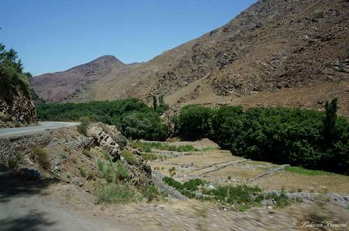
Paved Road between Asni and Imlil
What Gear?
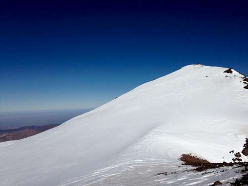
Summit view towards the South
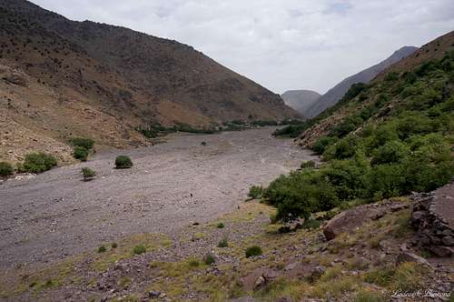
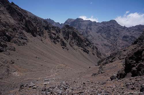
The big river plain up the valley above Aroumd
In the other months winter gear (crampons, ice axe) are advised. Warm clothing is mandatory as well since temperatures can be very low at the higher altitudes.
 Imouzzer in winter by Jurgen |
When to Climb
Imouzzer/Toubkal (13671 ft / 4167 m) Massif as seen from Imlil
Imouzzer can be climbed all year long. During the winter months including autumn and spring there is snow present on large parts of the mountain. In spring snow retreats to about 3000m. In winter the whole route is covered by snow. Generally most people climb Toubkal in the Spring season (end of march- until may). During the summer months temperatures can get high, even in the higher altitudes. I climbed Imouzzer in July, but it worked out fine. I was afraid it would be too hot, but it wasn’t... In the summer months there is no snow left on the mountain and temperatures are just above freezing point at night (at 3200m) and during the day at the summit temperatures were as high as +15 degrees C. On the lower parts of the mountain (above Imlil) temperatures are usually above 25 degrees C.
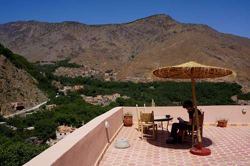
Hotel & Toubkal Refuges
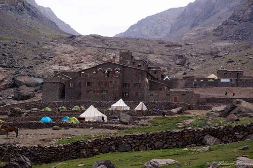
The Toubkal Refuges (3207m)
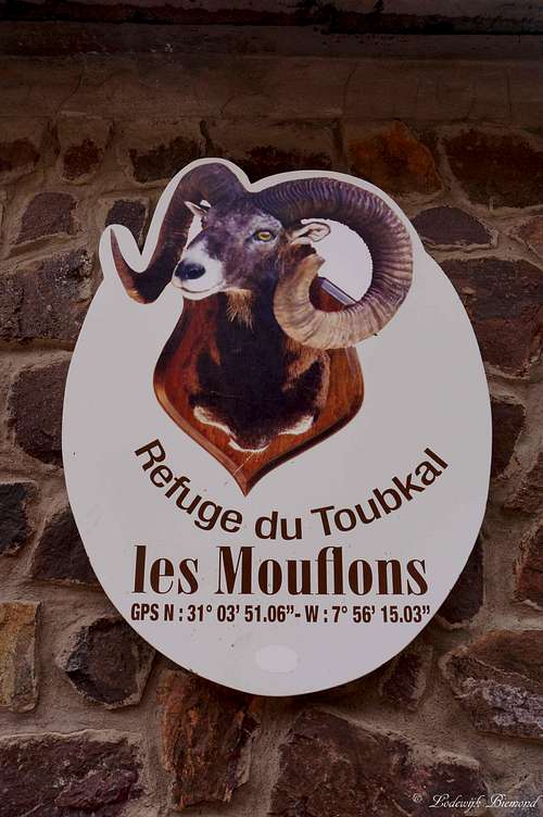
Refuge Les Mouflons
Climbing Imouzzer requires spending the night at the Toubkal Refuges at 3207 meters of altitude. You can choose from the Refuge du Mouflons or the French Alpine association’s Refuge Nelter. It is also possible to camp in front of the huts on a large terrain. Costs are of course lower, but I can imagine it being cold at night at 3207m. Below are the official websites for both Refuges. You can make reservations via the internet site. You have to pay upon arrival. We stayed at Refuge des Mouflons. We paid about 25 euros for a night including dinner and breakfast. Dinner is very recommended!
Weather
Maps & Books
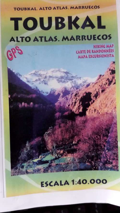
There aren’t many good maps available of the Toubkal area. In Imlil all kiosks sell the same map. The maps is not perfect, but it shows the most important trails and waypoints:
Publisher: Editorial Piolet
EAN/ISBN: 9788495945426
Scale: 1:40,000
Size Folded: 11x17cm
Size: 99x68cm
Another map of the area:
Publisher: Orientazion
EAN/ISBN: 9788493560003
Scale: 1:50,000
Size Folded: 12x24cm
Size: 70x50cm
 |  |  |
Books:
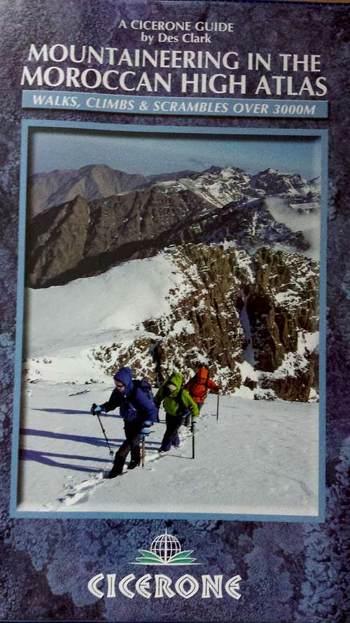
Mountaineering in the High Atlas
Author: Des Clark
Publisher: Cicerone Press
EAN/ISBN: 9781852846114
Size: 12x17cm
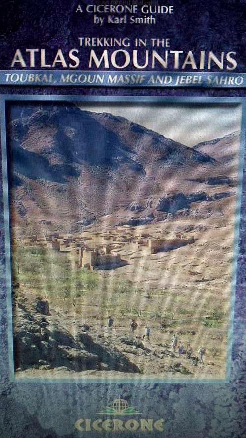
Trekking in the Atlas Mountains
Author: Karl Smith
Publisher: Cicerone Press
EAN/ISBN: 9781852844219
Size: 12x17cm
Both books and maps can be ordered online at Stanfords
External Links
Hotels in Marrakech: Click Here
Flights to Marrakech (Skyscanner): Click Here
Toubkal/Imouzzer Weather Forecast (All elevations!): Click Here
Toubkal National Park: Click Here
Annotated Toubkal Massif Pano as seen from Imlil (1740m)