
-
 3544 Hits
-
 86.26% Score
-
 22 Votes
|
|
Mountain/Rock |
|---|---|
|
|
31.07734°N / 7.7351°W |
|
|
Hiking |
|
|
Spring, Fall, Winter |
|
|
12228 ft / 3727 m |
|
|
Overview
Peak 3727m (right, with snow cornice) and Adrar-n-Dern (3853m) from the plateau above Tammast, late April.
Peak 3727 (meters) is a minor summit on the High Atlas crest 17 kilometers east of Jbel Toubkal. It's a real peak, standing out quite independently on the ridge and having about 80 meters (250 feet) of prominence, but it probably wouldn't merit a page on Summitpost if it weren't for this: climbing it seems to be the most efficient access to the main Atlas crest from a paved road on the south (Sahara) side of the range. It took me a long time to figure this out, so I'm posting the peak for the benefit of those who, like me, are centering their Moroccan adventures in the vicinity of Ouarzazate. If your base is Marrakech, well, by all means, head to Imlil and tramp up the well-beaten paths with everybody else.
From the top of 3727, several major summits are just a couple of hours' hike away. The huge dome of Jbel Iferouane (3996 meters/13,110 feet, among the 10 highest in North Africa) is a 450-meter ascent on good, walkable footing from the col to the west; Adrar Migiain is an undulating walk of a few kilometers in the other direction, overlooking rugged Adrar Afra.
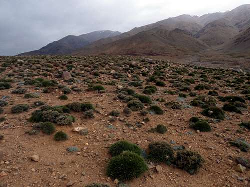
In its own right, 3727 gives you a taste of these high, desert mountains and a vast panorama of colorful mesas and canyons off toward the Sahara.
Getting There
Take the N9 60 kilometers north of Ouarzazate. In the middle of Agouim (at the southern base of the incredible Tizi-n-Tichka Pass), turn west on the paved road toward Sour and Aoulouz, marked as Route 6849 on some maps. Follow this past Sour and past Imaghoudine. About 30 kilometers after leaving Agouim, where the road climbs onto a high plateau and reaches the 2250-meter high point of its entire length, the pavement will end and you'll see a radio mast to your right. Just beyond, on the left, is an enormous but apparently seldom-used parking area, just before the road begins a steep and curvy descent off the plateau. Park here.Route
Walk two kilometers northwest up the sloping plateau to the base of the mountains. The most prominent drainage straight ahead has quite a good trail in it for awhile. You can veer off to the left and hike up the broad ridge south of the drainage, with pretty good off-trail footing all the way to the west summit. Or you can head into the righthand branch of the drainage and get on the ridge above there, leading to the main summit--this route is more scrambly, but you'll find some intermittent goatherder paths. Both variants are mapped at the bottom of this page.Though only six kilometers in length, total ascent from the road is about 1500 meters/4900 feet, and with the high elevation it may take you half of a long day to get to the top. Carry all the water you need; while there may be snowfields at the crest, they just kind of "ablate"--they don't normally produce usable streamlets.
Views
|
|


Red Tape
The route is entirely within Toubkal National Park, although you'd never know it if you hadn't seen the boundaries on a map. I believe the main regulations are not to remove plants and not to make campfires. Berber/Amazigh herdsmen have huts and corrals up here, which you should stay clear of.Maps
A print of a Google map will do you about as much good as anything available in this region. In addition to that, I used the "Toubkal Massif" 1:160,000 map, published by EWP and West Col Productions. This is where the spot elevation for the peak comes from, but other than that it's not very helpful, being a reprint of a Soviet military map from the 1970s, with no updating.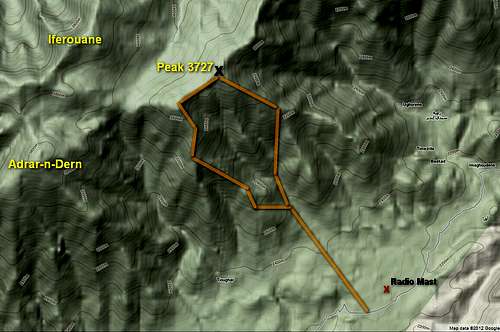
Click, then click again to enlarge.
Links
Weather forecast (NORTH, wetter side of range)Local geology
Downloadable Garmin maps
A description on MBPost of cycling the area (his "Route 3" goes along Route 6849 at the base of Peak 3727)
Not far from Agouim is Maison d'Hotes Irocha, which makes an excellent base for exploring this area (and anyway, there are not many alternatives). Among the pluses are terrific food and great hikes right from the door.