
|
|
Mountain/Rock |
|---|---|
|
|
39.02432°N / 106.64907°W |
|
|
Pitkin/Gunnison |
|
|
Mountaineering |
|
|
Summer |
|
|
13505 ft / 4116 m |
|
|
Overview
Note About Name: This peak is officially unnamed. Mountain climbers have named it Petroleum Peak after the lake by the same name that sits to the east of it.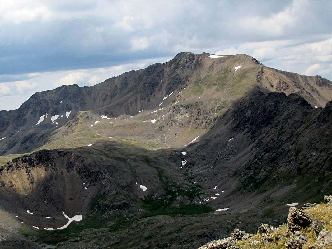
Northeast face of Petroleum Peak
Petroleum Peak rises in the upper portions of Lincoln Creek Valley near Aspen, Colorado. To the southeast, Petroleum Peak is connected to Anderson Peak (UN 13631 ft) and to the north, Petroleum Peak connects to Tellurium Peak (UN 13300 ft).
To the east of Petroleum Peak, at an elevation of 12000 to 12600 ft, you will find a plateau that houses many lakes. The largest of these lakes is the 12300 ft Petroleum Lake. A trail starts on Lincoln Creek Road and goes to end at Petroleum Lake. From the lake, Petroleum Peak can be accessed via its eastern slopes.
Reaching Petroleum Lake Trailhead requires a 10 mile drive on the rough Lincoln Creek dirt road.

East face of Petroleum Peak from Petroleum Lake

SE face of Petroleum Peak
Getting There
From the town of Aspen, drive roughly 10 miles east on Route 82 until you see the sign for the Lincoln Gulch Road (Forest Road 106) on the right (south) side of the road.Guidebooks might say that most cars can drive up Lincoln Gulch Road but I found it to be pretty rough and will not drive it in anything less than an SUV.
Drive the pot hole ridden Lincoln Gulch Road east. After 3.3 miles, you will reach the junction of New York Creek Road. Continue straight (left). 0.75 miles later you will reach the Tabor Creek Trailhead.
After the Tabor Creek Trailhead, the road seems to become much smoother. It continues east for another 2.5 miles to reach the Grizzly Reservoir. Here the road turns south and becomes rough again. 4WD is recommended. Drive the road another 3.5 miles to reach the signed junction of the trail to Anderson & Petroleum Lakes (11200 ft)
Views from the summit of Petroleum Peak:
 Anderson Peak | |
 Taylor Park |  Castle Peak |
 Tellurium Peak |  Truro Peak |
 Larson Peak & Petroleum Lake | |
Red Tape
No fees or permits needed for day hikes.For other regulations, see the website for White River National Forest.
 Petroleum Peak & Lake |  East Face |
 East Face | |
 Near Petroleum Lake | |
Weather
Click to see the forecast for the nearby town of Aspen.The rocky eastern slopes just below summit:
 |  |
 |  |
Map
 |