
|
|
Mountain/Rock |
|---|---|
|
|
39.48014°N / 119.64988°W |
|
|
Storey |
|
|
5574 ft / 1699 m |
|
|
Overview
Point 5574 is the highpoint of a long ridge in the Virginia Range, located just south of the town of Lockwood. The unnamed ridge is located on federal lands and is open to hikers. It is accessible via I-80, east of Reno, Nevada. Most of the Virginia Range along I-80 does not have good access for hiking, but this ridge is one of the exceptions. The summit has a prominence of about 210'.
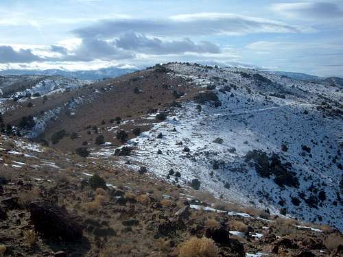
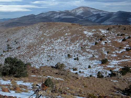
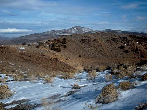
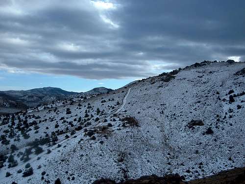
The ridge actually has three distinct summits, Point 5448, Point 5449, and Point 5574. Both Point 5448 and Point 5449 are easily reached on the way to Point 5574. Views from each of these summits are very nice. One can see the Northern Sierra Nevada range to the west, the Pah Pah Range to the north, and Clark Mountain 7,196’ immediately to the east, as well as other mountains in the Virginia range.
 Point 5449
 Point 5448
The ridge is best hiked in wintertime. Rattlesnakes are prevalent on the slopes during warm weather months and the mud can be unbearable from March through November. Be aware of wild horses which graze along the slopes of the mountain. While wild horses aren’t dangerous, nor are they too numerous, they leave tons of manure all over the mountain; so watch your step!
Getting There
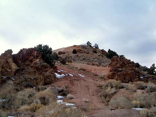
The trailhead is located about eight miles east of Reno, Nevada. From Reno take I-80 east to exit 22, which is the town of Lockwood. Take the main road (Canyon Road) through the town as it heads south into a canyon. Watch for the speed trap, as the speed limit is 20 mph through town. The trailhead is 2.5 miles from I-80. The trailhead is just past an intersection. It is on the right (west) side of the road and starts up a dirt road between two red rocks. The elevation here is about 4484 feet.
 The trailhead
Routes
There are two main routes up the ridge, both starting at the same place, and sharing the same route for the first quarter mile.
First, head up the dirt road as it climbs steeply from the main road. After about 0.2 miles the road heads south. It is here that you decide which route to take. If you descend the road, you can then hike back up the road as it ascends steeply up the south ridge. If you go straight, you can take the north ridge.
The south ridge is simple. It follows the road as it climbs 700 feet in just over half a mile.
 The south ridge route follows the steep road
Once atop the ridge, follow the road as it continues southeast towards the summit of Point 5448. The road branches, with one road heading to the left and one road to the right. Either of these can be taken to get to the summit of Point 5448. The road doesn’t cross the actual summit, but gets pretty close. Once the summit area is reached, the road continues briefly past Point 5448, and then turns to the left going downhill. Get off the road at this point and head towards the obvious summit of Point 5449. Once at this summit, head down to a ridge between Point 5449 and Point 5574. The elevation of the ridge is 5334 feet. Point 5574 is 240 feet up and just over a third of a mile away. In total it is about two and a quarter miles to the summit of Point 5574 via the south ridge, with an elevation gain of about 1,300 feet.
The north ridge starts near the top of the red hill. The red hill is just north of the dirt road, before it heads south. It is one of the most intriguing spots encountered on this trip, because it stands out among the brown sagebrush covered slopes that make up most of the hike.
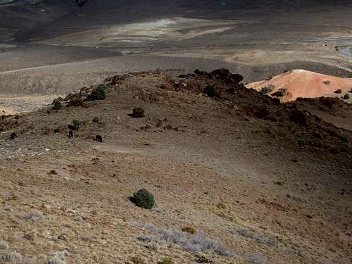 Looking down the north ridge towards red hill
Continue straight up the mountain as it heads through some rocky areas. The north ridge heads generally westward, and then veers back to the south. Head up a steep slope that connects to the main ridge. At this point you will reconnect with the dirt road. From here the route is the same as the south ridge. In total it is about two and one half miles to the summit of Point 5574 via the north ridge, with an elevation gain of about 1,200 feet.
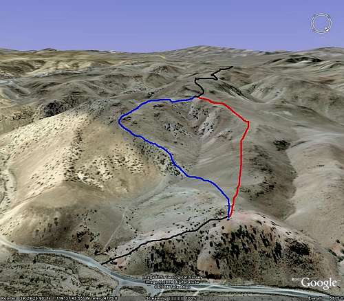 Google Earth™ view of the south ridge and the north ridge routes. The black line represents the main route (where south ridge and north ridge follow the same path). The blue line in the south ridge. The red line is the north ridge.
The best way to descend is via the north ridge. Do not descend the south ridge, as it is way too steep going down.
Red Tape
There is no red tape for either route up the ridge. However, there is a nice trail from the main road that goes to the road up the south ridge route. In fact, the trail cuts 200 feet off the hike up the south ridge. However, there is a no trespassing sign at the beginning of this trail. Thus, even though people generally use this trail anyway, it is advised to take the dirt road instead.