-
 10275 Hits
-
 80.49% Score
-
 12 Votes
|
|
Mountain/Rock |
|---|---|
|
|
43.08075°N / 109.6244°W |
|
|
Mountaineering, Trad Climbing, Scrambling |
|
|
Summer |
|
|
12160 ft / 3706 m |
|
|
Overview
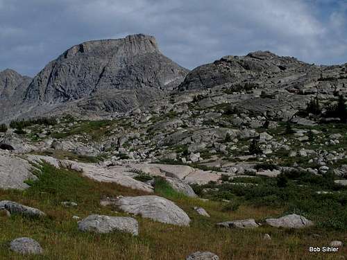
When people think of climbing in the Wind River Range, most look at Gannett Peak, the peaks enclosing Titcomb Basin, and the Cirque of the Towers. Left largely untouched is a lifetime's worth of peaks in this longest and most alpine of Wyoming's mountain ranges.
Also largely untouched, though, are many spectacular peaks in the aforementioned popular areas. Many of these "lesser" peaks see few or no ascents yearly because they are in the shadows of the famous peaks so many climbers seek. Among them are many relatively dull walk-ups, but there are also some unheralded Class 4 and 5 gems that offer challenge, excitement, and solitude on top of unforgettable views.
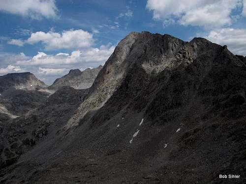
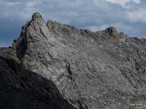
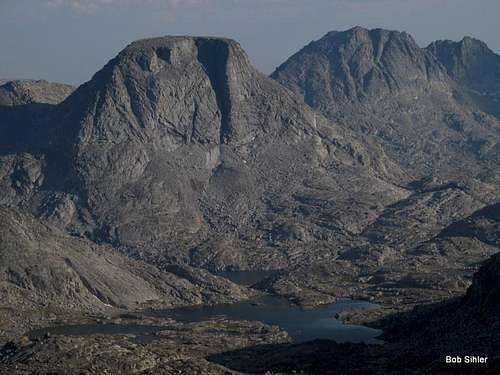
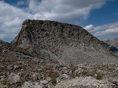
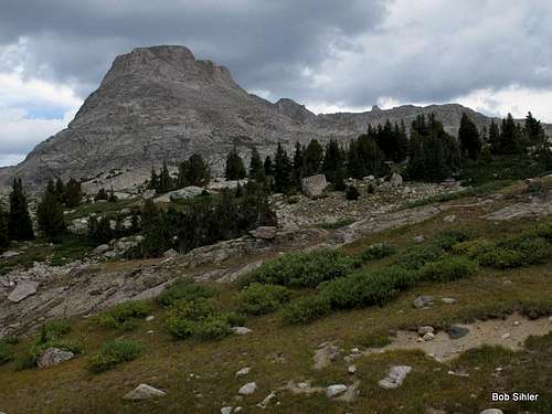
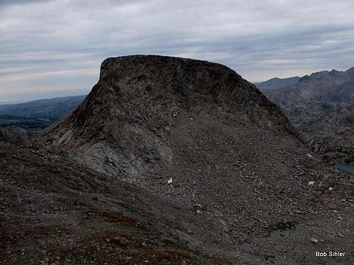
So meet Elephant Head.
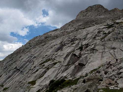
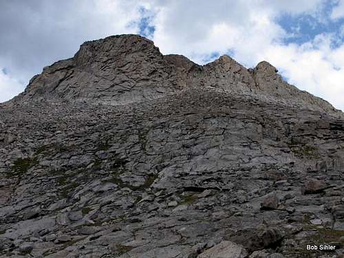
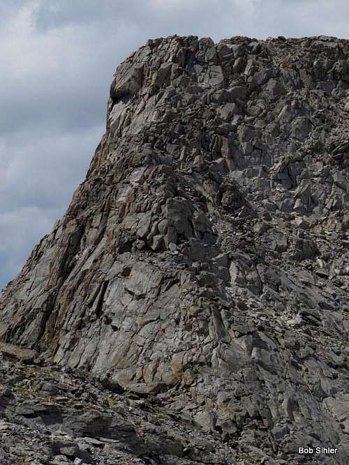
Prominently visible from Indian Basin and the lower reaches of Titcomb Basin, Elephant Head is probably in many a photograph but only a few personal climbing logs. But from a base camp nearby, it is a short outing with a high payoff, not suitable as an entire day's objective but something that pairs up well with other nearby peaks or which can be a great outing late in the day after setting up camp or early in the day before packing up and leaving. It can also provide a day's worth of technical rock climbing on the north and northwest sides of the peak, where there are established (but not widely known or climbed) routes from 5.4 to at least 5.8.
From certain angles, one can, I suppose, argue that the peak resembles an elephant's head. However, there is another name found on some maps-- Cairn Peak (for example, the Earthwalk Press map for the Northern Wind River Range has both names listed). Once, the summit had a cairn so gigantic that it was visible from Island Lake. Now, there is still a pretty large cairn up top, but it seemingly is not as large as the one that earned the peak its other name.
 |  |  |
 |  |  |
Getting There
Near the south end of Pinedale, turn east onto a signed road for Fremont Lake. Drive 14-15 miles to reach the Elkhart Park Trailhead.
For specific details, please see Bill Reed's page for Elkhart Park.
Route
Start from Elkhart Park, about 9400', and hike 10.5 mi to Island Lake, about 10,400'. While this sounds like one of the world's easiest backpacking approaches, it is more strenuous than it sounds, for the route does not ascend a drainage or other naturally ascending line but rather has several dips and reclimbs that make the total elevation gain closer to 2000' (still not that bad but frustrating nevertheless). And the first 5 miles are almost exclusively extremely dull hiking through lodgepole pine forest with no views of anything except more lodgepole pines.
Although there are several trail junctions along the way, with a good map and decent reading comprehension, you will not have trouble following the correct route.
Where you camp is up to you based on your itinerary. Island Lake makes a good base camp because routes to Titcomb Basin, Indian Basin, and other areas nearby all branch out from it.
There are two different means of trail approach to the peak from Island Lake. One is via the trail through Indian Basin and is the one you would use for routes on the north side. The other is from an unsigned but well-trodden trail climbing along an inlet of Island Lake. The inlet and trail are on the southeast side of the lake; the trail climbs steeply and disappears in less than a mile but gets you to within plain view of the southern and eastern aspects of the peak.
In Guide to the Wyoming Mountains and Wilderness Areas, Orrin Bonney lists six different routes on the peak:
- East Side-- Class 4
- East Ridge-- Class 4
- Northeast Couloir-- Class 4
- Northeast Ridge-- 5.5
- North Snow Couloir-- 5.0
- Northwest Buttress-- 5.3 (see info and link in the next section for more current beta)
I used two different non-technical ways on the peak:
- Southeast Ridge-- Class 4 (the same as Bonney's East Ridge)
- Southeast Slopes-- Class 3/4, mostly Class 2
Please refer to the attached route pages for specific details.
 SE Ridge | 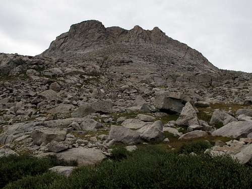 South Slopes |
Technical Routes
These are routes for which there is beta on MountainProject.
- West-Northwest Face-- 5.8, 3-6 pitches, 700'
- Northwest Buttress-- 5.6 (variations from 5.4-5.8), 6 pitches, 700'
These are unbolted routes. Under wilderness regulations, no new bolts may be installed!
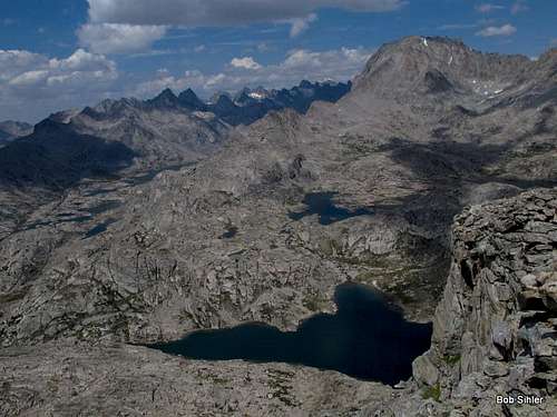
Some Views