
-
 6365 Hits
-
 78.27% Score
-
 9 Votes
|
|
Mountain/Rock |
|---|---|
|
|
45.28044°N / 91.21654°W |
|
|
Chippewa |
|
|
Hiking |
|
|
1535 ft / 468 m |
|
|
Overview
Ranked summits that are accessible to the public in northern Wisconsin are rather rare. One “Wisconsin Top 20” northern summit that has some limited public access is Flambeau Ridge, which is sometimes called Flambeau Mountain by the Wisconsin Department of Natural Resources (DNR) and by local residents. According to Lists of John, Flambeau Ridge has a rise of 450 feet, ranking it ninth in the state for prominence. At 1,535 feet in altitude, it is the nineteenth ranked summit in the state for elevation, and also happens to be the Chippewa County highpoint. There seems to be two areas in the almost flat summit area of the ridge that could tie for the highpoint on the ridge. The state DNR has acknowledged that pinpointing true highpoints is a problem on many of Wisconsin’s ridges, monadnocks, nunataks and other elevated landforms.
Flambeau Ridge is a monadnock, over three miles long east to west, and is covered by a thick forest of red and white pine, paper birch, balsam fir, black spruce, white spruce, aspen, tamarack, red oak, sugar maple and basswood. Flambeau quartzite covers much of this area, as the ridge is a quartzite syncline. This ridge slowed the advance of the glacier in northwestern Wisconsin and the glacier ice that did advance beyond the ridge was thin and remained for a long time. Those conditions were responsible for the terminal moraine that is now called the Chippewa Moraine. Though the summit is not a part of the Chippewa Moraine, it is only a few miles north of the moraine. This means Flambeau Ridge is not far from the Ice Age Trail.
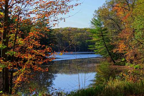
The headwaters of Birch Creek are found on the southernmost slopes, rising from Larose Lake. The Chippewa River is on the far northern edge of Flambeau Ridge, and to the northwest is the Flambeau River. There is a resort at the confluence of the two rivers and the whole area along the Chippewa River downstream to the Holcombe Flowage is dotted with many cabins, lodges and boat docks, making this a remote summer vacation area.
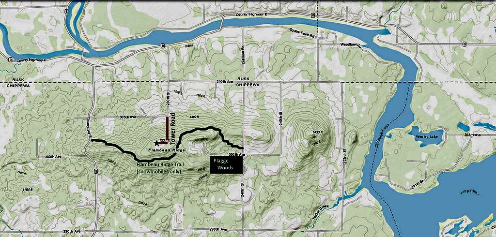
There are no hiking trails to the summit, but Tower Road, also called 230th Street, has been open to the public in years past by a DNR easement. The road, though rough, is now used mainly for maintenance work on several radio and communications towers on the summit area. A snowmobile trail, the Flambeau Ridge Trail, crosses the saddle between the two highest points on the ridge, passing close to the actual summit. Unfortunately, that trail is on private property, meaning use of the trail would require the permission of the property owner. Snowmobilers have seasonal rights granted to use the trail, but those rights have not been extended to hikers.


For many years, there has been a steel 100-foot observation tower at the summit, affording the best views of the region. That extra 40 feet of height in comparison to the 60-foot towers on Blue Mound and other Wisconsin summits really makes a difference. Construction of the Flambeau Ridge Forest Lookout tower was begun in the autumn of 1931 and completed the following spring. In years past, the tower proved quite valuable in spotting fires early to keep fires from growing into anything large. However, in 2015 an announcement was made that all Wisconsin fire lookout towers would be closed in 2016, with all the towers either being torn down or blocked from public use by removing the ladders or stairs. As of the summer of 2019, that tower was still standing on Flambeau Ridge, as shown on the ID photo.
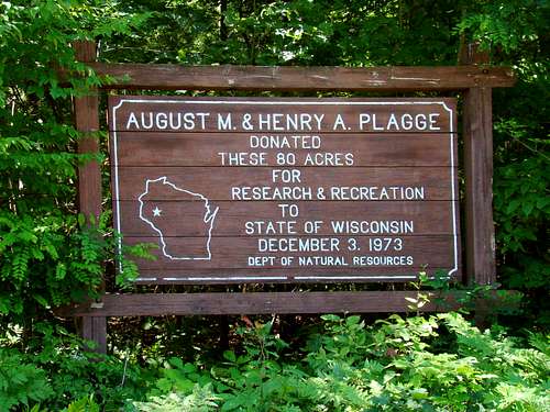
Much of the land on the ridge is privately held, with the major exception being the Plagge Woods State Natural Area on the southeast part of the ridge. The site was donated by Henry and Augusta Plagge. Plagge Woods is owned by the state DNR and was designated a State Natural Area in 1975. Exploration is allowed in Plagge Woods, however the area is only 80 acres and there are no trails.
Getting There
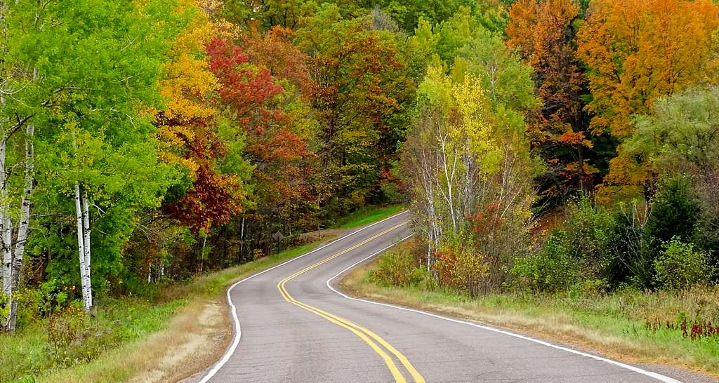
While Flambeau Ridge can be reached from many directions, the closest major roadway is Highway 53. From Bloomer, Wisconsin, it is 24 miles to the summit road. From the Highway 53 exit, go east and pick up Highways 40/64 and follow them north out of town. From where the highways divide, follow Highway 64 until you reach Road E. Turn north on E and follow it until you reach Gordoux Road. Turn right (east) and follow the road until you reach Tower Road, which is also 230th Street. This is your “trailhead”.
Route
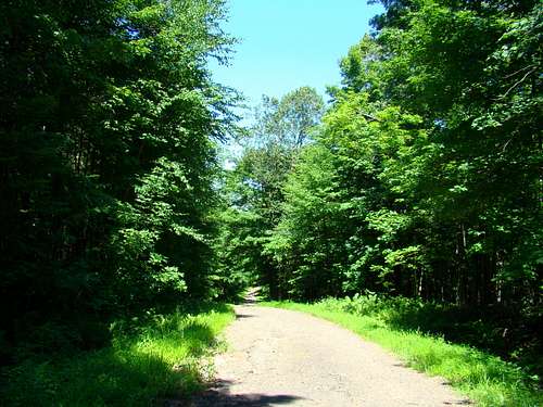
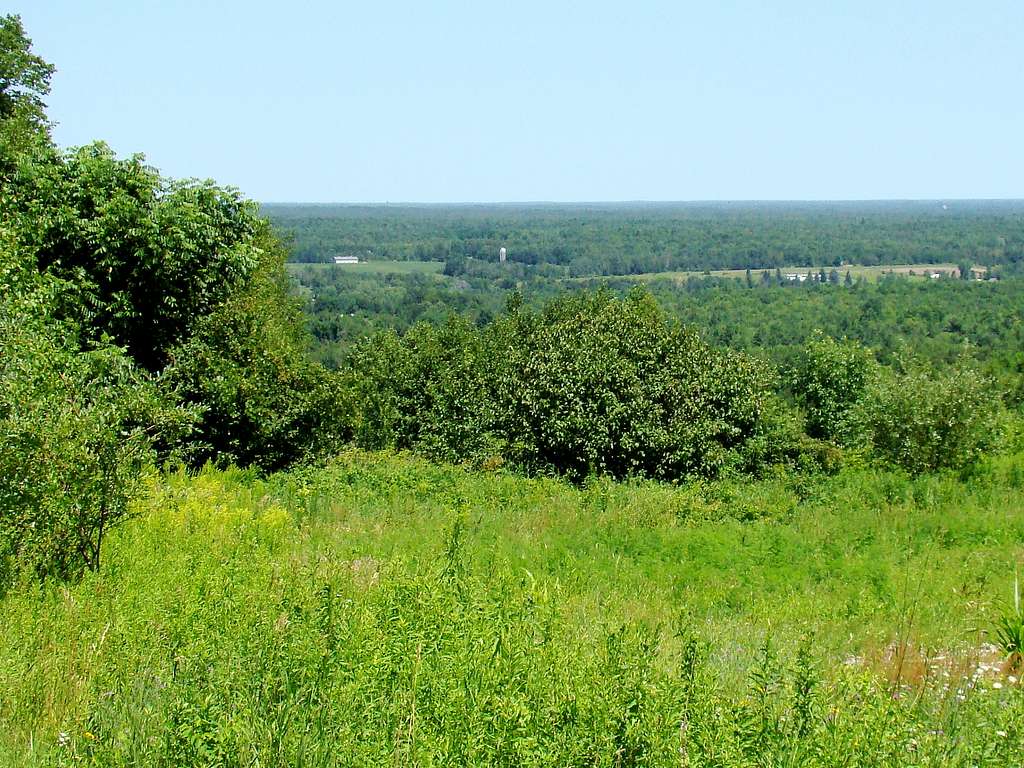
The only legal route directly to the summit area is on Tower Road, which is about .4 mile from the base to the end of the road. The fenced tower area prevents any further vehicle traffic and is pretty effective in greatly limiting foot traffic as well. The map in this section shows the location. Once at the summit area you will find there is not much to see. Because of the thick forest, there are almost no views from the summit area.
There are no marked trails and any exploration would require some bushwhacking and property owner permission. A GPS would be very handy if you get such permission.
Red Tape
The summit area is privately owned and is subject to changes in owner policy. The radio towers in the summit area are fenced off to keep the public out. Please watch for “private property”, “no trespassing” or other signs limiting movement. Since Tower Road is a shared access route, it seems unlikely that will be closed anytime soon. But the end of the road on the summit area seems to be about as far as one can go, without obtaining permission to explore any property of interest. Chippewa County maintains an online plat map service that can help interested persons find information on who to contact for such permission: Chippewa County Plat Map
When to Climb

Winter maintenance on the mountain is minimal and Wisconsin hunting seasons can pose some serious risks. Please plan your visit with these factors in mind. For additional relevant information, check out these links:
Weather Forecast and Conditions for Flambeau Ridge
Wisconsin Hunting Seasons Information
Camping
Because of all the water sports and fishing in the area, cabins and campgrounds are plentiful in the region. However, since it is so popular, please bear in mind that all these facilities can be full some weekends. So please plan ahead. Most of those who summit Flambeau Ridge do so as one of a few day hikes in the area. The nearby Ice Age Trail is one good prospect for some interesting exploring at the Chippewa Moraine.
Listed below are some campgrounds and other resources to help you locate a place to stay.
Lake Holcombe Camping & Lodging Listings
Additional Information
Contact info for the Wisconsin Department of Natural Resources (DNR)
DNR Ranger Station
117 South Riverside Drive
CORNELL WI 54732
715-239-6355-Forestry
715-239-6585 Law Enforcement
Chippewa Moraine Ice Age Center
13394 County Highway M
NEW AUBURN WI 54757
715-967-2800
715-967-2801 Fax
Chippewa Moraine State Recreation Area