
-
 10547 Hits
-
 79.78% Score
-
 11 Votes
|
|
Mountain/Rock |
|---|---|
|
|
44.04507°N / 90.02051°W |
|
|
Juneau |
|
|
Hiking, Trad Climbing, Sport Climbing, Toprope, Bouldering, Scrambling |
|
|
1077 ft / 328 m |
|
|
Overview
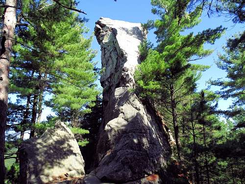
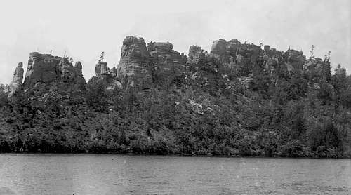
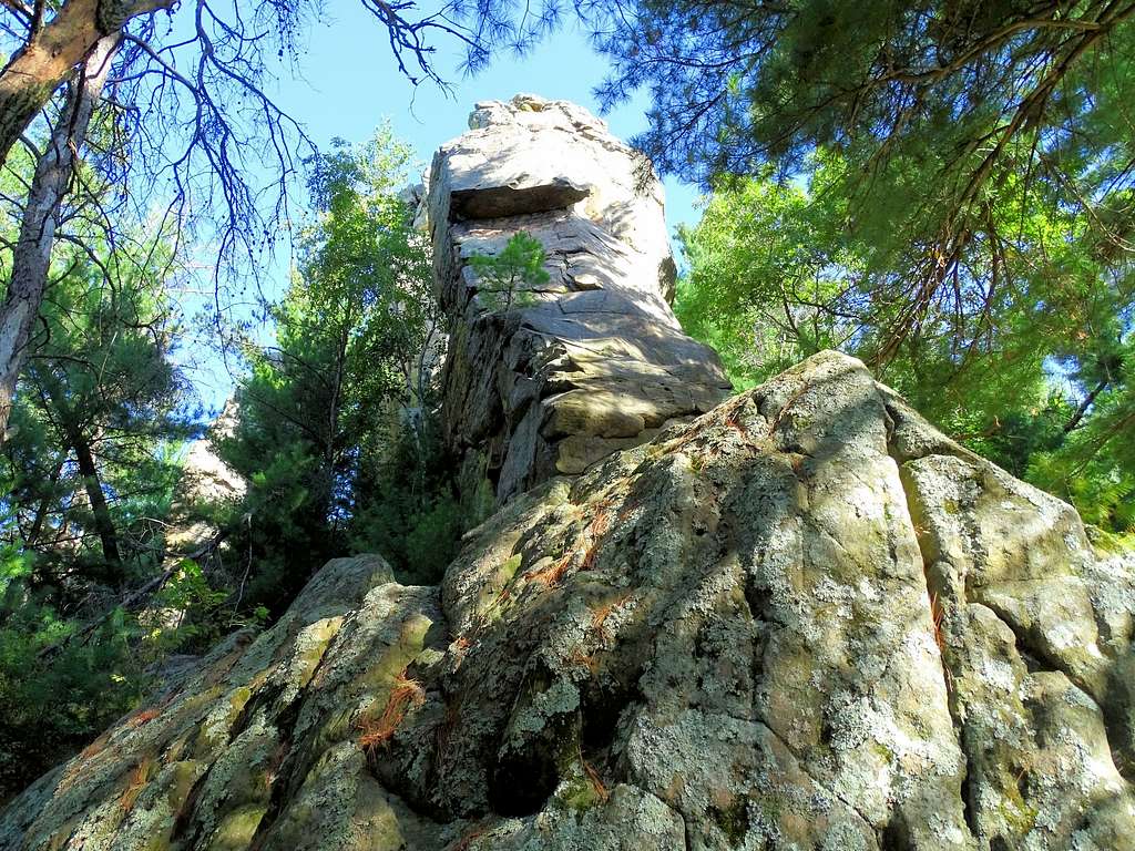
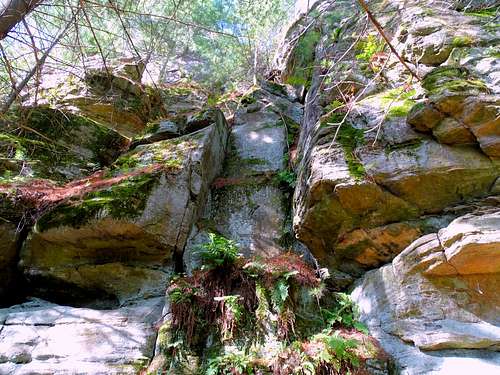
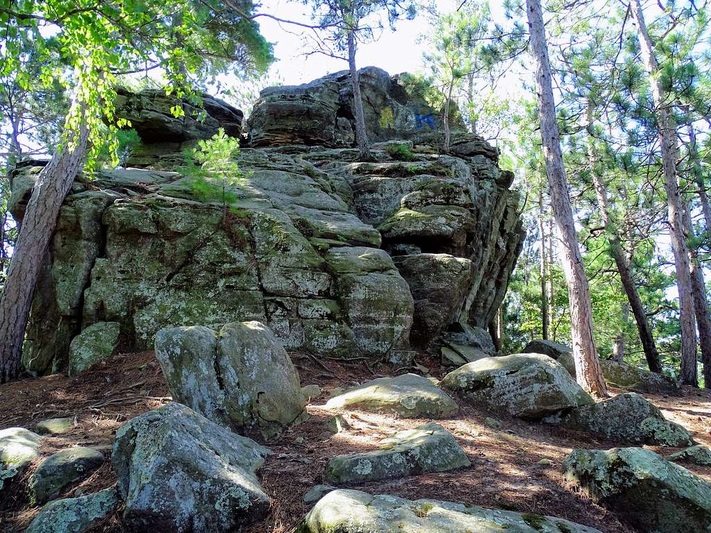
One of the best rock climbing locations in the state of Wisconsin is located near Necedah. Petenwell Rock (also called Petenwell Bluff) rises over 170 feet above the Wisconsin River, which flows along it’s eastern side. Lists of John puts the summit elevation at 1,077 feet, while other sites list the summit as low as 1,043 feet. The rock here is a beautiful sandstone ridge with many spires, quite capable of securely holding bolts.
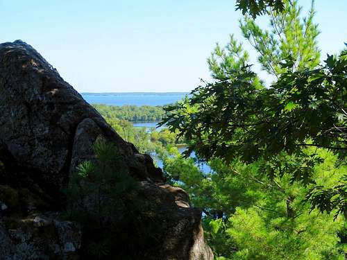
This area around Petenwell Rock was once the bed of a large ancient lake. Scientists say the top of Petenwell Rock was an island top thousands of years ago. 100 years ago, Petenwell Rock was much more exposed, with far less forest coverage. Today, nearby Petenwell Lake backs up from a dam just upstream from the rock.
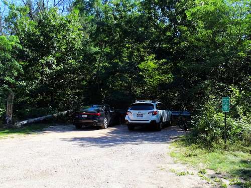
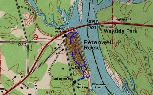
There are no official trails on Petenwell Rock, and the trails that are there reflect the volume of traffic (or lack thereof in some places). Most trails eventually vanish or dead-end at rock walls. Because it is a long ridge and has limited parking at a small parking lot to the southeast and a small parking lot on the north end, the trails closest to those parking areas are the most well-defined.
Even though Petenwell is renowned for its rock-climbing routes, there are still quite a few hikers and rock scramblers who visit. Hikers are generally disappointed by the lack of through-trails, steep and rough terrain plus the need to bushwhack in order to try to circle the rock. Nevertheless, hikers still enjoy coming to Petenwell to admire the rock formations and enjoy the glimpses down at the river and the lake.
Getting There
Petenwell Rock is 3 miles east of Necedah, Wisconsin on Highway 21. The ridge is sandwiched between the Wisconsin River and 19th Avenue. The north parking lot is right along the highway on the north side of Petenwell Rock. The is a little trail that goes out to fishing spots along the river, with a branch trail that goes up to some of the northern spires.
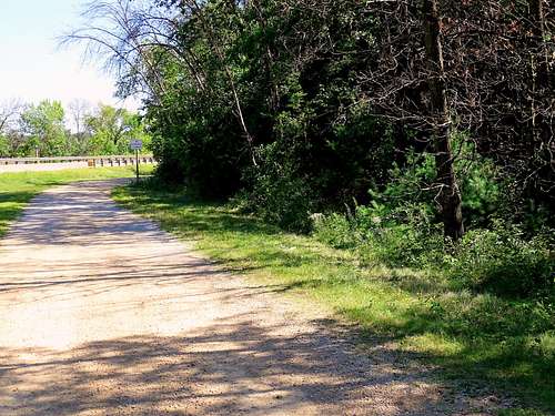
The south parking lot (small) is less than a half mile south on 19th Avenue. The trail to the southern and central climbing area starts just behind the barricade at the back of the parking lot. There is a trail branch a short way down the trail. The right fork goes out to the river, and the left fork goes toward the climbing area. Coyote Tower and Y-Crack will be the first rocks you come to.
Rock Climbing Routes
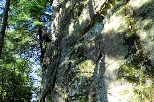
Mountain Project suggests that Petenwell Rock may be the best rock climbing area that is still open in Wisconsin. With somewhere in the ball park of 90 routes, there is something for most climbers there.
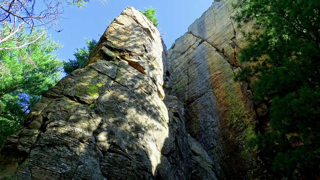
Some features really stand out on the ridge, including Hell Wall, Y-Crack, Coyote Tower, Air Spire, Anthrax, The Brig and several others. These features provide the basis for trad, sport, toprope and boulder climbs.
For more specific information on climbing routes, plus route map, click on the Mountain Project page link here: Petenwell Rock on Mountain Project
Scrambling Routes
For those who do not do rock climbing, but do enjoy a little scrambling, there are some places they will find enjoyable, though pretty much confined to the northern part of Petenwell Rock. However, because there is so much disagreement between scramblers on grading routes, I will just say that an old retiree made it to the ridge top in a couple places without too much difficulty or great risk. I have not found anyone who has an exhaustive listing of scrambling routes and I did not spend enough time to do so myself. But, the ridge area is small enough that a day spent exploring should pretty well cover all possibilities.
Red Tape
This climbing ridge has been open to the public many years, and has stayed that way thanks to most climbers acting responsibly. Things that could end all that would include destruction of the rock, large fires, illegal camping, trashing the area or illegal drug use. Please help keep the climbing area open and pristine by acting responsibly.
When to Climb
Though there are generally no closures at Petenwell Rock, safe climbing on these steep sandstone routes is dependent on dry sandstone. For the latest forecast and conditions, click on this link:
Petenwell Rock – Necedah Area Forecast & Conditions
Camping Options
There is NO camping here. Anyone who tries to camp here could ruin Petenwell Rock access for everyone. For the best camping options in the area, click on these links:
