
-
 30068 Hits
-
 88.51% Score
-
 27 Votes
|
|
Area/Range |
|---|---|
|
|
Hiking, Sport Climbing, Bouldering, Ice Climbing, Scrambling, Canyoneering, Skiing |
|
|
Overview
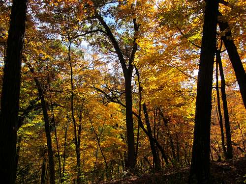
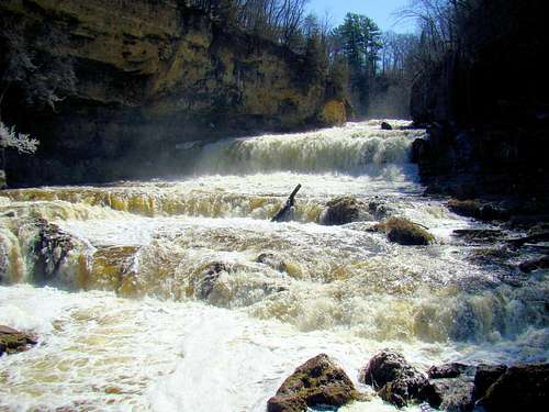 Willow River Falls
Wisconsin is one of the most beautiful states for hiking, climbing and outdoor adventures in the Midwest. This page is intended to be a general overview for what residents and visitors to the state will find in hiking and climbing opportunities. It is not possible in the space allotted here to do an exhaustive study of an area this large. However, this page does provide a platform to attach more pages to expand the information already here. Text links to Wisconsin’s trails and state parks pages, plus other resources, provide an abundance of additional information to this overview. Though there are no major mountain ranges like the Alps or Rockies located here, the “Badger State” still has plenty to offer. First-time visitors to the state will notice an abundance of forests, streams and lakes. Some reports place the number of lakes at 14,000. Officially, 46% of the state is covered by forests. However, when driving through almost any part of the state, it would appear to be a much higher percentage. The forests are a mixture of hardwoods and coniferous trees, with the coniferous trees being more common in the north. The weathered remains of ancient major mountain ranges are located in the northern part of Wisconsin and the area around Devil’s Lake. In various locations around the state are monadnocks – erosion resistant remains of ancient mountains that jut up above the surrounding plains. The Penokee Mountains, the Baraboo Range and Rib Mountain are a few examples of monadnocks. According to Lists of John, there are 71 ranked summits in the state of Wisconsin. However, there are well over 600 officially named summits and county highpoints, plus many more unofficially named summits. Lists of John is perhaps the best site to access maps and information for all those named summits in Wisconsin. Throughout the state, visitors will find high bluffs, rock outcroppings, small peaks, whitewater streams and waterfalls. Rock formations across the state are abundant. Types of rock commonly found in Wisconsin include quartzite, granite, dolomite, sandstone and limestone.
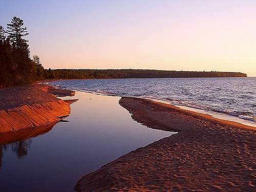 Meyers Beach Inlet at Lake Superior, by mountainhare
Water defines the majority of Wisconsin’s boundaries, with Lake Superior to the north, Lake Michigan to the east, the Mississippi and St. Croix rivers to the west. The Menominee and Montreal rivers also form part of Wisconsin’s borders. The abundance of water helps sustain a large wildlife population, which includes deer, elk, moose, woodland caribou, black bears, cougars, bobcats, grey wolves, red fox, gray fox, badgers, porcupines, raccoons, martens and beaver. An abundance of bird species is found in Wisconsin forests. The state name is a word derived from the name given to the Wisconsin River by an Algonquian tribe. There is a dramatic difference in the temperature and snowfall differences from north to south in Wisconsin. The Lake Superior Snowbelt area can receive as much as 160 inches of snow annually, while the southern areas of the state average around 40 inches. The large annual snowfall in the north makes for great skiing and snowshoeing every winter. While the southern part of the state may be sweltering in heat and humidity in the hottest part of the summer, the areas along Lake Superior are almost always very mild, and sometimes surprisingly cool even in July. Whereas the state may be divided into regions using different criteria, one way that describes the geography of the state is differentiating the areas that were glaciated from the areas that were unglaciated. The unglaciated areas are often referred to as the “Driftless Area”. This would be due to the lack of boulders, gravel and rocks normally left behind by retreating glaciers. However, there are five distinct regions that would be more precise in describing the geography of Wisconsin.
Wisconsin's Five Geographic Regions
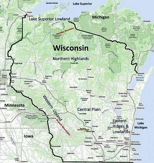 Wisconsin
Lake Superior Lowland – This is the smallest region in the state’s geography because it only extends from the Lake Superior shoreline southward from 5 to 20 miles inland. For the most part, this plain is heavily forested and receives extensive snowfall every winter. Northern Highland – This region of Wisconsin is the largest and highest, with the 12 highest ranked summits in the state found here, including Timms Hill and Rib Mountain. The Chequamegon – Nicolet National Forest occupies about 1.5 million acres in the Northern Highland. The area is sparsely populated and covered with dense forests and thousands of lakes. Whitewater streams abound, and there are many significant Northern Wisconsin Waterfalls Central Plain – This plain is somewhat “V” shaped as it lies to the south of the Northern Highland, to the east of the Western Upland and to the west of the Eastern Ridges and Lowlands. The Wisconsin Dells lie at the southern edge of the Central Plain and are probably the most beautiful area of the region. Though the Central Plain is called a “plain”, it also has many beautiful river valleys, particularly that of the Wisconsin River. There are a number of buttes, mesas, hills and small peaks scattered throughout the region. Lone Rock at Quincy Bluff and Wetlands State Natural Area is one example of the rugged beauty of this region. Western Upland – This region is where almost half of the state’s ranked summits are located. The area is also called the “Driftless Area” and is characterized by deeply carved river valleys, as well as beautiful limestone bluffs along the Mississippi River. Wyalusing Ridges at the confluence of the Mississippi and Wisconsin Rivers are good examples of this. The steep hills, peaks and bluffs of the Western Upland are blanketed with thick forest and make the whole region a hiker’s delight. Devil’s Lake is the most popular area and the Devil’s Lake Benchmark is one of the highest ranked summits in this region. Another interesting and noteworthy ranked summit in the Western Upland is Trempealeau Mountain, a peak that rises out of the Mississippi River nearly 400 feet above the normal water level. The summit with the greatest prominence in Wisconsin is located in the far southwest in Iowa County. Blue Mounds has 932 feet of prominence and is ranked number 13 overall at 1,719 feet in altitude. Another favorite summit inn this region is Eagle Peak, the highpoint of Interstate Park. Interstate Park is know for good rock climbing opportunities on both sides of the St. Croix River. Eastern Ridges and Lowlands – This region is the most heavily populated area of Wisconsin. It is also the richest agricultural region, thanks to good topsoil deposited by ice-age glaciers. Ridges, rolling hills and lowlands characterize this region. Most noteworthy is the Niagara Escarpment, also called “The Ledge”, which stretches 250 miles through Wisconsin from Waukesha County northeasterly through Green Bay and High Cliff State Park all the way to the state of New York. The Niagara Escarpment is known for high dolomite cliffs.
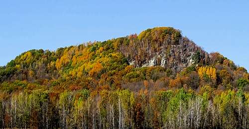
The Penokee Mountains
The Penokee Mountains are a part of the Penokee – Gogebic Iron Range of Wisconsin and Michigan. This range is a long narrow monadnock, around 80 miles in length, spanning from Ashland County through Iron County and into Gogebic County, Michigan. Scientists tell us these mountains only hint of what they once were, when they long ago rivaled the Alps that we know today. However, these mountains are still a thing of beauty with many rugged and rocky areas, clad with thick forest and laced with whitewater streams and waterfalls. The Penokee Range monadnock is broken with many gaps, most of which have northward-flowing streams. This area is rich with wildlife, including bears. So, all standard bear precautions are warranted here.
 Small black bears still warrant caution!
According to Lists of John, the highest point in the Penokee Range in Wisconsin is Mt. Whittlesey, at 1,875 feet. Located in Ashland County, Mount Whittlesey is the fifth-ranked summit in Wisconsin with 330 feet of prominence. Upson Lookout (1,825 feet) is the other named and ranked summit in the Penokees, though there are also three un-named ranked summits. Just to the north of the tiny village of Upson, are the Whitecap Mountains, part of the Penokee Range. The Whitecap Mountains Ski Resort operates one of the best ski areas in Wisconsin. Whitecap Mountain Resort offers plenty of up-to-date information for the area. Downhill skiing is not the only winter sport in the Penokees. Cross country skiing is also quite popular, and the Penokee Mountains Hiking Trail, the Uller Trail (below Whitecap Mountain) and the North Country Trail all have lengthy sections popular with Wisconsin cross country skiers. In the off-season from skiing, some of these trails see many hikers. Copper Falls State Park is located just north of the town of Mellen, which is near the west end of the Penokee Range. The state park offers camping, fishing and several hiking trails. Superior Trails has additional information for visitors, as does the Ashland County Hiking Trails website. The forest in this part of Wisconsin is part of the Chequamegon – Nicolet National Forest, and is managed by their office in Rhinelander, Wisconsin. They can be reached by phone at: (715) 362-1300.
The Baraboo Range
 Vultures Outlook, by Alpinist
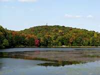
The Baraboo Range is located in Sauk and Columbia counties. It is also sometimes called the Baraboo Mountains or the Baraboo Hills. In 1980, the range was designated a National Natural Landmark. The range is a group of monadnocks, composed of Baraboo Quartzite and rhyolite. The Baraboo Range marks the eastern end of the Driftless Area because the western Baraboos were not glaciated, while the eastern end was. The size of the range is about 30 miles long and no more than 10 miles across, and it is bisected by the Baraboo River. The town of Baraboo is near the center of the Range, while Devil’s Lake is in the eastern part of the range. The lake was formed from terminal moraines that blocked any outflow, thus causing the formation of the lake. While much of Wisconsin is hilly, the Baraboo Range is visibly more prominent, with parts of the range rising over 600 feet higher than the Wisconsin River to the southeast. The four ranked summits in the Baraboo Range include the Devils Lake Benchmark at 1,467 feet, Gibraltar Rock at 1,247 feet, Happy Hill at 1,490 feet and Sauk Point at 1,593 feet.
 Devil's Lake, by parndt
Forest covers most of the Baraboo Range, though there are some cliffs and rock outcroppings in various locations. Devil’s Lake State Park is probably the main attraction in the area, rivaled only by Wisconsin Dells 18 miles north. The Cascade Mountain Ski Area is located in the far eastern part of the range in Columbia County near Portage. The Devils Head Resort also operates a ski area in the Baraboo Range in eastern Sauk County next to Parfrey’s Glen State Natural Area. Other attractions in the Baraboo Range include the Natural Bridge State Park and White Mound County Park. Four state natural areas are located in the range, including Parfrey’s Glen, Lost Lake, Spring Creek and Hemlock Draw. Hiking and climbing opportunities are plentiful in the Baraboos, and are outlined in the state park websites, plus at other sites like the Devil’s Lake Visitors Guide, Travel Wisconsin’s Sauk County’s Seven Scenic Natural Wonders site and the Ice Age Trail site. The 400 State Trail follows the course of the Baraboo River.
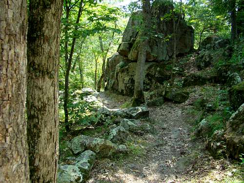
The Ocooch Mountains
 Ocooch Mountains Sign
The Ocooch Mountains are a name given to the Western Upland area of Wisconsin, which is also known as the Driftless Region. Unlike the more distinct boundaries of the Baraboo Range or the Penokee Mountains, the boundaries are not so well-defined for Wisconsin’s Ocooch Mountains. In fact, the name does not normally show up on current maps. A broad definition might suggest the Ocooch Mountains extend southward from Pepin County in the north, along the east side of the Mississippi to northern Grant county, eastward from the Mississippi River to Interstate 94 and the Baraboo Range and for several miles south of the Wisconsin River west to its confluence with the Mississippi River. This loose definition would mean the Ocooch Mountains would cover a much larger area than either the Baraboo Range or Penokee Mountains. It would probably also include at least 25 of Wisconsin’s ranked summits, including Blue Mounds, the summit with the highest prominence in Wisconsin.
 Fall Glory, by Stu Brandel
The Ocooch name first appeared in written records and maps in 1819 and suggested the name was only for the southern portion of the Western Upland. Several references to an adjacent area then called the Smokey Mountains were differentiated from the Ocooch by being lower and less rugged. Some old records gave some overlap of the Ocooch Mountains with the Baraboo Range. An 1833 map suggested the Ocooch Mountains to be further north in the Western Upland through the area that is now Clark, LaCrosse, Jackson and Taylor Counties. One Native American tribe from the region, the Ho Chunk, called the area Wah-Koh-Ch. The Ioway tribal name for the mountains was “Paxochi Ahema’shi”, which means “Mountains of the Snowy Lodges”. Visitors to the Ocooch Mountains are amazed at the small peaks and ridges that generally rise from 250 feet to 400 feet from the valley or canyon floors to the ridge and peak tops. Numerous streams and rivers drain this mountainous region. Canoers love paddling these quiet shady streams under high bluffs and cliffs. Hardwood trees are in abundance here, making autumn excursions very colorful. For a fly-over view of the Ocooch Mountains, you can click on this YouTube link: Ocooch Mountains of Richland County Noteworthy state parks that are located in the Western Upland/Ocooch Mountains region include Wildcat Mountain State Park, Governor Dodge State Park, Wyalusing State Park, Perrot State Park, Blue Mound State Park, Mill Bluff State Park and Tower Hill State Park. Trail maps are included in many of these state park links. In addition to these state parks, there are other parks and state natural areas in the region. Some major trails through the region would include the Great River State Trail, LaCrosse River State Trail and the Elroy-Sparta State Trail.
Wisconsin Hiking Trails
 Eagle Peak Trail
There are over 2,700 miles of trails open to hikers in Wisconsin. Some of these trails will take hikers to named summits, while others will take climbers to rock climbing destinations. For anyone who loves hiking on forest-canopied trails, Wisconsin has much to offer. Most of the trails are there simply for hiking, snowshoeing or skiing enjoyment. The links below will provide you a look at many of the major trail options across the state and will cover fees, maps, locations and regulations:
Wisconsin State Park System List of Trails (includes maps & details)
Ice Age Trail in Wisconsin (includes trail map)
North Country Trail in Wisconsin (includes map information)
Hiking Trails in Wisconsin (TravelWisconsin.com)
Wisconsin Hiking Trails (from Wisconsin Explorer)
Rock Climbing
 Porkchop buttress at Devil's Lake, by Alpinist
Devil’s Lake State Park is one of the most popular recreational areas in Wisconsin, and not only offers great hiking but also has the state’s most climbing routes on its high quartzite cliffs. The nearby Wisconsin Dells area also has some climbing routes on Chimney Rock. However, because of the great popularity of these two areas, if you are looking for uncrowded conditions, it might be best to plan for weekday and non-holiday visits. Due to the large number of routes available and the popularity of the area, there are several guide services available. The link below provides more information for guides and outfitters in the Devil’s Lake area: Devils Lake State Park Visitors Guide Some of the other areas in the state that offer good rock climbing would include Governor Dodge State Park, Interstate Park, High Cliff State Park, Petenwell Bluff at Necedah, Willow River State Park, Granddad’s Bluff and Castle Mounds State Park. There are many more opportunities elsewhere, but these are the main areas. Mountain Project has an extensive listing of rock climbing routes around the state. To access that list, click here: Rock Climbing Routes in Wisconsin
When to Hike, Climb or Explore
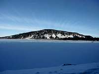
 South Mound, Wisconsin
With the abundance of options to snowshoe and cross country ski in Wisconsin, access to the trails in the state is mostly a year-around opportunity. A few of the trails are only open for winter access. For specifics, check out the links elsewhere on this page to area you have in mind. Of course, you will want to check the latest weather forecasts for the latest conditions and alerts for any serious storms. You can get up-to-date forecasts and conditions for any area by clicking on the link below and entering your destination: Weather Underground: Forecasts & Conditions Hunting seasons might also affect your choices of where to go and when. You can learn more about hunting seasons in Wisconsin by clicking on the link below: Wisconsin Hunting Seasons Information
Public Lands, Fees, Permits, Regulations & Camping
 Timms Hill, by Holsti97
There are numerous public lands in the state of Wisconsin. Fees, permits, licenses, regulations and red tape can vary depending on which agency administers the lands, campgrounds or trails in question. Of course, these fees and regulations can change from year to year, so please check their sites posted below for the latest up-to-date information you need. In Wisconsin, the National Park Service manages the Apostle Islands National Lakeshore, the St. Croix National Scenic Riverway, The North Country National Scenic Trail and the Ice Age National Scenic Trail.
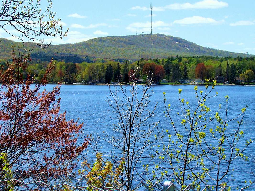 Rib Mountain view from Wisconsin River
The National Forest Service manages the Chequamegon-Nicolet National Forest in northern Wisconsin. The forest service also manages five National Wilderness Areas in the Chequamegon-Nicolet National Forest, including Headwaters Wilderness, Porcupine Wilderness, Blackjack Springs Wilderness, Rainbow Lake Wilderness and Whisker Lake Wilderness. Another wilderness in Wisconsin managed by the forest service is the Wisconsin Islands Wilderness Wisconsin has 47 state parks, 13 state forests and 101 wildlife areas of various types. Many of these have trails. Some have summits and/or rock climbing. Most of the state parks have campgrounds, plus there are often more nearby. Four excellent up-to-date websites that provide more details are listed below:
Wisconsin State Park System Trail & Park Finder
Wisconsin State Parks Listings at StateParks.com
State Park Camping Regulations & Reservations
Travel Wisconsin Campgrounds Directory