
-
 17882 Hits
-
 81.84% Score
-
 14 Votes
|
|
Mountain/Rock |
|---|---|
|
|
44.52354°N / 90.80714°W |
|
|
Clark |
|
|
Hiking, Scrambling |
|
|
1264 ft / 385 m |
|
|
Overview
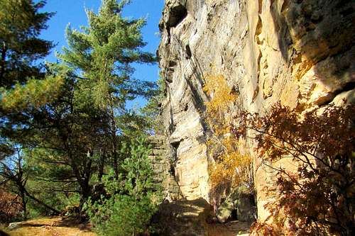 Sunny Autumn Day on Wildcat Mound
One of the best-kept secrets for great hiking and scrambling in Wisconsin is Wildcat Mound in Clark County. Not to be confused with the Wildcat Mound at the Wildcat State Natural Area in Jackson County, this summit proves to be different from what many people would expect to find in “America’s Dairyland”. The terrain along the trail brings to mind hikes through certain parts of the Black Hills. Though not a ranked summit, this peak is characterized by thick forests with plenty of rocky cliffs and overhangs that form a semi-circle from the west around the south side to the east. Formed during the last major ice age, the rocky points on the mound offer spectacular views of the region. This is pretty special for a state where the forests are normally so thick that special towers are needed at most summits to have any kind of view.
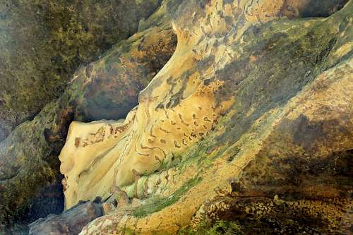 Wildcat Mound Sandstone Natural Patterns
The sandstone found here has iron stains in patterns that resemble leopard spots and tiger stripes, giving inspiration to the name of Wildcat Mound. Some of the soft sandstone cliffs and columns near the ground level have been marred with carvings for many years. There are some old, very weathered carvings that resemble petroglyphs, but it would take an expert to determine who made them, since they have been weathered to near-obscurity over time. Unlike the climbing restrictions at Roche-a-Cri or Mill Bluff, there are no restrictions for rock scrambling here, and opportunities abound on the steep rocky slopes, crevices and gullies. Of course, caution is always warranted for climbing on soft sandstone.
The peak is the heart of Wildcat Mound Park, owned by Clark County. Long ago, this land was privately owned, but became public property during the Great Depression. According to USGS figures, Wildcat Mound has 249 feet of prominence. Because of the difficulties of the terrain and the narrowness of the trail, not many mountain bikers venture here. Judging from the lack of horse droppings, equestrians apparently do not find this area appealing either. Not located near any major population areas or close to any freeways, the peak is usually pretty quiet, with the exception of infrequent ATV’s going by on nearby roads.
A few visitors have been alarmed on the lower trail section when they have stumbled on to sunning snakes. However, there have been no reports of poisonous snakes. Bears, wolves, foxes and deer live in the Clark County Forest, but the bears and wolves are almost never seen on the peak. The forest on the mound is comprised mostly of red and white pine, aspen, oak, maples, hickory, birch and spruce.
Getting There
Wildcat Mound Park is located along County Road B. For those traveling from Interstate 94, exit 88 at Osseo is the closest turnoff. From the Interstate, travel east 15 miles on Highway 10, then turn south on Highway 12 and travel 5.3 miles to County Road B. Turn left and drive 4 miles to the park.
For visitors traveling west from Neillsville on Highway 10, go about about 7 miles and turn south onto County Road B, then follow the road for about 6.5 miles to the park.
Route Information
The trail leaves the inner parking lot (see map) near the toilets and ascends100 feet over a short .1-mile stretch via a stairway made of something like railroad ties. There are no markers anywhere along the trail on Wildcat Mound and the trail itself is faint in a few places. Sandy conditions are common on the lower half of the trail loop.
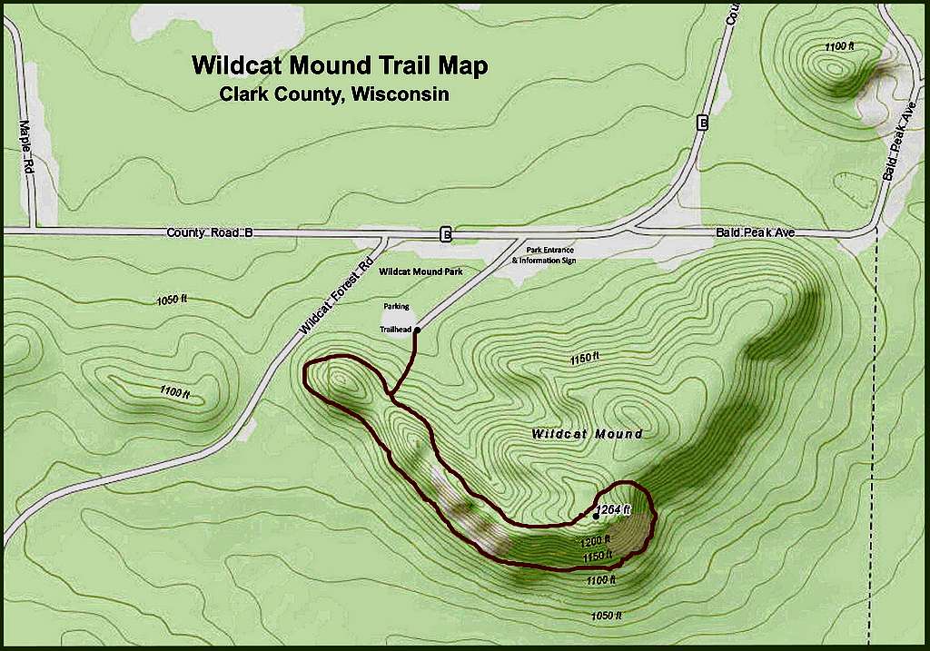 Wildcat Mound Trail Map
At the rim, it splits into the two ends of a loop trail. The east portion eventually works its way to the rim, following it for about .4-mile to a place that descends down to the lower portion of the loop. Several places along the rim afford excellent views to the west and south from atop various cliffs. The true summit is along this trail and is not far from where the upper trail descends down to the lower half of the loop.
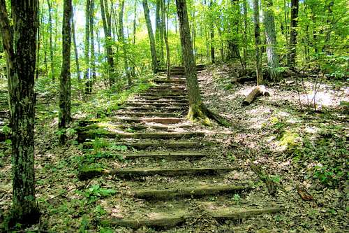 Wildcat Trailhead Stairway
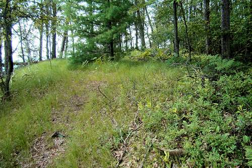 Wildcat Mound Highpoint
The lower portion of the loop trail is longer at about .7-mile, and winds from the trail split west, then south along the base of a number of cliffs and rock formations, some reaching as much as 100 feet high. There are some interesting small cave-like rock formations, plus numerous crevices. Several places along the way allow from some steep rock scrambling opportunities to the upper trail. Or, if you prefer, you can continue on until you reach the far end of the loop, where you will need to ascend to complete your route. If you hike the whole route, you will have gone about 1.2 miles and ascended about 200 feet from the trailhead to the highpoint.
The entire mound is open to the public, and if you prefer to continue to explore more cliffs, ridges and the forest off-trail beyond the end of the loop, you have that right. Be aware that if you choose to do this solo, rarely do other people ever venture off the trail and help may not ever arrive to aid you if you are injured in a scrambling accident. Also, this is prime tick country and Wisconsin has had its share of Lyme disease cases, so please take precautions to protect yourself. Bears are rarely seen here, but if it helps you feel more secure, carrying bear repellent is not really a bad idea.
Red Tape
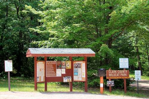 Wildcat Mound Information
No permits are needed to hike or picnic. Guns are not to be discharged anywhere near the trail. There is a nightly fee to camp, and more information about that can be found at this link:
Clark County Wildcat Mound Park
Also important for visitors to know are the park rules. Those are available at this link:
Clark County Forest Regulations
When to Climb
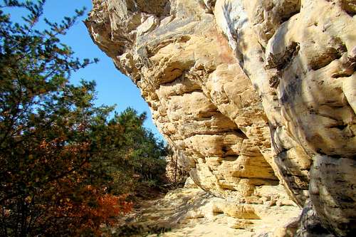 Rocky Overhang Along the Wildcat Trail
The park is open year-around, but that does not mean that visitors will always find it desirable to hike and climb there. There is no winter maintenance on Wildcat Mound. During a mild and dry winter, hiking is still possible. However, winters like the one from 2018-2019 saw snow depths across the region from 6 to 8 feet by late winter, effectively eliminating everything but snowshoeing.
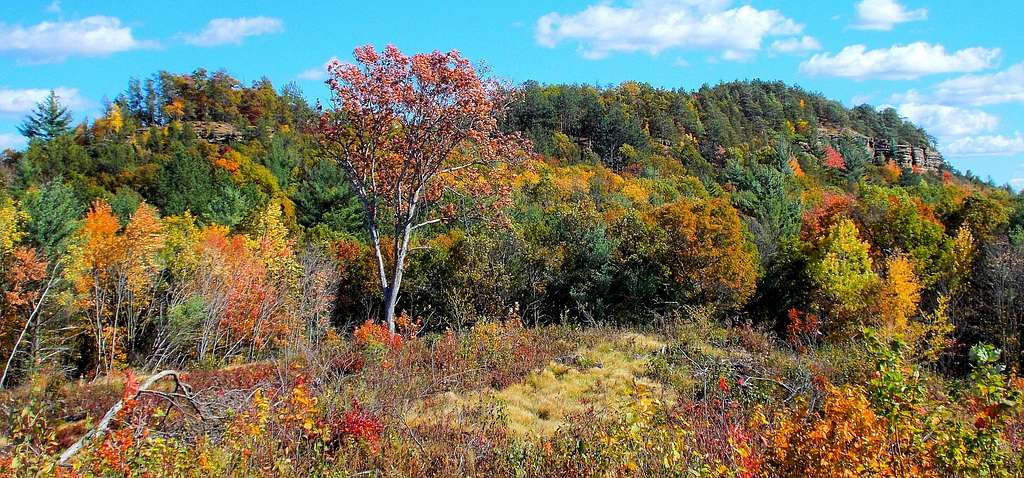
Hunting seasons may not be the best times to visit either. Deer rifle season, generally from around Thanksgiving through the end of the year, is probably the best time to avoid the area. And for rock scramblers, when the soft sandstone gets wet, the rock is more likely to break or crumble. All things considered, a dry autumn day may well prove to be the best choice for pleasant hiking and scrambling, plus photo taking. Another plus is that the insect levels are low then and the fall colors are outstanding.
Two links that may prove to be helpful for your plans to visit Wildcat Mound include:
Wildcat Mound Area Weather Conditions & Forecast
Clark County, Wisconsin Hunting Information
Camping
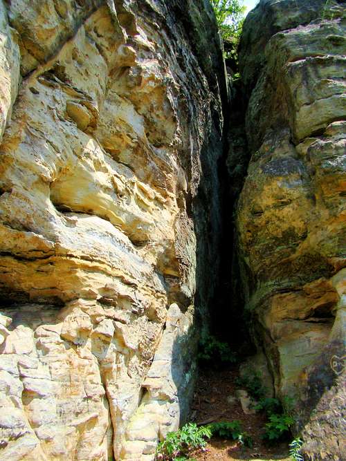 One of Several Interesting Crevices
Wildcat Park is built on the perimeter of Wildcat Mound. Day use at the park is free and the park offers camping, drinking water, picnic areas, pit toilets, charcoal grills, ATV & hiking trails and vault toilets. For more information on about the park, click here:
Camping is not allowed on top of Wildcat Mound, but it is allowed at the Wildcat Park Campground for a nightly fee. To make a reservation, click on this link:
Wildcat Mound Park Camping Reservations
Russell Memorial Park is about 8 miles away and offers excellent camping facilities. You can get up-to-date details at this link:
Additional Information Resources
Clark County Forestry & Parks Administrator
517 Court St. Room 103
Neillsville, WI 54456
Phone: (715) 743-5140