|
|
Mountain/Rock |
|---|---|
|
|
47.76693°N / 121.1938°W |
|
|
King |
|
|
5724 ft / 1745 m |
|
|
Overview
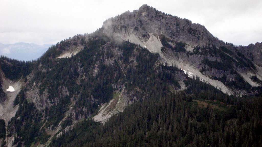
Captain Point is a 5724' (784' prom.) high point located nine miles northeast of Skykomish, and five miles northwest of Stevens Pass. While it is the second highest peak in an area bound by the Tye, Beckler, and Rapid Rivers, it is hopelessly outclassed by Mount Fernow, the undisputed monarch of the region.
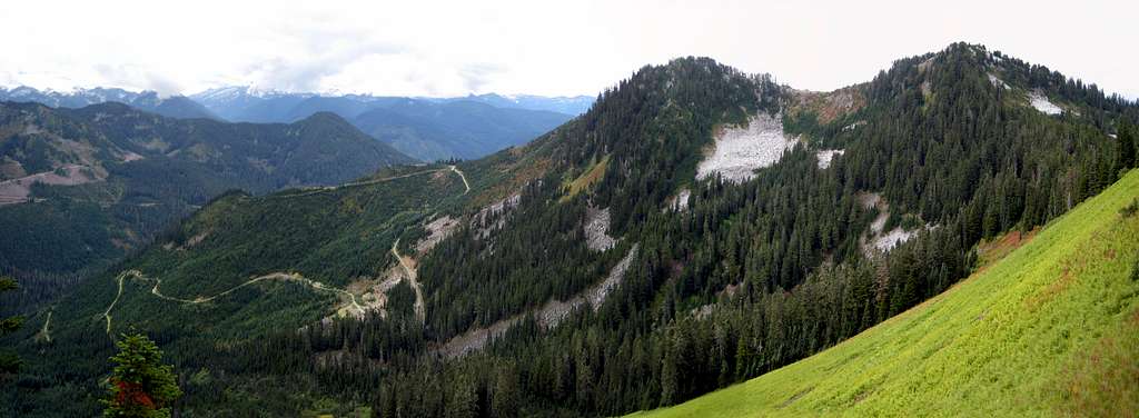
Another factor contributing to Captain Point's lack of popularity is likely the unsightly logging roads that were carved to within spitting distance of it's summit. Indeed, this is a peak with two personalities: When viewed from the north, it appears to be a pleasant alpine scramble. When viewed from the south, it appears to be just another cut-over 'dumpster dive'.
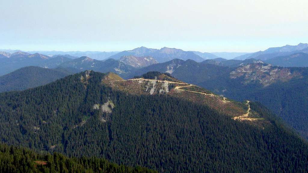
Perhaps the one saving grace of Captain Point's roads is easy access. For those looking for big views, but are a little short on time, this peak makes an easy part-day objective. For those with a little more time, nearby 'Tall Halla Mountain' can be added for a prominencian's '2fer'. For those with all the time in the world, a forgotten, faded trail leading south from Scorpion Mountain will allow one to appreciate the unspoiled north side of Captain Point.
Getting There
Follow US2 approximately six miles east from Skykomish, then turn left on the 'Old Cascade Highway'. Please note that there are several places along US2 where one can access the 'Old Cascade Highway' - the one you want is easy to locate as it is directly abeam US2's mile marker 55. Follow the Old Cascade Highway for just over two miles, then turn left on FR6710. Follow FR6710 for 3.4 miles (passing the Iron Goat Trailhead along the way), where a left hand turn will descend toward Martin Creek. This will be the start of the route for those taking the South Ridge. For those heading to the East Ridge, continue another 1.6 miles up FR6710, where a locked blue gate will impede further progress.
Route
South Ridge -
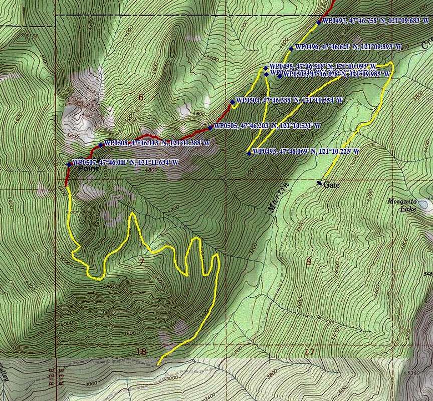
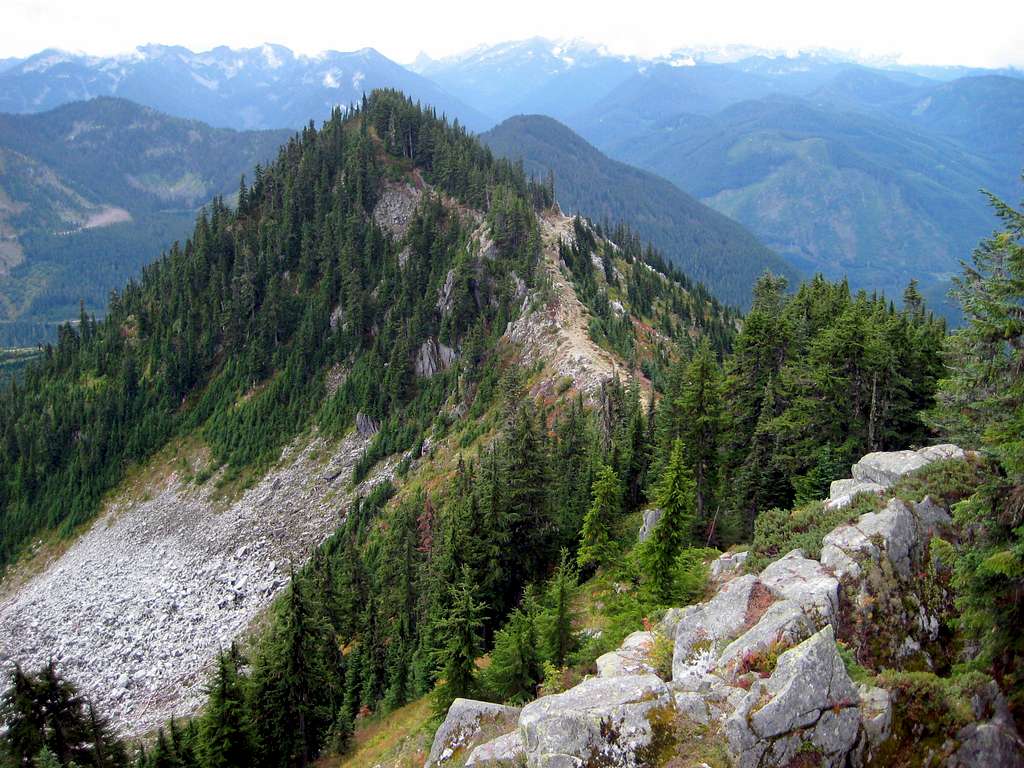
After crossing Martin Creek, drive as far as you dare up the 'mainline', which will switchback steeply up Captain Point's southeast flank. This road will require a fairly high clearance four wheel drive vehicle (the section I drove tested the limits of my AWD Escape), but it appears that one could drive well up over 5000' if properly equipped. Use a combination of hiking and driving to get to the end of the road, which passes west of Pt. 5652 (south summit) before ending at a 5500' saddle south of the true summit. From the saddle, simple scrambling will lead to the top.
East Ridge -
This route is longer than the South Ridge Route, but is more aesthetically pleasing, and offers two small bonus peaks (designated 'Golden Peaks' by Fred Beavon) along the way. From the blue gate, follow the steep mainline roughly 2.7 miles to the first intersection of significance. This is located near the 4660' saddle between Captain Point and 'Tall Halla Mountain'. Turn left off the mainline, and follow it about 0.4 miles to it's termination at 4900'. A mountain bike will be helpful on this road, particularly on the way down. For those with electric bikes or motorcycles, I saw no signs specifically prohibiting their use beyond the gate.

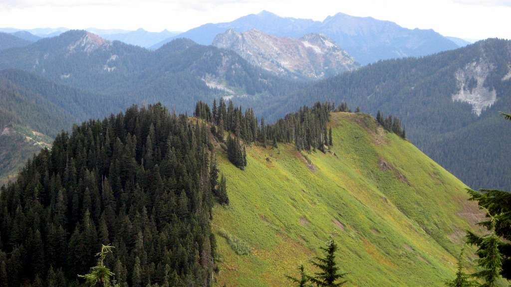
On the hogsback above the road end, easily locate what I call the 'East Ridge Trail'. The reality is, this trail is one section of what was once a long, continuous trail stretching from the Rapid River, along Johnson Ridge, Captain Point, and Valhalla Mountain to the Pacific Crest Trail. Follow the trail west to Pt. 5500 and Pt. 5540. These small bumps offer great views, as well as an impressive meadow slope on the south flank.

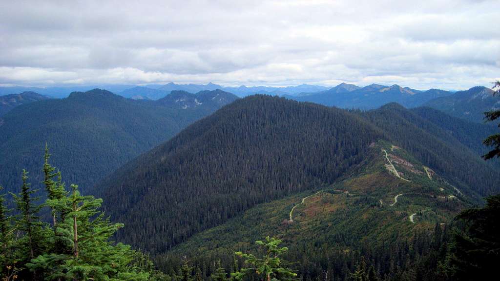
The trail will occasionally fade in spots - when in doubt, return to the ridge crest. After dropping to the saddle west of Pt. 5540, the trail will cross over to the north side of the ridge and begin descending.
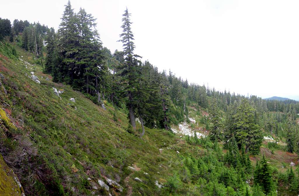
At this point, you will want to leave the trail, and scramble steep class 2 heather and talus slopes to Captain Point's summit.
North Ridge -
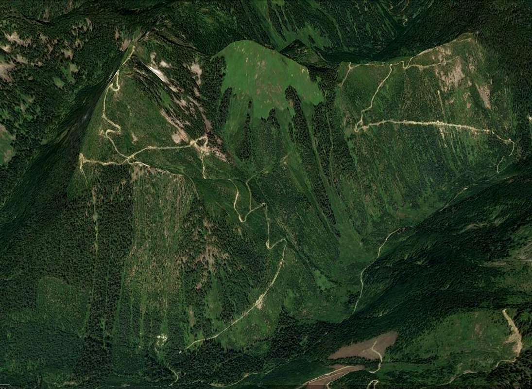
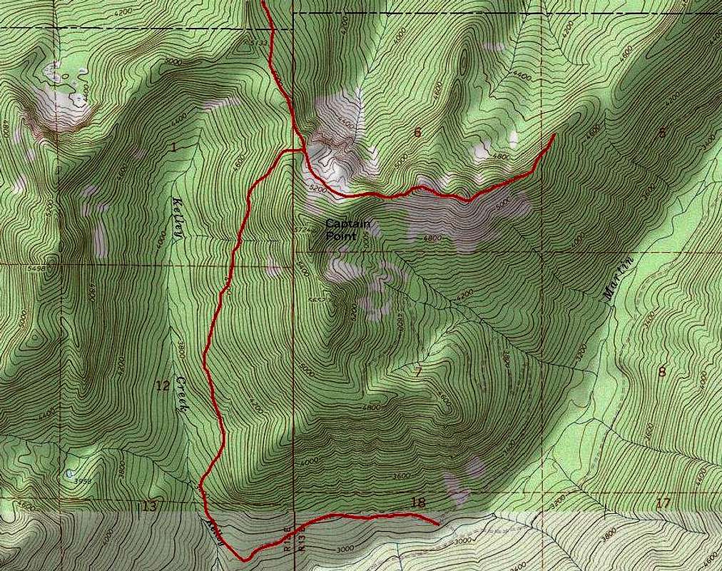
For those interested, the 'East Ridge Trail' you left behind at 5300' will traverse open slopes toward Scorpion Mountain. For those with lots of time and energy, this trail offers an additional access to Captain Point. Additionally, the 'Kelley Creek Connector' trail can be used from Martin Creek to tie into this trail north of the summit. The trails have been approximated in the photo below. As I have not hiked either of these trails, I cannot speak as to their condition. Rumor has it that the trail leading south from Scorpion Mountain has faded completely in places.
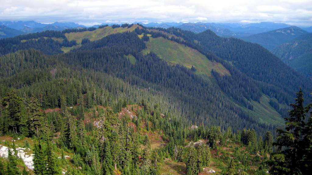
While there are a few obscuring trees at the summit of Captain Point, the views are actually quite good relative to the amount of effort reaching the summit.


Red Tape
There are no requirements for a Northwest Forest Pass at either 'trailhead'. Please do not park in such a way as to block the road or gate.
When to Climb
Any time you can drive a reasonable distance up FR6710.
Camping
Beckler River Campground is probably the nearest civilized camping. If one wanted to camp near the summit, there is no shortage of old road grade that could be used for that purpose.

