Overview
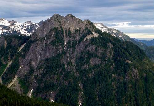
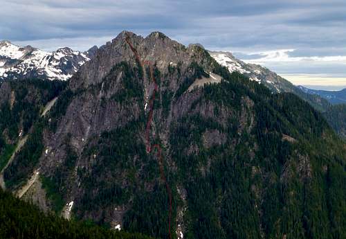
![Bear Mountain from Frog Mountain]() Bear Mountain from Frog Mountain
Bear Mountain from Frog Mountain
Bear Mountain is a rarely climbed peak located 11 miles due north of Skykomish, Washington. With almost 1500' of prominence, and a very impressive profile when viewed from most angles, one would assume this peak would be more popular with peak baggers. The reason it is not is quite simple - Bear Mountain is a bear to climb. Would-be summiters of Bear Mountain need to give this peak the respect it deserves. I certainly under-estimated this peak, thinking a 5500' peak (located just one mile from a major Forest Service road) would be a part-day pushover. It ended up consuming most of the day, was continuously steep, and presented route finding challenges.
Note: This route would be particularly dangerous in inclement weather or wet conditions. Please be reasonably assured of stable weather conditions before attempting this route.
Getting There
Follow US2 east from Skykomish for 0.8 miles. Turn left (north) on Beckler River Road (FR65). Follow FR65 for 12.5 miles to Jack Pass (Elev. 2589'). Continue on FR65 another 0.7 miles to a sharp right switchback and park (N47 52.856 W121 20.035 Elev. 2200').
Note: We examined four different approaches to Bear Mountain on the morning of this climb, and made the determination that this was the best route. How you decide to navigate to the base of this mountain is certainly at your discretion.
Route
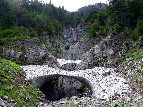
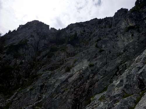
From the parking location, begin a nearly level traverse for 0.6 miles towards San Juan Creek (west, then southwest). There will be a few hundred feet of vine maple to deal with, but this will be the only vine maple encounter on this route. Your objective is the intersection of San Juan Creek, and the east flowing creek draining the east side of Bear Mountain (N47 52.602 W121 20.593 Elev. 2300'). Follow the small creek west for a short distance. At an elevation of about 2500', it will cliff out, as is evidenced by the photo below.
Starting up Bear Mountain at 2500'
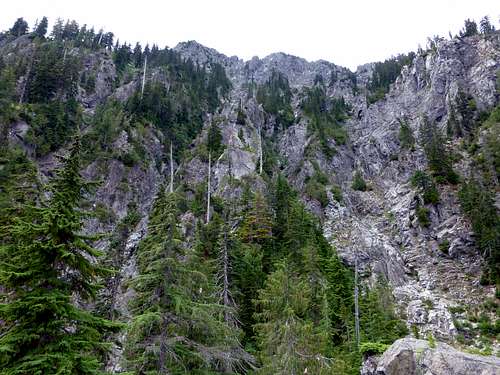
We elected to turn left onto the forested rib on the south side of the drainage,as the map showed the drainage eventually turning away from the summit area. In hindsight, this was a very good decision, as going up the right side would have made our day even more difficult. Once on the rib, start going straight up towards the summit area. It will be very steep - some of the climbing would be class 4, were it not for the vegetation providing "bush belays". Eventually we arrived at a high point on the rib (N47 52.471 W121 21.060 Elev. 3850') where we could get the first good view of our objective.
Bear Mountain from 3850'
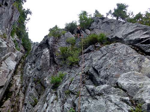
The rib was narrow here, with gullies on both sides. There were gendarmes higher up on the rib above us, which meant we had to find a way around. We elected to drop into the gully on the left hand side (not certain if the right side gully would work or not). We scrambled a few hundred feet up the gully, which ended up cliffing out. By this time, however, we were past the gendarmes on the rib, which meant we could climb out of the gully, and continue our ascent on the rib. This did require a little class 4 climbing to exit the gully. Below is a picture of our rappel of this section on the descent.
Preparing to rappel Class 4 terrain at 4000' on Bear Mountain
We continued up the rib (mostly class 3), to its apex at 5050' (N47 52.389 W121 21.399). From here, we had a pretty good view of the final route to the summit.
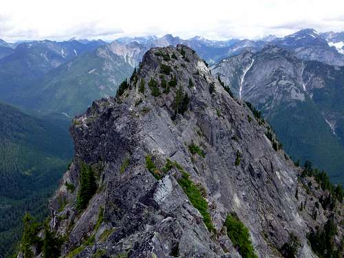
Bear Mountain south summit from 5050'
The last 500' will be mostly class 3, with a few moves that could be called class 4. Thankfully, many of these steep sections have handy shrubs available for "bush belays". We did elect to use the rope on a few of these sections as a handline on the descent.
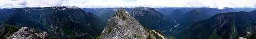
Bear Mountain summit pano
Bear Mountain north summit from south summit
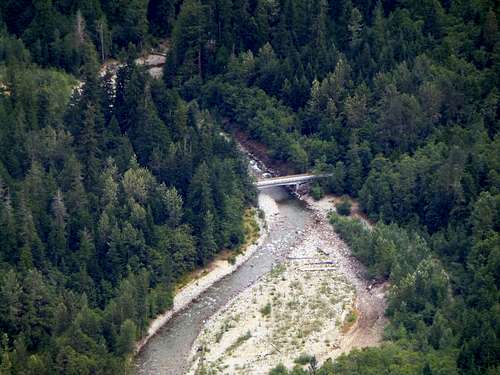
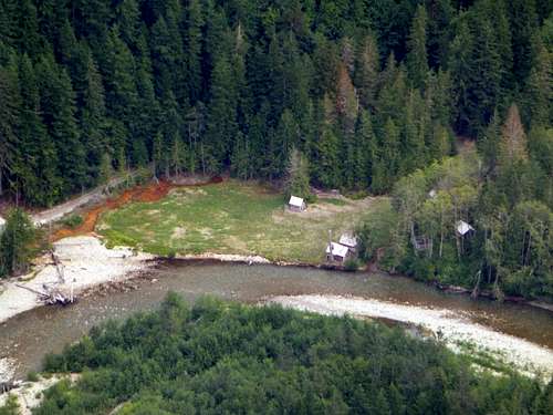
![North Fork Skykomish River bridge from Bear Mountain]() North Fork Skykomish River bridge from Bear Mountain
North Fork Skykomish River bridge from Bear Mountain![Garland Mineral Springs area from Bear Mountain]() Garland Mineral Springs area from Bear Mountain
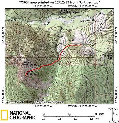
Garland Mineral Springs area from Bear Mountain![Bear Mountain route map]() Bear Mountain route map
Bear Mountain route map
![Our route up Bear Mountain]() Our route up Bear Mountain. I'm not sure if it's the best route, but it worked well for us.
Our route up Bear Mountain. I'm not sure if it's the best route, but it worked well for us.
Red Tape
No parking pass is required to park in this area.
Camping
There are numerous camping areas available (official and unofficial) along the North Fork Skykomish and Beckler Rivers.