
|
|
Mountain/Rock |
|---|---|
|
|
47.77596°N / 121.35536°W |
|
|
King |
|
|
5615 ft / 1711 m |
|
|
Overview
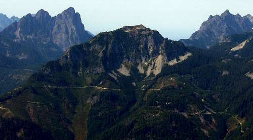
Eagle Rock from Mt. Fernow
With almost 1400' of prominence, and great views, Eagle Rock certainly should have been called "Eagle Mountain" or "Eagle Peak". For anyone interested in a Highway 2 area climb, but short on time, this peak fits the bill. Total distance from the parking area to the summit is 0.8 miles, the climbing is no harder than class 3, and round trip time from the car should be under three hours. Views from the top are almost as good as from the higher neighbors to the west (Baring, Gunn, Merchant, Townsend), with only a fraction of the work required. Additionally, unlike nearby Beckler Peak and Evergreen Mountain, you are almost guaranteed to have the place to yourself.
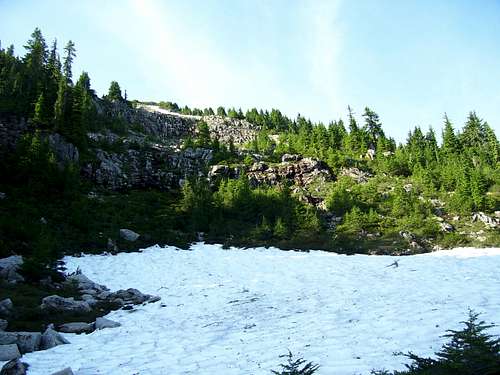
Access Eagle Rock from the Beckler River Road (FR65), and follow FR6510, FR6514, and FR6517 10.8 miles to a point 0.5 miles east of Eagle Rock's summit (N47 46.610 W121 20.678 Elev. 4150'). This location can be seen in the photo below.
Eagle Rock 'trailhead'
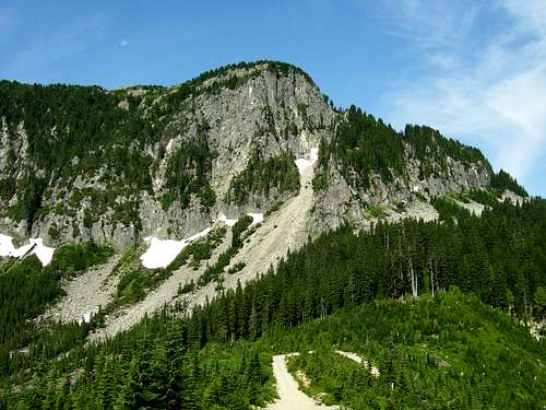
From this location, head west, straight up the hill. You will exit the brush and enter open forest within a few hundred feet. After a few hundred yards, the trees will give way to the talus slopes that lie beneath cliffs on Eagle Rock's northeast side. Make an ascending, counterclockwise traverse to the north side of Eagle Rock. The photo below was taken at N47 46.790 W121 21.251 Elev. 4850'.
Eagle Rock route at 4850'
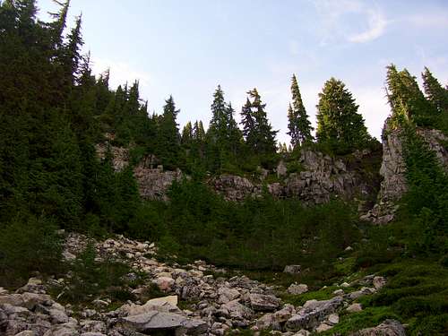
This is where the most "difficult" climbing was encountered on my route. One could probably find an easier way to the upper part of the mountain by continuing the traverse around the mountain, but this route worked just fine for me. I scrambled up on the far left side of the photo, and encountered about 50' of slightly exposed class 3. If one were concerned about the downclimb, 50' of rope could be used as a handline for descent.
The 'crux' of my scramble
After topping out on the step at about 5000', traverse a few hundred yards southwest to the base of the slope leading to Eagle Rock's summit. The photo below was taken at N47 46.735 W121 21.304.
Eagle Rock route at 5000'
From here, 600' of easy class 2 on the right, or class 2/3 up the center, will bring you to the top. The route to the top can also be seen on the left skyline on the photo below.
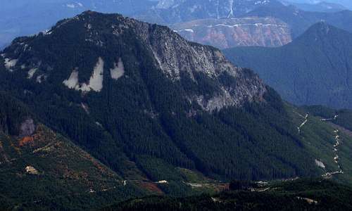
Eagle Rock from Mt. Baring
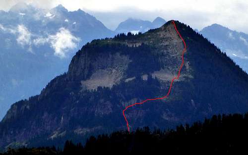
Eagle Rock from the north (Bear Mountain). Red line shows my route to the summit.
The view from the top is fairly rewarding for less than an hour's work.
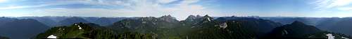
Eagle Rock summit pano
Getting There
From 0.8 miles east of Skykomish on US Highway 2, turn north on the Beckler River Road (FR65). Follow this road 0.6 miles to FR6510 on the left (west) side of the road. Follow FR6510, FR6514, and FR6517 for 10.8 miles to the parking area 0.5 miles east of Eagle Rock's summit (N47 46.610 W121 20.678 Elev. 4150'). Not all the road branches are marked, and it is assumed that you have a USGS or Green Trails map to help you find your way. The road is rough towards the end, and those with low clearance, two wheel drive vehicles will most likely want to park 0.5 miles from the road end (depending on how much you like your car).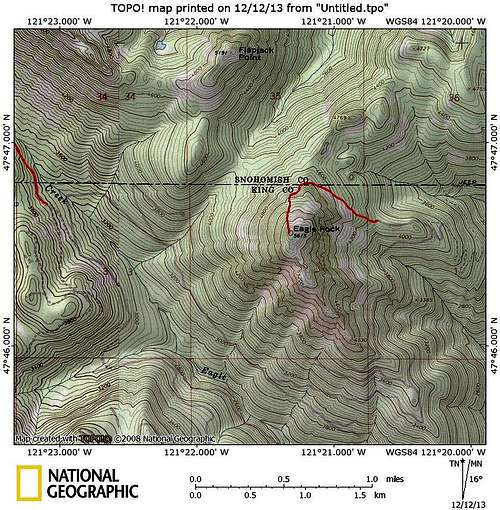
Eagle Rock route map. Red line on left of map shows the start of the unofficial (but very well defined) trail to Eagle Lake.