
|
|
Mountain/Rock |
|---|---|
|
|
47.86568°N / 121.40586°W |
|
|
Snohomish |
|
|
6213 ft / 1894 m |
|
|
Overview
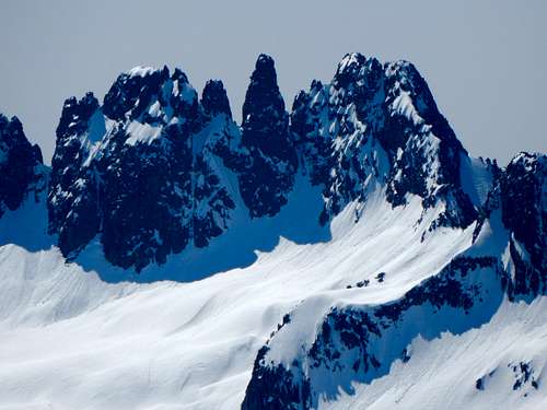 Spire Mountain from Hubbart Peak
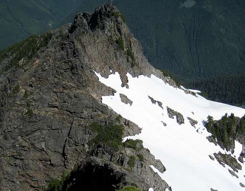
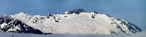 Spire Mountain from Excelsior Mountain. Spire Point (6065') on left.
As a climb, Spire Mountain has proven to be somewhat unpopular. The 'freshest' trip report I could find was 14 years old, and the completely sun-bleached runners on the route suggested it had not seen humans for some time. The reasons for the lack of interest are, in my opinion, as follows: 1. Gunn Peak, located four miles S/SW, is slightly higher, and has almost twice the prominence. 2. Two short sections of class 4/5 climbing on Spire's summit ridge, with exposure that will make even the bravest climber take pause. 3. Relative obscurity, as it is not visible from any major road. 4. Difficult access (16 miles round-trip, brushy road walk, and 7000' cumulative elevation gain) via the standard 'Beckey Route'.
 Spire Mountain from 3000' on South Crested Butte
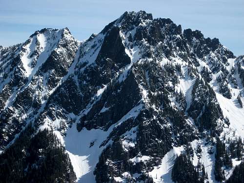 Spire Mountain from Iron Mountain
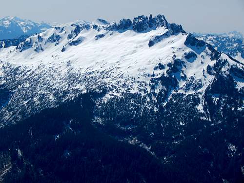 Spire Mountain from Hubbart Peak
Getting There
 Washouts on North Fork Skykomish Road
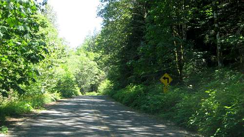
To get to the Galena area the 'easy way' (at the expense of a longer drive), follow US2 to the Beckler River Road (FR65), located one mile east of Skykomish. Follow FR65 up and over Jack Pass - the first seven miles will be paved. After crossing the North Fork Skykomish River, FR65 will intersect with FR63. Stay left on FR63, and follow it west - at this point, the road is once again paved. After about 4.6 miles, FR63 will cross the river again. Shortly after crossing the bridge, FR63 will curve to the right and crest a small hill - park here for the start of the 'north approach', near a 15 mph sign.
 Start of North Approach for Spire Mountain. This view looks back east towards the bridge. We entered the woods about 200' east of the sign - if you go much further east, you will encounter a small cliff band.
Route
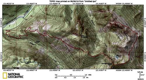
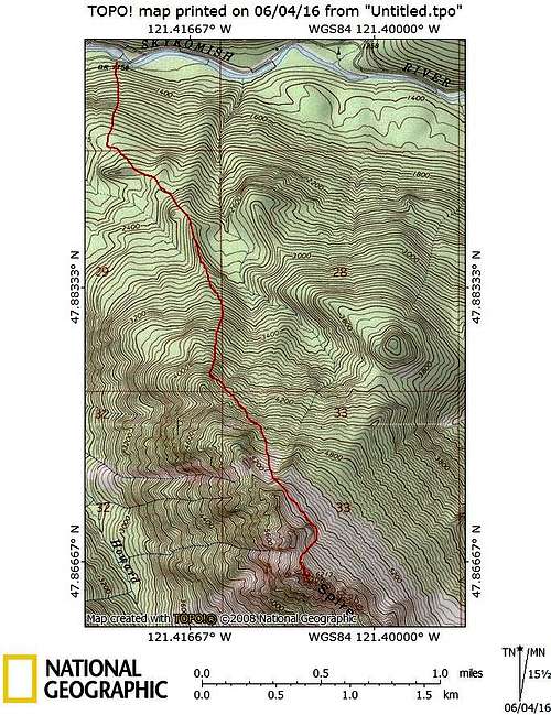 Spire Mountain North Approach map
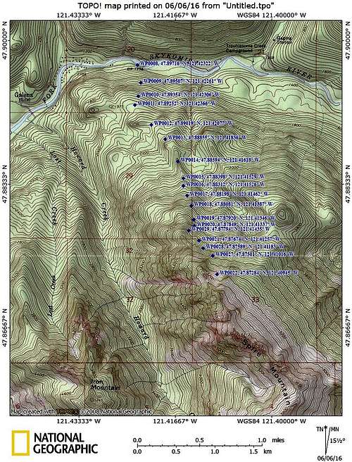 Spire Mountain North Approach waypoints. Please note that the waypoints are not all sequential.
 From the parking location one mile east of Galena, plunge into the woods opposite the river, and begin heading steeply uphill. The first 600' of elevation gain will be fairly steep, but brush free. After crossing an old logging road, make an oblique traverse to the left, aiming for a 2300' saddle (waypoint 12), where you will cross another old logging road. Continue uphill to the southeast - at roughly 2700', the terrain will narrow into a well-defined hogsback. Follow the hogsback to its termination at about 3300'. Continue straight uphill - after a short section of vine maple, you will break out into a talus slope at 3400'.
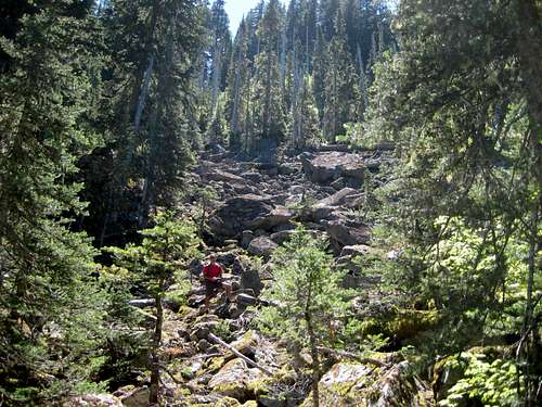 Start of talus on Spire Mountain at 3400'
Ascend the talus slope, keeping on the left edge. Follow the marked route through another short section of vine maple, bypassing a small cliff band on the right, then traverse slightly uphill and to the left. Soon you will find yourself on a fairly brush-free hogsback (defined by waypoints 19 and 20). On the descent, do not come down west of these waypoints, as there is an annoying cliff band (not shown on the USGS map) that will make your life difficult.
Continue straight uphill (to roughly 4200' to 4400'), where you will find yourself in open terrain below large cliff bands. From this point, begin a traverse to the southeast, slowly gaining altitude as the terrain allows. At waypoint 27, you will have the choice of continuing the traverse (some small trees to deal with, but easy grade), or heading straight up a wide gully to 5400' (not steep, but ice axe recommended).
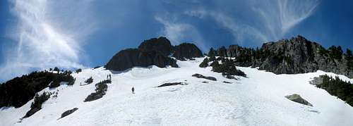 Spire Mountain at 5000' - photo taken near 'Waypoint 22'. Our route took us up the snow ramp on the left third of the photo.
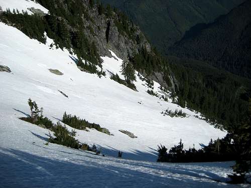 5400' on Spire Mountain North Approach
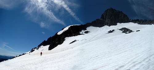 Spire Mountain at 5500'. The high point in this photo is Point 6040+.
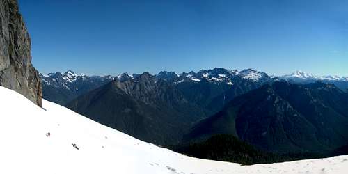 5500' on Spire Mountain North Approach
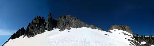 Spire Mountain summit block wide angle. The 5940' saddle is in the right third of photo. The Northwest Ridge can be plainly seen leading left to the false summit, then the true summit.
I have never done this approach, so I will not attempt to describe it in detail. I have followed the road to its end recently (Iron Mountain), which presented no special difficulties beyond some light brush (early season). Below is a map which I believe approximates the approach, based on the Cascade Alpine Guide, and two trip reports, which are linked below.
 Approximation of Beckey Route on Spire Mountain
The summit ridge:
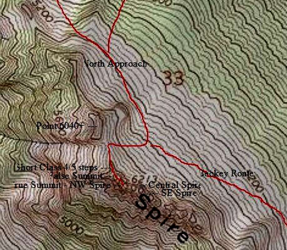 Spire Mountain closeup map - not sure why this photo turned out so weird.
 As the old saying goes, 'Don't believe everything you read'. The Cascade Alpine Guide describes the final climb up the Northwest Ridge as 'class 3'. Well, that may be true for 90% of it, but there are two short sections that are decidedly class 4 and 5. From the 5940' saddle, begin towards the summit on easy, but brushy terrain (a small pruning saw may help you if you don't like small trees). At 6000', your view should look something like the photo below.
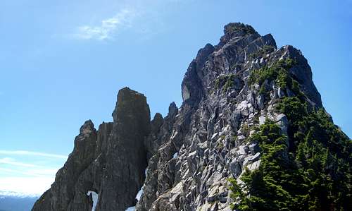 Spire Mountain Northwest Ridge. If you zoom in on this photo, you will be able to pick out the red sling we left behind on the crux.
Looks easy enough, but at 6100', you will happen upon a nasty little 10' step of class 5. One of the trip reports I read called it an 'awkward mantle move'. The photo below does not convey just how tricky (and exposed on both sides) this spot is. I could not commit to the move, chickened-out, and lassoed the rock horn above me with the red sling (left it behind for the next person - you're welcome!). Another possible method for dealing with this step (if you're not a self-righteous purist with regards to 'aid climbing') would be to use a 'shoulder-stand technique' with your climbing buddy.
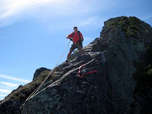 Preparing to rappel the class 5 step on Spire Mountain
Just a short distance beyond the class 5 step is what I would call about 20' of class 4. The climbing is much easier, but still very exposed. One nice feature of this ridge is that the rock is high-quality gabbro, and the holds can generally be trusted.
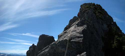 Rappelling the class 4 step on Spire Mountain
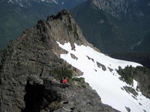 Class 4 step on Spire Mountain. The 5940' saddle is just to the right of the climber's head.
This will be the last technical hurdle on your way to the summit, so you may as well leave your rope behind for the rappel. From here, easy class 3 will put you on the top a false summit. For our climb, we used a 100', 8mm rope, which was more than adequate. For rappel anchors, I would recommend two double-length (not pre-sewn) runners.
 Looking down Spire Mountain's NW Ridge from the false summit. If you zoom in on this photo, you will see our rappel rope lying on the class 4 step - just beyond it, you will see the slings for the class 5 step's rappel anchor.
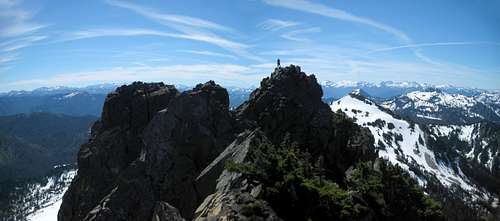 Spire Mountain summit from false summit
Follow the ridge crest, or slightly on the west (right) side, towards the true summit. At one point, it will be necessary to drop about 20 feet below the ridge crest. You still need to watch your step, but the climbing is easy class 3, and does not require a rope.
 Spire Mountain false summit from true summit
Views from the summit area are grand. Be sure to get an early start, so you can take your time soaking it all in.
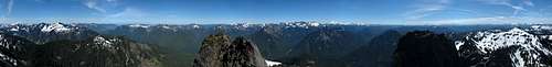 Spire Mountain pano
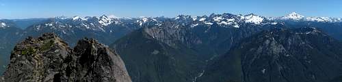 Spire Mountain north view - too many awesome peaks to list in this photo.
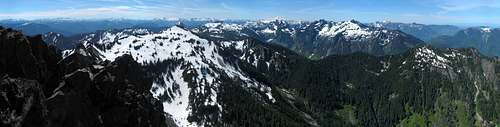 Spire Mountain south view. The Becky Approach follows the prominent ridge from right to left. The large snow covered mass on the ridge is Spire Point (6065'), with Conglomerate Point (5375') to the right of it. The brown colored summit on the right side of the photo is Iron Mountain (5245'). Also prominent in the background is the Gunn Peak 'Massif'.
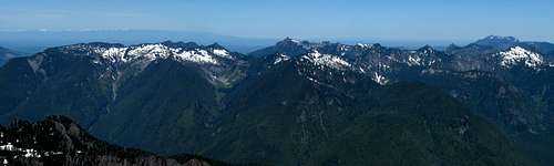 Spire Mountain west view. Most of Ragged Ridge can be viewed in this photo.
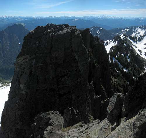 Spire Mountain's Central Spire
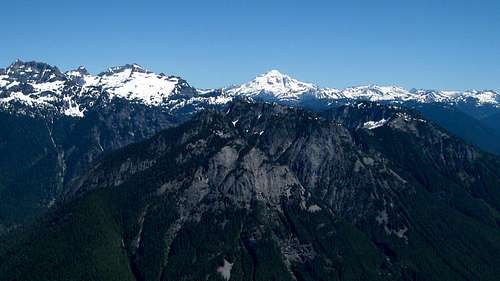 Troublesome Mountain from Spire Mountain
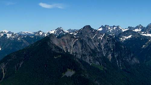 Hubbart Peak from Spire Mountain
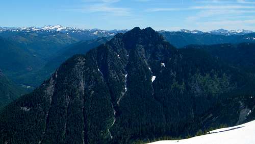 Bear Mountain from Spire Mountain
When to Climb
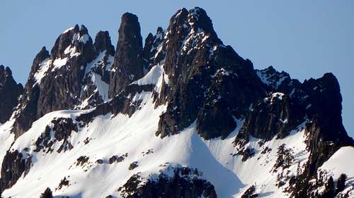
 Spire Mountain from South Crested Butte
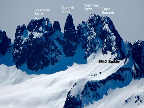 Spire Mountain from Hubbart Peak
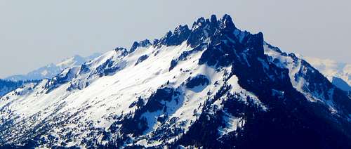
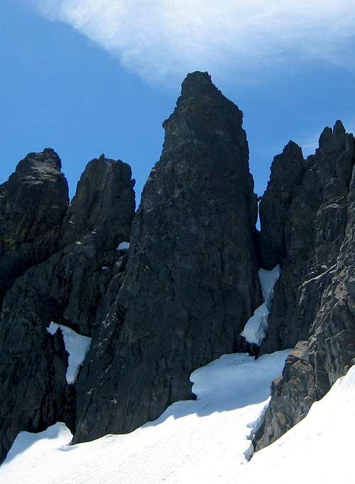 Central Spire on Spire Mountain. Notice the huge chockstone on the right side - apparently, it was used by the first ascent party in 1938.
Camping
See page 18 and 19 of the link below for a trip report from the original 1934 party:
Took me a while, but I finally found a 'fresher' trip report:
http://www.fwbdesign.com/hike-s/2011spire-fl/story/