
|
|
Mountain/Rock |
|---|---|
|
|
47.91704°N / 121.41491°W |
|
|
Snohomish |
|
|
5288 ft / 1612 m |
|
|
Overview
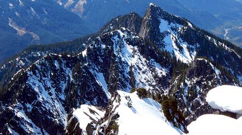 Scott Peak from Hubbart Peak
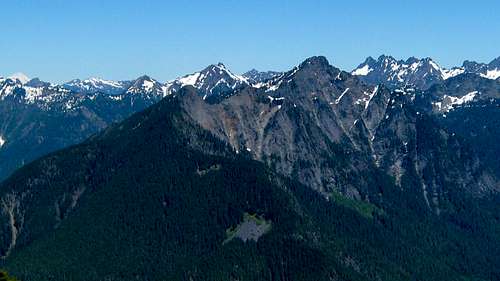 Scott Peak and Hubbart Peak from Spire Mountain
While most of the scramble up Scott Peak is a steep forested slope with little brush, precipitous terrain on all sides of the summit block makes the final portion of this climb more challenging than one might expect. Regardless of the final approach used to the summit, one should expect some class 4 climbing, and at least one rappel on descent.
Getting There
Follow US2 to the Beckler River Road (FR65), located one mile east of Skykomish. Follow FR65 up and over Jack Pass - the first seven miles will be paved. After crossing the North Fork Skykomish River, FR65 will intersect with FR63. Stay left on FR63, and follow it west - at this point, the road is once again paved. After about 4.6 miles, FR63 will cross the river again. Just before crossing this bridge, find a wide spot to park, and begin hunting for the start of FR6340 (Elev. 1160'). The river has done some damage in this area, so the first 100' of the 'road' is a boulder filled gully. Having said that, with a little poking around, FR6340 is not too hard to find.
For those coming from the west, it is possible to approach FR6340 via bike from the 'Index side' of the North Fork Skykomish Road. This would also be a good option for early season ascents when Jack Pass is still snowed in. For those interested in this option, please refer to the Spire Mountain page for more details (the start for Spire Mountain's north route is only 500' from FR6340).
Route
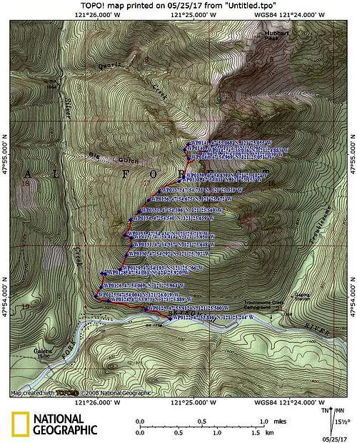 Scott Peak route map
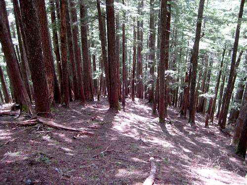
Travel along the lower SW Ridge will involve some light salal brush, but overall it is very tame by Cascade bushwhacking standards. At roughtly 1900', you will arrive at the base of a fairly substantial cliff band. We chose to traverse to the left to get around, which seemed more intuitive based on the game trails we were trying to follow. The map seems to suggest that traversing to the right would probably work as well. We found a nice little gully to take us to the top of the cliff band, defined by WP127 and 128 on the route map. From here, simple scrambling with light salal brush brought us to a nice rocky overlook at 3100' (WP 133).
 North Fork Skykomish Valley from 3000' on Scott Peak SW Ridge
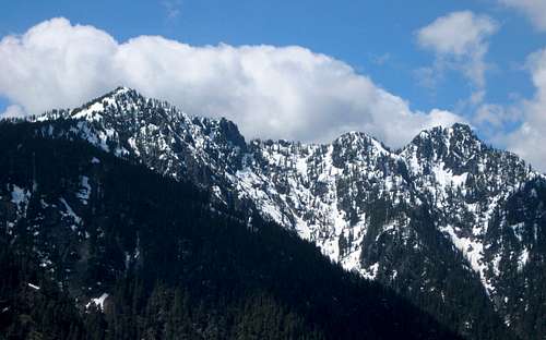 Mineral Butte and Pt. 5241 from 3000' on Scott Peak
From this location, the SW Ridge became very open, and the brush was nonexistent for the rest of the climb.
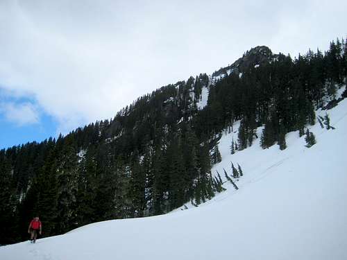
 Typical terrain on Scott Peak SW Ridge at 3500'
At about 4000', the ridge will finally start to lay over, and give your weary legs a little bit of a break. From here, there is a fairly nice view of Spire Mountain, weather permitting.
 Spire Mountain from Scott Peak at 4000'
Continue up the SW Ridge, arriving at an open basin/slope at roughly 4400'.
 Scott Peak summit from SW at 4400'
From here, it is possible to study the summit block. Coming at the summit block directly from the south did not look too appealing to us, so we decided to make a gradually rising traverse over to the NW Ridge (I had studied this ridge from Hubbart Peak, and it appeared 'easy'). After passing around a cliff band, we angled up to intersect the NW Ridge at roughly 4700'. Travel was fairly simple until about 5000' - then things got a little spicier.
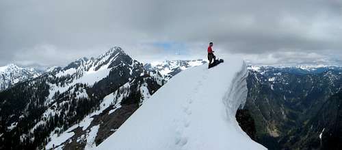
Travel along the last portion of the NW Ridge was made a little uncomfortable by cornicing on the northeast side of the ridge, and nasty moats on the southwest side (In hindsight, I probably would have enjoyed this peak a little more as a late season climb). After getting past this delicate balancing act, we found ourselves up against a short portion of class 4 rock about 100' below the summit. Had I brought along a little more equipment (slings, biners, harness) this probably would not have been that big of a deal. Nonetheless, we thrashed our way through it, then floundered through deep snow for the final push to the summit. Thankfully, we did bring along 100' of 8mm, which made the decision to commit to the summit a little easier.
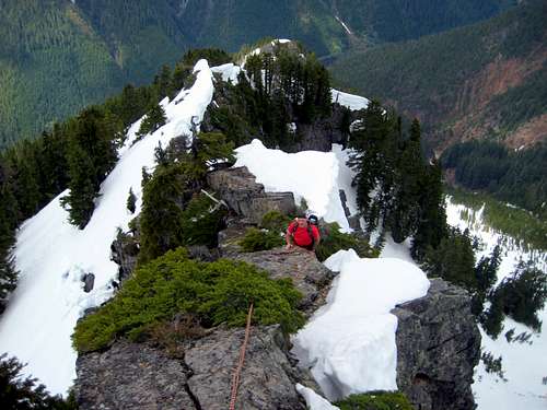 Class 4 portion of the NW Ridge on Scott Peak
Use caution as you approach Scott Peak's summit (in early season), as it is sure to be corniced.
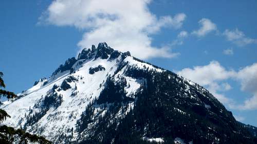
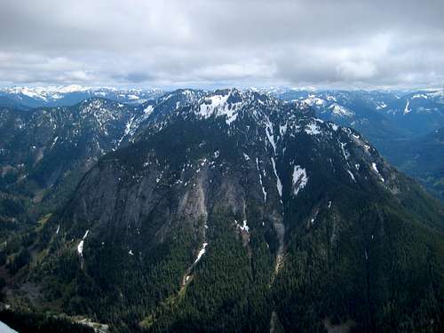
 Hubbart Peak from Scott Peak
Views from the top were quite pleasant, but our views of the 'big boys' were obscured by a high cloud layer. If you would like a better idea of the views on a clear day, please see the Hubbart Peak photo gallery, as it is probably very similar.
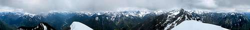 Scott Peak summit pano
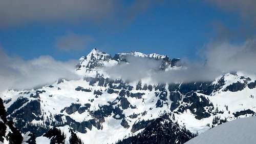 Columbia Peak from Scott Peak
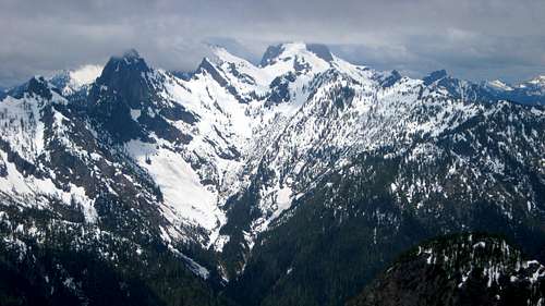
 Troublesome Mountain from Scott Peak
We really didn't want to backtrack our route under the conditions of the day, so we decided to descend via the south/southwest face of the summit block. While it did not seem much easier in terms of steep, class 4 climbing, it did reduce our exposure to a couple objective hazards (moats, cornices). Once descending to 5100', with the help of one 'rappel', a steep snow slope brought us back to our original route.
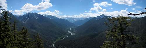
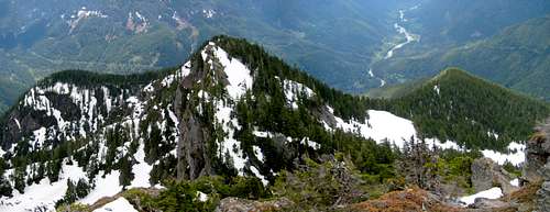 Looking south from Scott Peak summit. Southwest Ridge on right.