
|
|
Mountain/Rock |
|---|---|
|
|
47.94372°N / 121.5889°W |
|
|
Snohomish |
|
|
4897 ft / 1493 m |
|
|
Overview

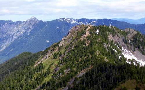
This photo shows the described route following the skyline from right to left. As is suggested by the steep cliffs in this photo, any deviations from the ridge should be made on the west side.
The first step in climbing Static Peak is to get yourself to Big Greider Lake (Elev. 2932'). In the past, this was a simple matter of driving to the DNR trailhead, and hiking the 2.5 mile trail to the lake. Now, an additional two miles of road walking is necessary, which would not be so bad if the road had been left in good shape. Unfortunately, all the culverts in this road have been dug out, making this part very tedious (a friend recently told me he counted 89 "tank traps" between the south shore trailhead and Boulder Lake trailhead!). My guess would be, that in the not too distant future, the trails to Greider Lakes and Boulder Lake will be badly overgrown, and all but forgotten. So, get out there and climb Static Peak while you still can!
Note: Static Peak and Greider Peak can also be approached from the west, but I am not familiar with these routes. Hopefully, these routes will get added to this page in the near future.
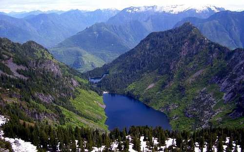
Static Peak rises above the south end of Big Greider Lake, so the next step will be to get yourself to the other end of the lake. You could certainly boulder hop and brush bash for half a mile to accomplish this, but I found it much easier to float across the lake in my trusty one man raft. Both the Green Trails map and the USGS map show a trail that climbs from the north end of Big Greider Lake up the east slopes of Greider Peak. Whether or not this trail could be utilized to gain access to the upper ridge, I do not know. It did not look very tempting the last time I looked at it, and is probably overgrown. Upon arriving at the far end of the lake, look for a steep gully that comes down from the saddle between Static Peak and Greider Peak. It is basically the last gully before the large cliffs on the south end of the lake. This class 3 scramble will give you brush free access to the upper ridge. It is marked by x's in the photo below - my apologies for the poor photo quality.
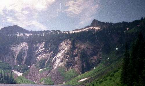
Static Peak (right of center) from Big Greider Lake
Scramble up 1400' to the 4300' saddle located at (N47 56.845 W121 35.444). Now turn left, and follow the obvious ridge south to the summit of Static Peak. Any deviations from the ridge should be made to the right (west side of the ridge). As I recall, the climbing towards the top was mostly class 3 (if anyone remembers differently, please let me know), and no rope or special equipment was required.
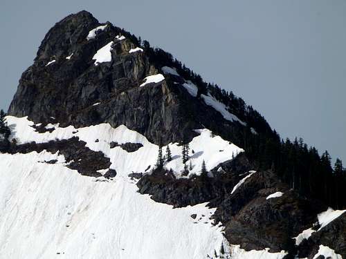
Static Peak from Little Greider Peak. The scramble route follows this ridge, or just right of the ridge crest.
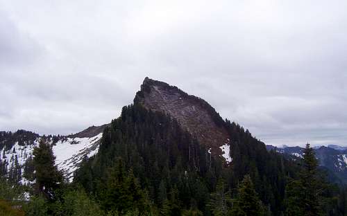
Static Peak from Greider Peak
Here are a few views from the top:
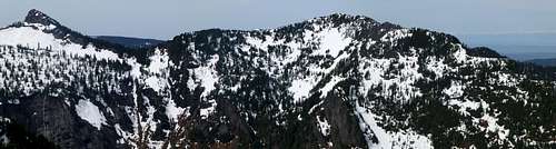
Static Peak pano
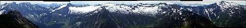
Static Peak pano - Frostbite Peak to Mount Stickney
Big and Little Greider Lakes from Static Peak
If you have budgeted some extra time into your day, be sure to make a quick side trip to Greider Peak for an easy "2fer". From the 4300' saddle, a half mile of class 2 scrambling along the ridge to the northwest will bring you to the 4828' summit.
Greider Peak from Static Peak
Static Peak and Greider Peak from Little Greider Peak. As is suggested by this photo, it is probably fairly simple to proceed straight up to Greider Peak's summit in early season from the trail between Little Greider Lake and Big Greider Lake. These peaks could easily be combined with Little Greider Peak on the same trip for a '3fer'. The normal couloir for accessing the low saddle between the two peaks can be plainly seen in this photo - getting to its base requires traversing around, or floating across, Big Greider Lake.
Getting There
Take Highway 2 to the town of Sultan. Just past downtown, turn left on the Sultan Basin Road. Follow this road about 13 miles to Olney Pass. At Olney Pass, you will notice a registration kiosk - make sure you fill out a registration form before continuing. This area is patrolled regularly by the Snohomish County PUD. At the fork in the road at Olney Pass, stay to the right (left fork heads down to the dam). The gate should be open during summer months, but check first at www.snopud.com just to be certain. Follow the south shore road about five miles to the south shore boat launch/trailhead.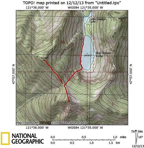
Static Peak/Greider Peak route map. Static Peak is the south peak, Greider Peak is the north peak.