
|
|
Mountain/Rock |
|---|---|
|
|
45.68498°N / 10.55171°E |
|
|
Lombardia |
|
|
Hiking, Mountaineering, Sport Climbing, Scrambling, Via Ferrata |
|
|
Spring, Summer, Fall, Winter |
|
|
4964 ft / 1513 m |
|
|
Overview
Monte Spino 1513 m
Monte Spino 1513 m, called in the local dialect "L'Espì" (which means Spino, in English "thorn", in reason of its thorn shape addressed towards the sky) is a limestone mountain located between the Fobbiola Pass, the Spino Pass and the Buco of the cat. To the North loom some rocky limestone pillars above the Prato della Noce, To the south the mountain slopes down with the predominantly grassy slopes of the "Costa Mandria". The rough and bumpy SW ridge joins up with that of the Marmere and forms the border with the Alto Garda Bresciano Park. To the East we find the ridge of the Forseul.
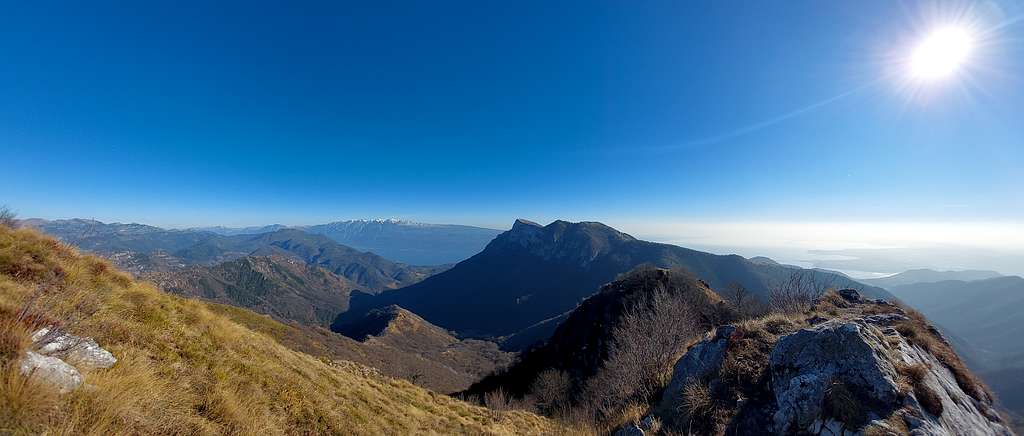
To the North Monte Spino projects some rocky limestone pillars above the Prato della Noce, these rock formations actually do not belong to Monte Spino, but are named Marmera and Monte Forametto.
Getting There
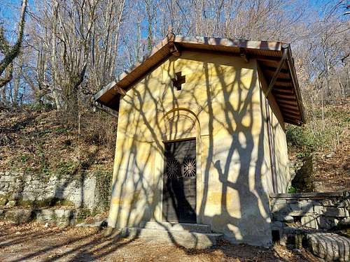
From the Gardesana Occidentale state road, coming from Limone, you reach Toscolano Maderno, where you turn right with signposts indicating Monte Maderno. After passing the hamlets of Maclino and Vigole you reach Sanico. We proceed on a narrow asphalted road towards the Croce di Ortello. The bottom becomes dirt with some steep and difficult sections. We continue ignoring two successive crossroads on the right proceeding on the dirt road which at the bottom has a slightly bumpy bottom. We thus access the small church of S.Urbano 872 m where the transit ban prevents us from continuing. Limited parking possibilities
Normal Route from Sant'Urbano
Difficulty: E
Difference in level: 650 m from Sant'Urbano
From the car park in front of the church of Sant'Urbano at an altitude of 872 m, go up a few meters and immediately leave trail no. 23 for Monte Pizzocolo, turning left along a mostly flat cart track (sign no. 6) which after a few minutes reaches the intersection with the detour to the left for Passo Buelino. Continue along the main itinerary, rising in the upper Poiano valley and finally a wide oblique reaching the locality of "Pirello" 1030 m, where the road coming from S. Michele arrives from the left. Go up to the right following path 8 to the Pirlo Refuge and Passo di Spino.
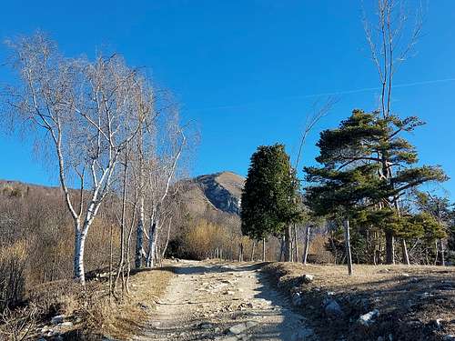
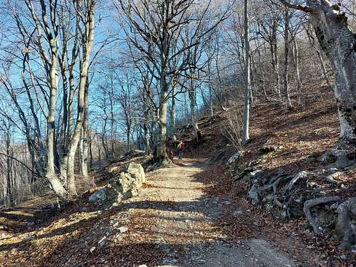
The wide mule track initially with a cemented base rises in the woods and gains altitude in the midst of beech and fir trees, crosses a panoramic clearing from which our destination, Monte Spino, appears on the left, reaches a crossroads near a building, where keep left, and finally re-enter the thick wood with some ups and downs, reaching Passo di Spino 1160 m, between Monte Spino and Monte Pizzoccolo.
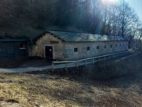
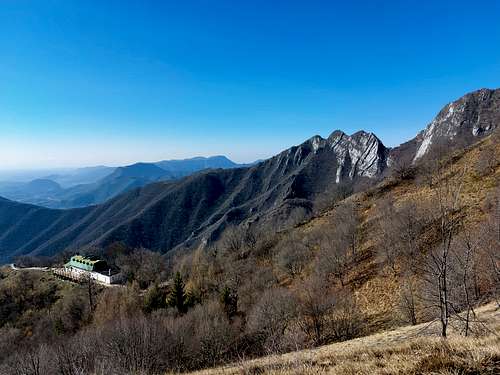
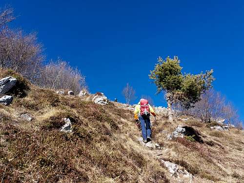
Here we find an alm and the "Antonio Duse" Regional Ornithological Observatory. In the distance to the left you can see the Rifugio Refuge, Monte Spino and the rocky slabs of Marmera and Monte Forametto. We proceed, among some ruins of war, along a wide dirt road with several boards illustrating the activity of the ornithological observatory. You pass by a cliff often used as a climbing wall and you reach a panoramic grassy knoll. To the right of a modest grassy hump is the "Path of the Thieves", right next to the "Casel de l 'Uselí" (Birdhouse) of the Western Gardesana Regional State Forest. A few more minutes and take the "Monte Spino" path (wooden signs) to the right which begins to climb the south-east side of the mountain. Shortly afterwards you cross the variant of the "Sentiero dell'amicizia" on the right, which you ignore to continue along the main itinerary.
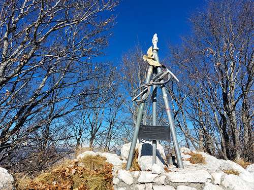
We go up the steep slope that overlooks the Rifugio Pirlo, while behind us it appears the great structure of Monte Pizzocolo. There are no particular difficulties, although the very steep path overcomes some short rocky leaps, however never exposed. The panorama becomes progressively wider to the south by seeing an increasingly vast sector of Lgo di Garda. The route now faces a vast meadow slope that we climb up in the direction of the above summit. We reach the top of the grassy pyramid, which is not the actual summit. In fact, the itinerary proceeds crossing the bumpy summit ridge with scarce differences in height between rocks and stretches of vegetation, always keeping the left side (South) until it reachs a large grassy saddle (signposts) from which in a minute it gets the beautiful summit signal.
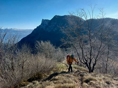
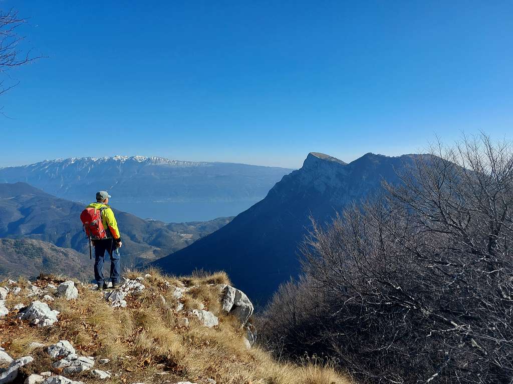
The isolated position of the mountain grants a wide-ranging view, in addition to the nearby Monte Pizzocolo facing east, the long ridge of Monte Baldo with Lake Garda can be seen in the same direction. To the west, the view is partially obstructed by the trees that reach the top of the Spino, however, moving a little, we observe Monte Guglielmo and the great peaks of the Adamello Group.
Towards the northeast we observe the Ledro Alps and the mountains located at the northern end of Lake Garda including Bondone, Monte Stivo and Monte Altissimo di Nago.
Descent: the return takes place backwards with the possibility of a short digression to reach the nice Rifugio Pirlo.
Red Tape
No fees no permits required. Cars are not allowed beyond Sant'Urbano
When to Climb
All year round
Huts and other accomodation
Rifugio Giorgio Pirlo allo Spino 1165 m
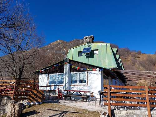
The Refuge Pirlo allo Spino, owned by CAI (Club Alpino Italiano) Sez. Salò, is immersed in the Parco Alto Garda at 1165 m above sea level and stands at the foot of Monte Spino and Monte Pizzocolo.
Different other possibilities in Toscolano Maderno, Sanico and surroundings.
Bibliography
"Prealpi Bresciane" by Fausto Camerini - Collana Guide dei Monti d'Italia, CAI-TCI