
|
|
Mountain/Rock |
|---|---|
|
|
37.52521°N / 107.0919°W |
|
|
Download GPX » View Route on Map |
|
|
Mountaineering |
|
|
Summer |
|
|
12593 ft / 3838 m |
|
|
Overview
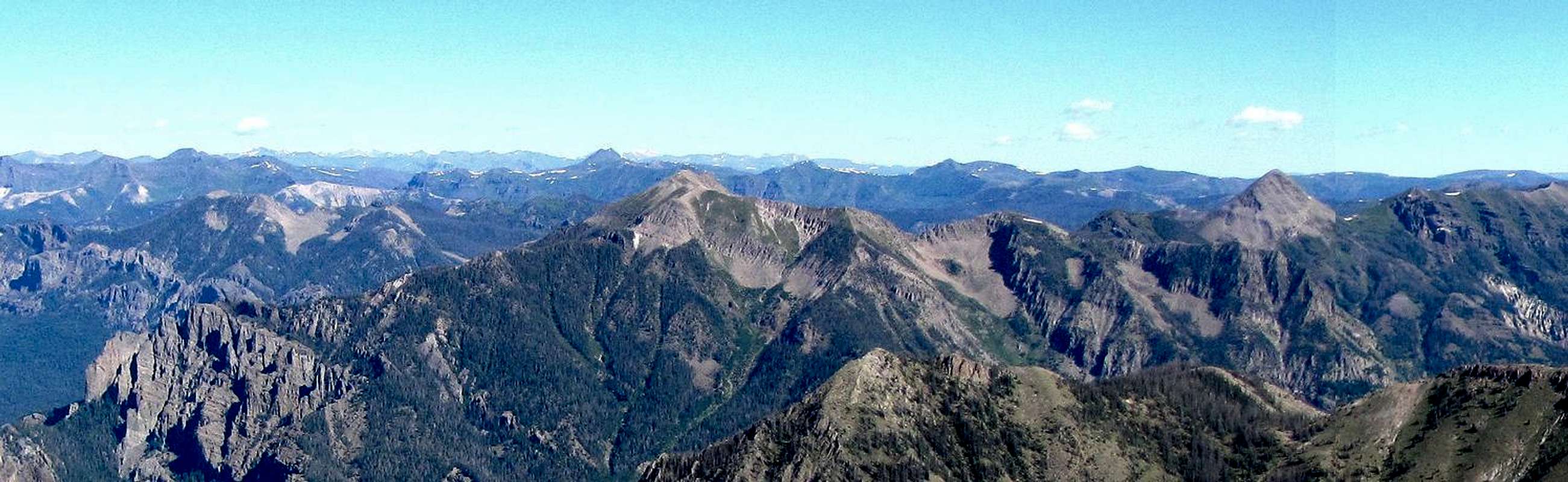
(R) Sugarloaf and (L) Toner Mountains. From the summit of Pagosa Peak
Sugarloaf and the nearby Toner Mountain are a couple of mid 12ers that rise in the Weminuche Wilderness of the San Juan Mountains of southwestern Colorado. A trail starts at Middle Fork Trailhead near the town of Pagosa Springs and goes deep into the wilderness. This trail can be followed to an elevation of 11700 ft or so to reach the base of the summit of Sugarloaf Mountain where you can leave trail and hike to the top.
Getting There
See map below. From the junction of Route 160 and Piedra Road (a few miles west of the springs in Pagosa Springs) turn north onto Piedra Road (Road 600) and follow it through the subdivisions. Pavement end after 6 miles and the road becomes Road 631. This was a well graded dirt road where I could drive 30-40 MPH. At Sportsman’s Campground and Cabins, turn right onto Road 636 and drive to the end of it at Middle Fork Trailhead. The last 1.5 miles became somewhat rough but I did not need 4 wheel drive. Total distance from Route 160 was 23 miles (took a good 50 minutes to drive).Route
All distances are per my GPSDramatic view to the north at trailhead.
 Cliffs at Trailhead
Head east on the trail and cross the Middle Fork of Piedra River. This log served as a perfect bridge. Without the log, crossing will likely require you to get wet.
 Log over creek
On the east side of the river, the trail heads north going flat for half a mile or so until it reaches a series of switchbacks going up quickly.
 |
 |

Continue up the trail through switchbacks followed by less steep areas. At the time of my hike, much of the pine trees appeared dead.

Waterfall by the trail.

Many fallen logs created obstacles on the trail slowing me down. Flowers in the dead forest and the meadows were beautiful.
 |
 |
 |
 |
Toner Mountain could then be seen.
 Toner Mountain
And then Sugarloaf itself. Farther up, Sugarloaf went out of view again.
 Sugarloaf Mountain
On the way up, I wanted to stay on the trail as much as I could to gain elevation but this caused me to get a little far from Sugarloaf. I left trail at around 11800 ft and ended up walking through the forest doing some downhill to reach the base of the peak. The best place to leave trail is probably at around 11650 ft. Sugarloaf may not always be in view so you must know where you are.
 Summit of Sugarloaf Mountain
I then went up first the grassy and then the boulder covered slope which became increasingly more steep.

Looking down the steep boulder covered slope.
 Looking down the steep slope I climbed
Summit turned out to be a long and narrow area. Views from the summit.
 Pagosa Peak Pagosa Peak |
 Toner Mountain Toner Mountain |
 Peak 11985 ft Peak 11985 ft |
 South River Peak South River Peak |
 Red Mountain Red Mountain |
 Peak 12848 ft & Peak 12660 ft Peak 12848 ft & Peak 12660 ft |
 Pagosa & Cherry Cairn Peaks Pagosa & Cherry Cairn Peaks |
 Looking northwest Looking northwest |