
-
 7995 Hits
-
 71.85% Score
-
 2 Votes
|
|
Mountain/Rock |
|---|---|
|
|
38.82382°N / 112.10297°W |
|
|
Sevier |
|
|
Hiking |
|
|
Spring, Summer, Fall, Winter |
|
|
7351 ft / 2241 m |
|
|
Overview
A short but distinct peak northwest of Richfield, Utah, that overlooks the red sandstone Willow Creek Canyon. It has a cap of limestone that creates the table top look.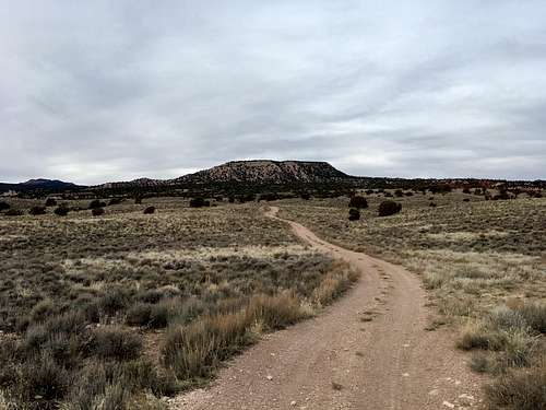
Table Mountain from the East atop the highest shelf.
Getting There
From Exit 40 on I-70 at the north end of Richfield, drive northwest away from the town. Veer right as soon as you hit the dirt roads. Continue straight through the clearing. Stay on this road as it winds its way through the broken landscape. Right after you come around the corner of the hill close to the freeway, the road turns left and forks. Go straight west instead of turning back east along the road that completes a U-turn. Drive 300 feet and park at the next fork. This is as far as vehicles are allowed to travel.Route
From the vehicle, take the right fork heading north. Turn left just after the first steep section. Continue on the dirt road for roughly 2 miles when another fork is reached on shelf below the peak. Take a right at this fork, which heads toward the northeast flank of Table Mountain. Walk this until it ends. Meander up the steep northeast slope of the peak to gain the summit plateau. From here, walk to the northwest corner of the "table top" to the true summit.Round-trip Distance: 6.14 miles
Elevation Gain: 1818 feet