
-
 3628 Hits
-
 72.72% Score
-
 4 Votes
|
|
Mountain/Rock |
|---|---|
|
|
38.97376°N / 112.12567°W |
|
|
Skiing |
|
|
Spring, Summer, Fall, Winter |
|
|
9765 ft / 2976 m |
|
|
Overview
One of many peaks in the Pahvant Range of Central Utah. Willow Creek Peak stands among them on the eastern edge of the central, low-angled ridge line that connects several 9-10,000-foot peaks.Getting There
Take highway 50 that runs between Scipio and Sevier Valley (towns of Salina, Aurora, Redmond). Approximately 5 miles out of the Sevier Valley, drive along Forest Road 102. It meanders up a canyon and gains the main backbone of the range after several miles. Most passenger vehicles can make it up this road. The road that travels north-south in the range is Forest Road 96. Turn right (north) onto this road. The first peak encountered is Willow Creek Peak.Route
Approximately 0.5 miles and 200 feet of elevation gain will get you from the road to the summit that is populated by a cluster of deceased trees that make it an ominous summit to visit.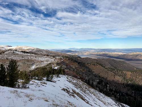
Looking North to the Wasatch
Red Tape
This area sits in the Fish Lake National Forest. There are no fees. However, Forest Road 102 is closed except to snowmobiles in the winter. Also, avoid this road after a rain due to how slick it becomes, which can lead to unmanageable erosion when people drive on it.