
-
 2454 Hits
-
 72.08% Score
-
 2 Votes
|
|
Mountain/Rock |
|---|---|
|
|
39.06104°N / 111.52091°W |
|
|
Hiking |
|
|
Spring, Summer, Fall, Winter |
|
|
11071 ft / 3374 m |
|
|
Overview
This is the second highest point of the southern portion of the Wasatch Plateau after Heliotrope Mountain. Though almost 100 feet higher than Mary's Nipple, it is often overlooked because it is further removed from the valley below, and thus, appears less prominent. It rises 1,500 feet above the saddle with Mary's Nipple and 700 feet above the beautiful Island Lake to the northeast.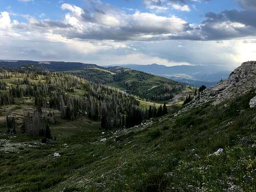
View South from the Eastern Slope
Getting There
From Salina: Drive north on US-89 for 3.7miles. Turn right onto 3500 Redmond Switch Road toward Willow Creek. JoinWillow Creek Road and drive east for 14.7 miles. At the three-way intersection,turn left (North) onto Skyline Drive. Continue on this for 10.5 miles. Once ontop of the mountains, turn left at the 4-wayintersection onto Forest Road 1271 and take this for 0.2 miles.
From Mayfield: Drive east from Mayfield onEast Canyon Road that turns into Forest Road 0022. Take a slight right after 5miles onto Forest Road 0023. Drive for 0.6 miles and turn right onto FR 0290 orcontinue straight onto FR 0022.
FR 0290 - This is definitely a 4WD road forabout 6.6 miles until it joins Skyline Drive on the bench. The crux of thedrive is after Woods Lake where a steep muddy section makes it difficult topass, which makes the route from Salina or FR 0022, preferable.
FR 0022 – Better maintained dirt road thatveers northeast a small amount to Skyline Drive at Twelve Mile Flat Campground.This may take longer than FR 0290 but the risk of getting stuck is aconsiderably less. Turn south on Skyline Drive and drive for 5.8 miles to the4-way intersection near Island Lake Peak.
Route
From the camping pullout at the end of Forest Road 1271, take the easiest path to the eastern slope of the peak. Meander up one of several moderate slopes to the ridge and follow the ridge north to the summit.Round-trip Distance: 1 mile
Elevation Gain: 237 feet![Subalpine Summit Ridge]()
Subalpine Summit Ridge
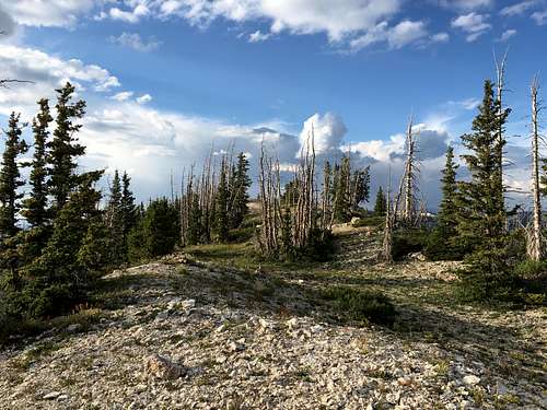
Subalpine Summit Ridge