
-
 2011 Hits
-
 71.06% Score
-
 1 Votes
|
|
Mountain/Rock |
|---|---|
|
|
39.04452°N / 111.64005°W |
|
|
San Pete |
|
|
Hiking |
|
|
Spring, Summer, Fall, Winter |
|
|
9574 ft / 2918 m |
|
|
Overview
Order Mountain is one of the higher peaks resulting from the fault east of Sevier Valley though considerably shorter than its eastern neighbor, Mary's Nipple. Like waves of sandstone and limestone rock lapping at the western flank of the Wasatch Plateau, the fault peaks have gentle western slopes but steeper eastern faces.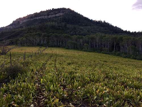
East Ridge
Getting There
From the small town of Mayfield, drive east on W Canyon Rd for 6.1 miles. Turn right onto Forest Rd 0290. About 1.3 miles up the road take a right to stay on FR 0290 that crosses Twelve Mile Creek. Continue on FR 0290 for another 1.6 miles. Turn right onto FR 0159 and stay on this road, which primarily goes south until it crosses Beaver Creek as it turns west. After it turns west, take the forks that go as straight west as possible. The most difficult part of the drive comes when you past the fork with FR 1248 that goes south. You will want to continue west.The road gets quite narrow with vegetation, downed trees, and rocks making for a tight squeeze (my 72" wide Ford Escape barely made it). The road gets quite rough from here as well for about 2 miles until you hit the last fork in the road. Take a sharp left turn at the fork to head south and drive 0.2 miles until you see a sign in a clearing stating no vehicles wider than 66". ![East Side]()
East Side from Mary's Nipple
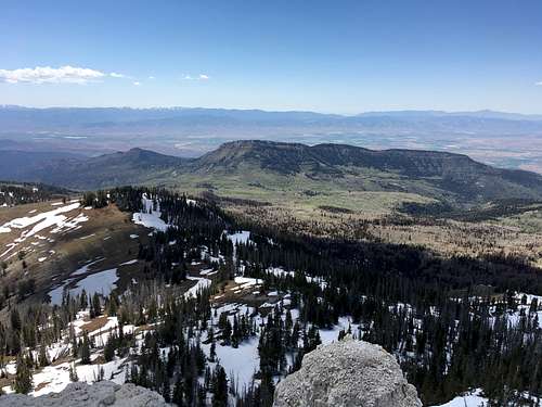
East Side from Mary's Nipple
Route
From the furthest reaches your vehicle can go, the simplest way to ascend this peak is straight up the eastern flank. There is no trail, which makes for a great deal of bushwhacking through dense brush and fallen trees. Higher up, the vegetation density decreases but this gives way to loose, steep, rocky slopes so use caution. This route has some 3rd class moves over the limestone belt of rock.Round-trip Distance: 1-1.2 miles
Elevation Gain: 1,015 feet.![East Side Route]()
East Side Route
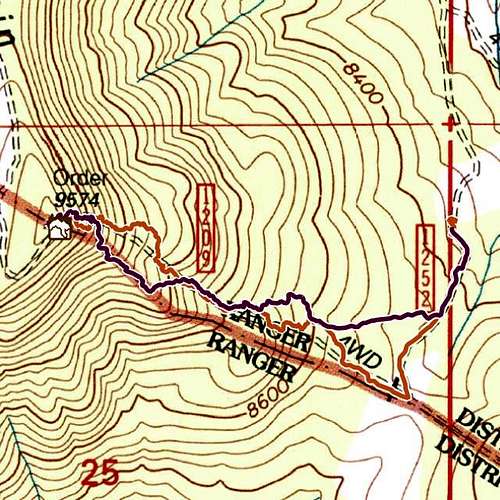
East Side Route