
-
 5335 Hits
-
 71.06% Score
-
 1 Votes
|
|
Mountain/Rock |
|---|---|
|
|
39.00242°N / 111.47073°W |
|
|
Sevier |
|
|
Hiking |
|
|
Spring, Summer, Fall, Winter |
|
|
10804 ft / 3293 m |
|
|
Overview
White Mountain is a high flat-top topographical feature common in Central Utah known commonly as a mesa (means table in Spanish). It stands at the southern end of the Wasatch Plateau with a rim of white limestone overlooking much of the state. The subalpine summit is actually difficult to determine given that the flat area on top of the mesa varies by only 4 feet over an area of 0.5 square miles.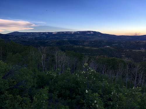
Southwest Profile
Getting There
From Salina: Drive north on US-89 for 3.7 miles. Turn right onto 3500 Redmond Switch Road toward Willow Creek. Join Willow Creek Road and drive east for 14.7 miles. At the three-way intersection,turn left (North) onto Skyline Drive. Continue on this for 10.5 miles. Once on top of the mountains, turn right at the 4-way intersection onto Forest Road 0161 and take this south for 4 miles. Higher clearance and 4WD are highly recommended from this point on. The climb on the dirt road to go east is quite steep on slippery limestone so parking in this meadow is probably the best option.
From Mayfield: Drive east from Mayfield on East Canyon Road that turns into Forest Road 0022. Take a slight right after 5 miles onto Forest Road 0023. Drive for 0.6 miles and turn right onto FR 0290 or continue straight onto FR 0022.
FR 0290 - This is definitely a 4WD road for about 6.6 miles until it joins Skyline Drive on the bench. The crux of the drive is after Woods Lake where a steep muddy section makes it difficult to pass, which makes the route from Salina or FR 0022, preferable.
FR 0022 – Better maintained dirt road thatveers northeast a small amount to Skyline Drive at Twelve Mile Flat Campground.This may take longer than FR 0290 but the risk of getting stuck is aconsiderably less. Turn south on Skyline Drive and drive for 5.8 miles to the4-way intersection near Island Lake Peak.
Route
The maps are wrong in this area so it's best to follow these directions. From the end of the road passable by the vehicle, hike up the steep dirt road and over the next rise. The depression to the east has a meadow with a fork in the road. Turn left here and hike downhill. Turn right as soon as the road permits you. Continue up another rise and across some high meadows to the next depression with a large meadow. Turn right here. Shortly, you will encounter the log barricades to keep off-highway vehicles out. Hop over this and follow the faint road east uphill to the south rim of the mountain before it veers northeast again. Once on top of the mesa, you're basically on the summit.Round-trip Distance: 2.4 miles
Elevation Gain: 166 feet